
HOME


|
HOME
|
|
|
|
|
|
P R O F I L E |
||||
|
  WONDERFUL WATER TOWERS IN BRITAIN
 Barton map number 18 LINCOLNSHIRE UNDER CONSTRUCTION
In order to display a database of water towers, Britain has been divided into county groups with each group on a separate web page. The starting point is the towers identified in Barton B. (2003) Water Towers of Britain, The Newcomen Society. This data has then been updated.
Website: Click Here ADDITIONAL INFORMATION
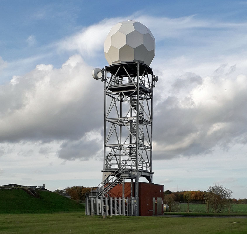 INGHAM TOWER, (18LS00) This tower is located a short distance north of Lincoln, just west of the A15 near Ingham. It is a landmark erection that may not even be a water tower in spite of being managed by anglian water. We would welcome any information about it. 1 Ash Grove, Gainsborough 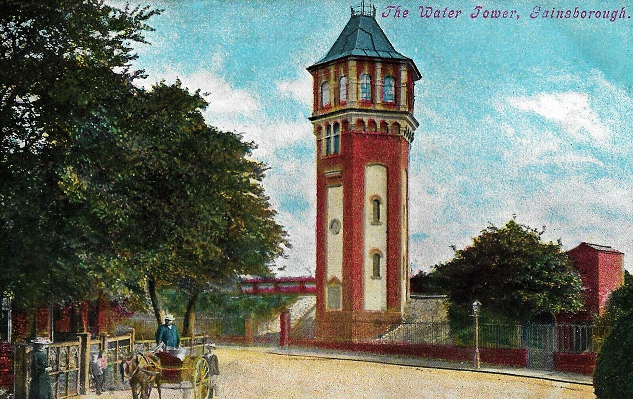 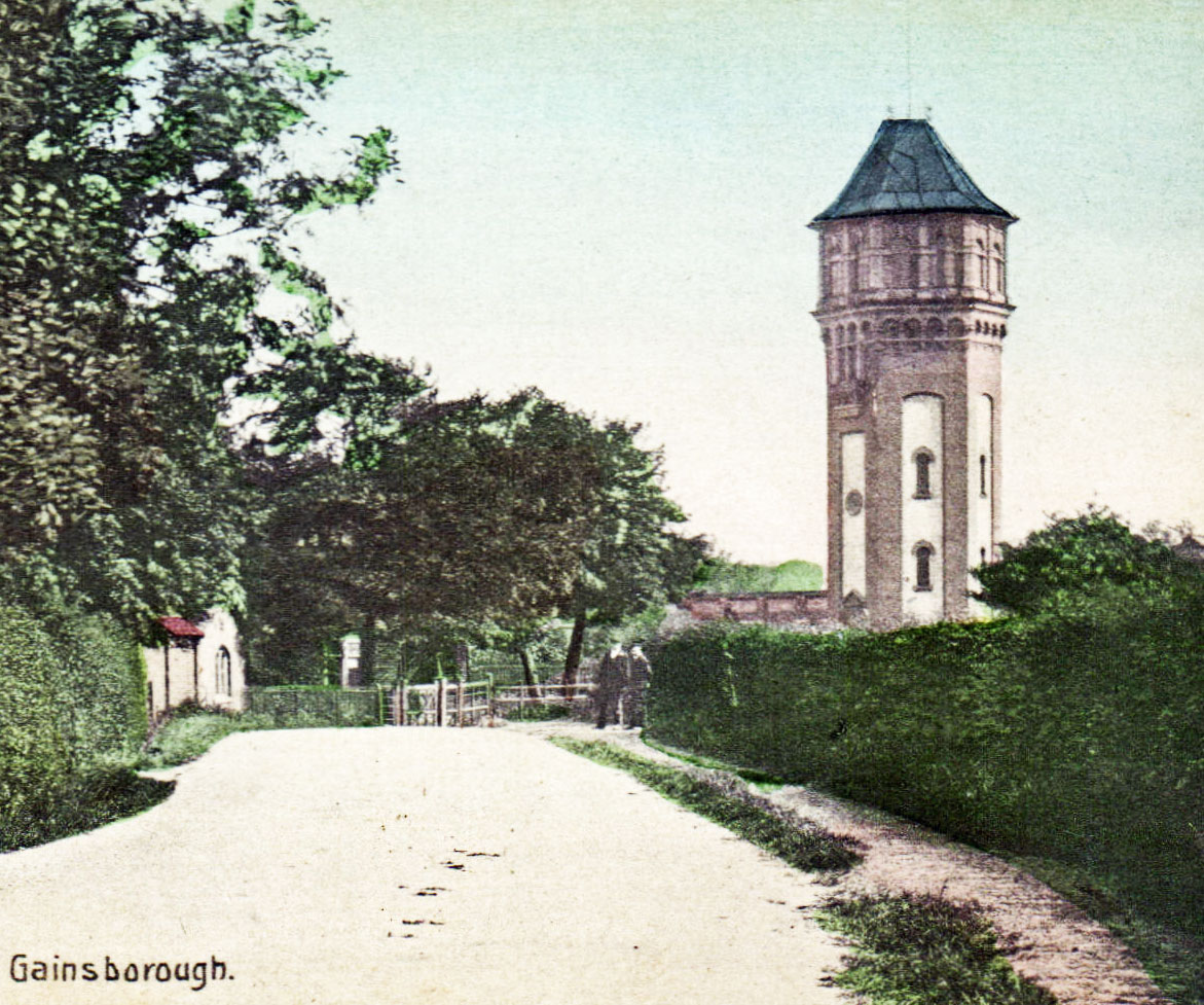 COX'S HILL WATER TOWER (18LI02) Gainsborough, Lincolnshire. It is sited on the south side of the junction of Heapham Road and Summer Hill. This is a grade II listed hexagonal building that dates from 1897. The design engineer was Henry Riley and it makes a pleasing appearance on the local landscape. It was surrounded by a former reservoir which was constructed in 1864 at the top of Hickman Hill DN21. Grid. Ref. SK820900. 3 Gorse Lane, Grantham 4 Blyborough 5 Woodnook 6 Lobthorpe 7 Barkston Heath 8 Fillingham 9 Hareswood  WESTGATE WATER TOWER (18LS10) WESTGATE WATER TOWER (18LS10)51 Chapel Ln, Lincoln LN1 3AZ. Erected in 1910, this tower is part of a network of water supply facilities for the locality. See Bracebridge Heath Water Tower immediately below. The tower is Grade II listed. 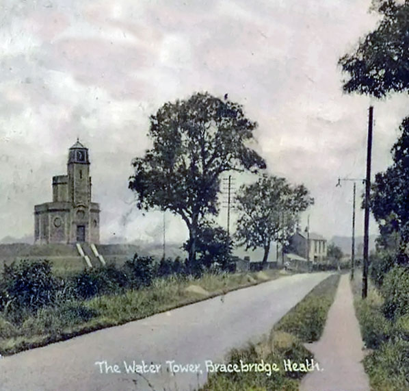 BRACEBRIDGE HEATH WATER TOWER, (18LS11) Grantham Road, Bracebridge Heath, a village and civil parish in the North Kesteven district of Lincolnshire, a short distance south of Lincoln. The site comprises a water pumping station and reservoir. In 1904/5 a typhoid epidemic in Lincoln resulted in 131 deaths. Contaminated water supplies were blamed and it was necessary to improve the quality of the supply. A new source of supply at Elkesley resulted from 1911 to the present day with water pumped from Elkesley into Westgate water tower. The surplus passes by gravitation to Bracebridge Heath Reservoir and tower, which serves the low districts of Lincoln as well as Bracebridge Heath and RAF Waddington. 12 Nettleham Fields 13 Brocklesby 14 Swinstead 15 Toft Newton 16 Newton Bar 17 Ashby de la Launde 18 Clay Hill, Sleaford 19 Potterhanworth 20 Lenton 21 Dorrington 22 Folkingham 1 & 2 23 Scopwick 24 Ruskington 25 Evedon 26 Martin 27 Anwick 28 Billingborough 29 Bardney 30 Burton Pedwardine 31 Heckington 32 Great Hale 33 Billinghay 34 Ludford 35 Baumber 36 Quadring 37 Crowland 38 Holland Fen Boston (Brothertoft) 39 Pinchbeck 40 Chatterton Tower, Spalding 41 Pinchbeck Road, 42 Kelstern 43 Stenigot 1 & 2 44 Weston 45 Sutterton 46 Canister Bridge 47 Fulletby 48 Whaplode Drove 1 49 Garfits Lane, Boston 50 Whaplode Drove 2 51 Revesby 52 Horncastle Road, Boston 53 Grain Silo, Boston 54 Fishtoft 40 Chatterton Tower, 55 Grimoldby Spalding 56 Old Leake 57 Gedney 1 & 2 Spalding 58 Little Sutton 59 Wingland 60 Mablethorpe 61 Mumby 62 Skegness 1 & 2 63 Hemswell 64 Le Tails Mill, Lincoln 65 St Johns, Bracebridge Heath 66 Waddington 1&2 67 Cranwell 68 Stamford Railway Station 69 Rauceby Hospital 70 Digby 1&2 71 Bass Mailings, Sleaford 72 Binbrook 73 Manby For Grimsby Harbour Tower (unitary authority of North East Lincolnshire) see (20HS24) Humberside. GROVERS MILL—Alien Creatures from space invade and the water tower gets attacked. Within minutes, stunned listeners were introduced to a Professor Pierson from Princeton University. Played by Mr. Welles, he told of Martians scrambling out of cigar?shaped space ships near Grovers Mill. The first hints of hysteria appeared as “newscasters” reported that Martians were using gas and meteorites to destroy the Army and police units that had rushed to the scene. Frightened listeners began telephoning local police and newspapers. The switchboard at Police Headquarters in New York was jammed, and two officers were dispatched to CBS Radio to find out the truth. In New Jersey, the interplanetary battleground, residents panicked. Many reportedly jumped into their cars and headed for open country, convinced that the invasion was authentic. The Church Service was halted in Cape May when a woman interrupted the proceedings. “I just heard on the radio that New York has been bombed and destroyed,” she screamed. “It's the end of the world! You may as well go home to die!”. Rumours spread in Bergen County that monsters were coming out of the meadowlands. A few miles away, two breathless teenage girls ran into Union City Police Headquarters and cried out that dragons were crawling out of the Holland Tunnel. There were many such strange incidents. Meanwhile, back at Grovers Mill residents grabbed their guns and went out to attack the invaders in the misty evening weather. They shot up the local water tower mistaking it for a Martian invader. The panic rapidly extended throughout the state as individuals reacted to the threat. The hysteria was not confined to New Jersey. In Birmingham, Ala., residents gathered in groups and prayed: in Providence, R.I., the police got reports of flying?saucer sightings, and in some South-eastern states a rumour spread that a meteorite had killed 40 to 7,000 people in New Jersey. However in Growers Mills, the tide of battle was turning. The seemingly unbeatable Martians had acquired germs that earthlings long had been immune to, and soon all invaders were reported dead. The hysteria quickly subsided after the broadcast ended, but Government and police officials just as quickly demanded that the Federal Communications Commission conduct an investigation. Grovers Mill was chosen by Orson Welles, then a young producer, as the site of a “broadcast” announcing a “visit” by strange beings from Mars. The program sparked hysteria throughout the state and country. Mr. Welles was using the names of actual Federal, state and local officials. Unfortunately, few listeners had paid attention to an announcement at the beginning of the program that the play being presented was an adaptation of H. G. Wells' “War of the Worlds,” and was “purely fictional.” A large number of cars bearing the curious reportedly rolled into sleepy Grovers Mill, but there was no catastrophe to view other than a shot up water tower. Finally, the state police put out reassuring messages over the teletype, advising municipal police that the scare was a fake. 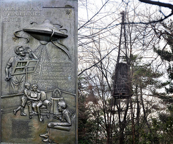
The plaque that commemorates the wild events of 30 October 1938 and the water tower that was mistaken for a Martian invader and shot to pieces. REGION England - Central, WATER TOWER INTEREST |
||||
|