
HOME


|
HOME
|
|
|
|
|
|
P R O F I L E |
||||
|
  WONDERFUL WATER TOWERS IN BRITAIN
Barton map number 15
In order to display a database of water towers, Britain has been divided into county groups with each group on a separate web page. The starting point is the towers identified in Barton B. (2003) Water Towers of Britain, The Newcomen Society. This data has then been updated.
Website: Click Here ADDITIONAL INFORMATION Warwickshire 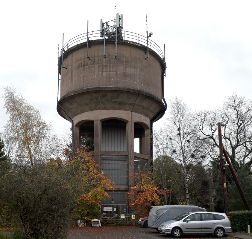 LAPWORTH WATER TOWER(15WS01) LAPWORTH WATER TOWER(15WS01)Lapworth is located on the northwest side of the M40 in Warwickshire. The tower was built 1957 and has a capacity of 200,000 gallons. Made from reinforced concrete, the drum is 45 ft diameter with domed floor and supported on 8 reinforced concrete columns. This tower can be viewed from Pound Close and Lapworth Street off the Old Warwick Road, the B4439. The water tower is managed by Severn Trent Water and supplies about 350 houses. 2 Bearley - Demolished. Thought to have been a steel structure supporting a steel tank circa 36 ft square and 12 ft deep, about 50 ft high overall with a capacity of 80,000 gallons. 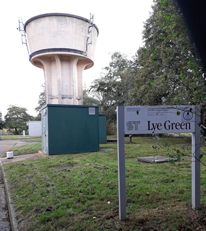 LYE GREEN WATER TOWER. (15WS03) LYE GREEN WATER TOWER. (15WS03)The village of Lye Green lies about 6 miles west of Warwick. The water tower is in the centre of the village. Grid Ref. 198657. It is managed by Severn Trent Water. 4 Atherstone on Stour GONE 5 Little Shrewley GONE 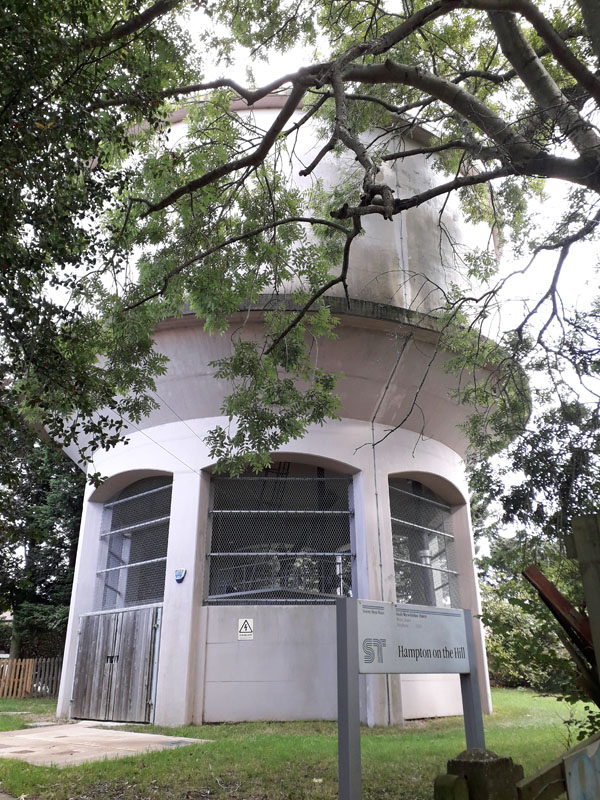 HAMPTON ON THE HILL WATER TOWER. (15WS06) HAMPTON ON THE HILL WATER TOWER. (15WS06)Located about one mile west of Warwick, this tower lies just north of the B4095 and is managed by Severn Trent Water. 7 Budbrooke GONE 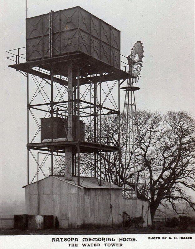 WELLESBOURNE WATER TOWER. (15WS08) WELLESBOURNE WATER TOWER. (15WS08)The tower illustrated appears to have been located in the Natsopa Memorial Home at Wellesborough in Leicestershire, but has now gone. The Natsopa Memorial Home opened in 1921, a memorial to printers who fell in the great war. The home closed in June 2013. It is confused with Wellesbourne in Warwickshire. For this reason the Wellsborough data is replicated on this web site page. 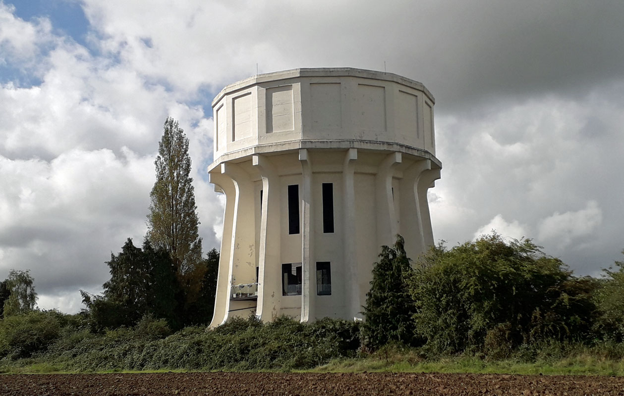 CROMWELL WATER TOWER. (15WS09) CROMWELL WATER TOWER. (15WS09)Burton Green, south-west of Coventry and about 3 miles north of Kenilworth. CV8 1PL. This magnificent tower was built in 1933 and was decommissioned in 2004. Subsequently converted to residential use in 2016. Grid Ref. 268753. It is 50 feet high; this imposing tower is locally called "Kenilworth's second castle" on account of it being visible from miles around. Over the entrance door it says "Corporation of Coventry 1980", not sure why? 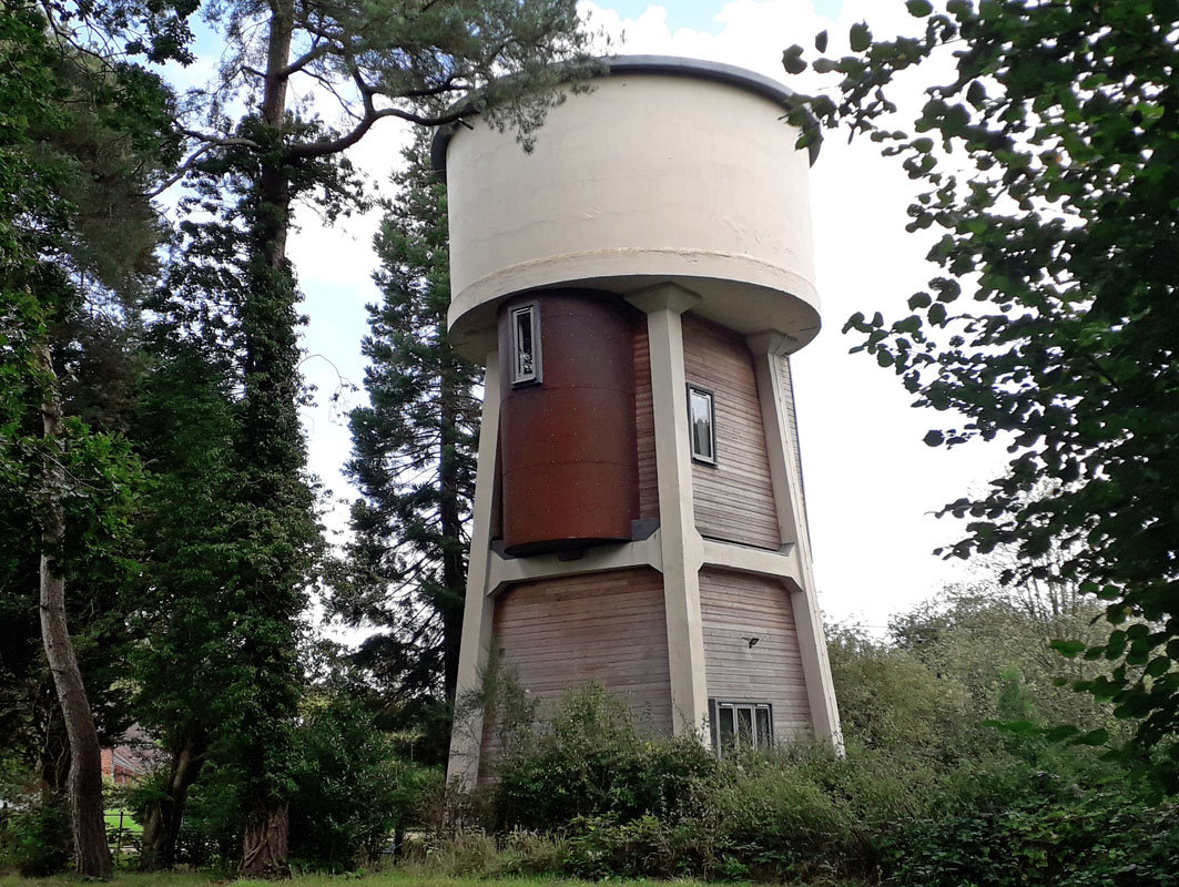 TILE HILL WATER TOWER. (15WS10) TILE HILL WATER TOWER. (15WS10)It lies to the north of the village of Burton Green, south-west of Coventry. This tower dates from 1932 when it was built as a tank on the Meridian supply network. It was subsequently converted to residential which it remains. It has more recently been refurbished and looks most attractive. Grid Ref. 271763. 11 Market St, Warwick GONE 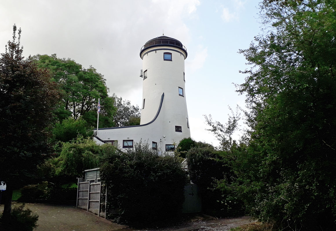 TAINTERS HILL WATER TOWER. (15WS12) TAINTERS HILL WATER TOWER. (15WS12)This tower, which dates from 1778 was once a windmill. In 1884 it was converted to a 20,000 gallon water tower. It was again converted, this time to residential, in the 1970s and remains so. It lies on the northern side of Kenilworth, just off the A429. Grid Ref. 290727. 13 Arley GONE 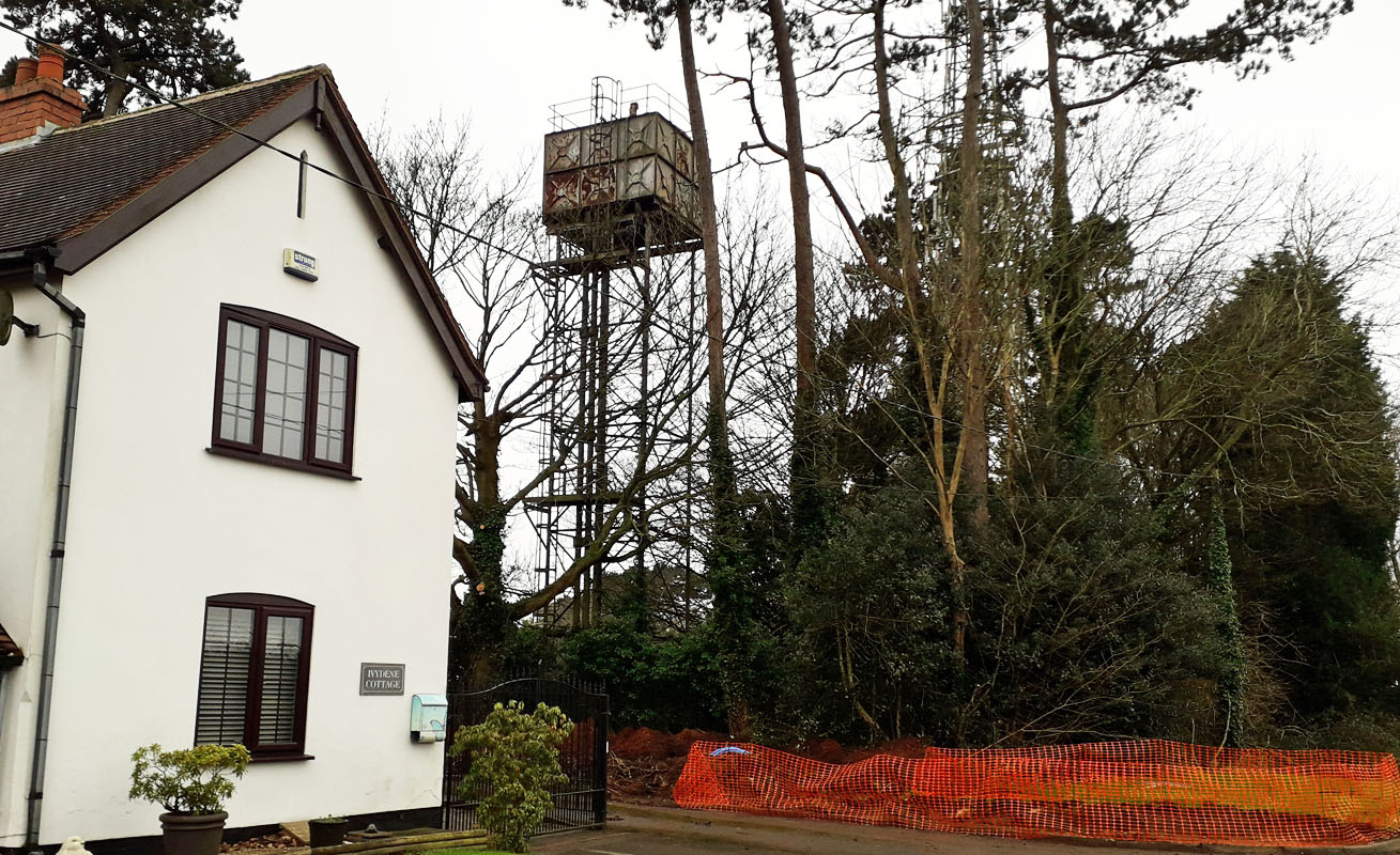 CORLEY WATER TOWER. (15WS14) CORLEY WATER TOWER. (15WS14)Church Lane, Corley. Built in 1974. Situated just off the B 4098 about 5 miles north-west of Coventry. As you enter Corley, the tower is about 100m west of the signpost for Corley School. Tower Grid Ref. 2962 8510. 15 Tuttle Hill, Nuneaton 16 Gaydon GONE 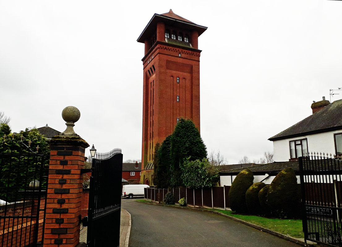 BEDWORTH WATER TOWER. (15WS17) BEDWORTH WATER TOWER. (15WS17)Gatehouse Lane/Tower Road. CV12 8UE This tower lies in the middle of a new housing estate just south-west of Bedworth centre in the Nuneaton and Bedworth District. It comprises an imposing brick and terra-cotta structure with a stone over the entrance door confirming it was built in 1898 by Bedworth Water Works. Grid Ref. 354 865. 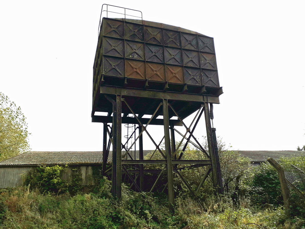 OFFCHURCH WATER TOWER. (15WS18) OFFCHURCH WATER TOWER. (15WS18)Offchurch lies about 2 miles east of Leamington Spa. The water tower lies about a mile further east near Burnt Heath Farm. Grid Ref. 375655. There is major road enhancement going on in the vicinity which suggest extensive development to come in the future. The old Foss Way runs NE-SW and the tower is on the right just across the junction with the road from Offchurch. It comprises a steel tank on legs holding about 30,000 gallons of water. 19 Harbury GONE 20 Bulkington GONE 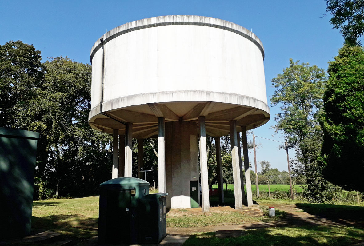 EDGE HILL WATER TOWER. (15WS21) EDGE HILL WATER TOWER. (15WS21)The tower lies about 5 miles to the north-west of Banbury. It lies on the junction of the B 4086 and Edge Hill village road, near an establishment called Knowle End. Here the B 4086 hill is steep and winds around the water tower site. Grid Ref 3815 4830. Built of circular reinforced concrete, it is 49 feet in diameter, has 12 columns and holds 180,000 gallons of water. 22 Deppers Bridge GONE 23 Stretton on Dunsmore GONE 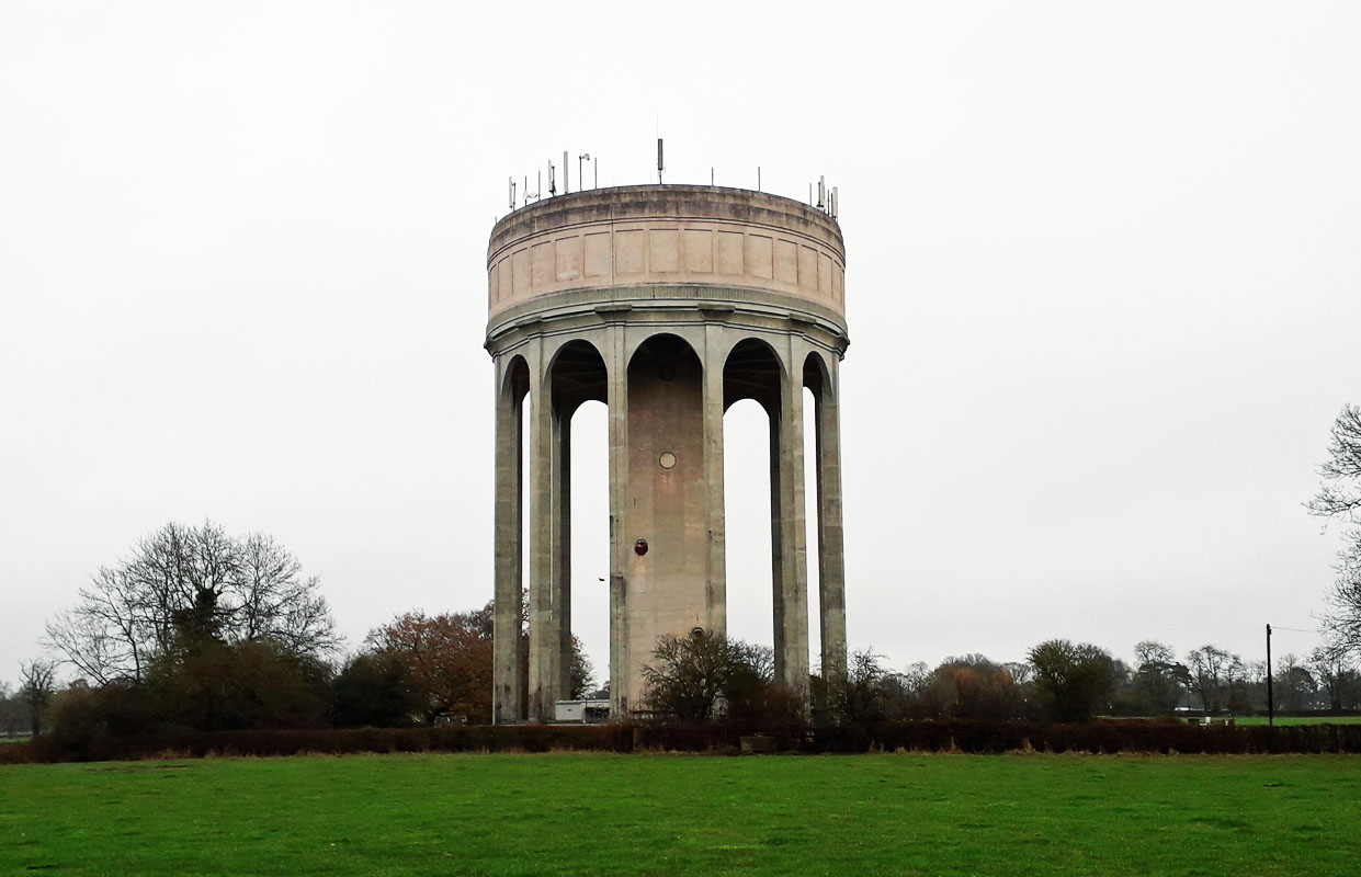 ASHLAWN ROAD WATER TOWER. (15WS24) ASHLAWN ROAD WATER TOWER. (15WS24)Ashlawn Rd, Rugby. This tower sits in 0.99 of an acre and in November 2023 was being sold by auction with a starting price of �95,000.00. It produces an income of �31,000.00 per annum or thereabouts. It is visible from the B4429 road south of Rugby. Grid Ref. 507729. There is a large new residential development nearby. 25 Hatton Asylum 1 & 2 26 Avon Carrow 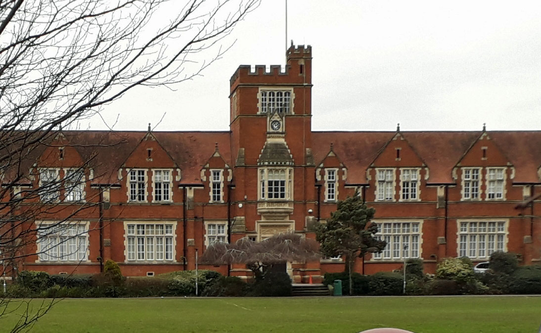 COUNDON WATER TOWER. (15WS27) COUNDON WATER TOWER. (15WS27)Coundon Rd, Coventry CV1 4AU. Coundon lies about a mile north-west of the centre of Coventry. This stately building is now Bablake School which was originally founded elsewhere in 1545. The tower appears as a centre feature of the building. It can be viewed from the access lane to the south-east of the main entrance. Woodlands and playing fields are a feature of this location. We would welcome further information regarding the above. 28 North Waste, Coventry NOT FOUND 29 Killcote House 30 Nelsons Cement 31 Northgate St. Warwick DEMOLISHED 32 Punchbowl, Warwick DEMOLISHED 33 Rugby Stoney DEMOLISHED 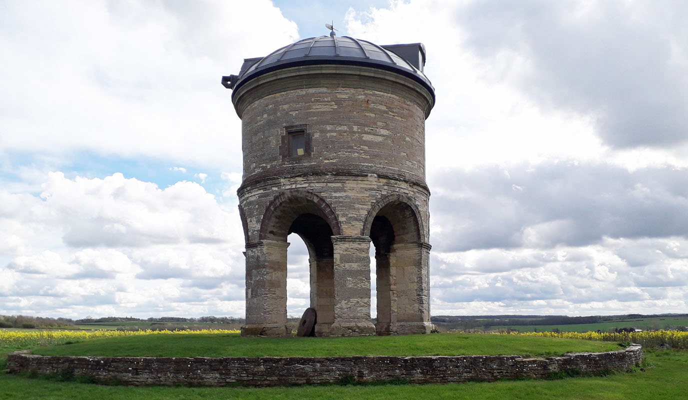 CHESTERTON DECEPTION TOWER. (15WS34) CHESTERTON DECEPTION TOWER. (15WS34)This tower is a landmark visible from the M40, on the right, as you drive north-west through Warwickshire. It is sited on a hill top about a mile from the motorway, just after junction 12 and before the service area. Water tower enthusiasts are impressed by its arched legs and stone construction prompting a closer inspection. When you get near Chesterton village, ask the locals where the tower is and you will be intrigued that they direct you to Windmill Hill and point out, if you are near it, that you are on Windmill Hill Lane. The tower is sited on an open space area of land and so exploring it is relatively easy, until, that is, you realise that it is a windmill that has lost its sails and not a water tower at all. Grid Ref. 348595. Nevertheless it is impressive, having stood on the hilltop for nearly 400 years! Northamptonshire 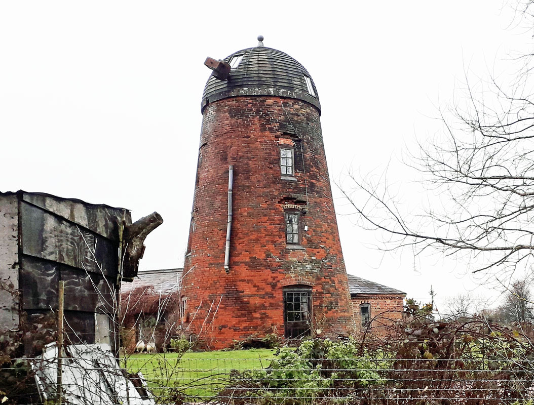
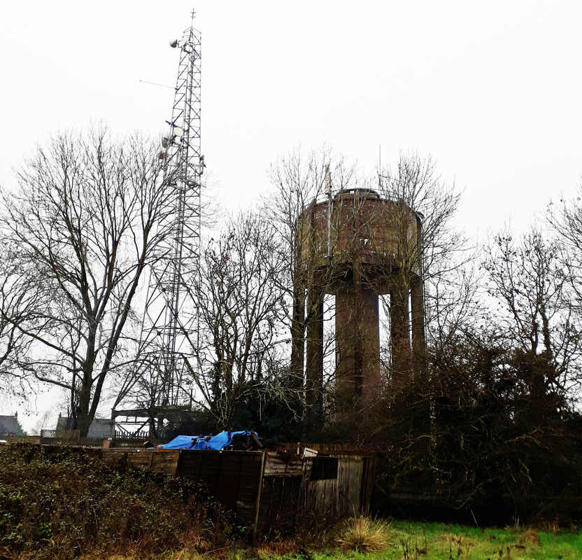 BARBY WATER TOWER. (15NS01) BARBY WATER TOWER. (15NS01)These two towers lie about 200 yards from each other in a field on the north-west side of the cross roads, just south of the village of Barby, south-east of Rugby. Grid Ref, 542695. They are described as two water towers elsewhere but appear to be a water tower and a windmill, the latter converted to residential. One may well be in Warwickshire as the county boundaries are in the immediate vicinity. 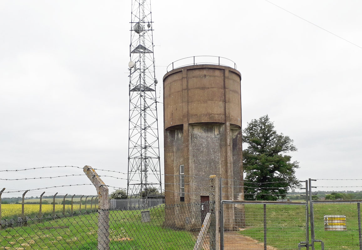 PRESTON CAPES WATER TOWER. (15NS02) PRESTON CAPES WATER TOWER. (15NS02)The village of Preston Capes is about six miles south of Daventry. This tower lies to the west of the village on the road to Charwelton by the road junction with the road south-west to Woodford Halse. Grid Ref. 567546. On the same plot is an aerial mast making the tower easy to spot. 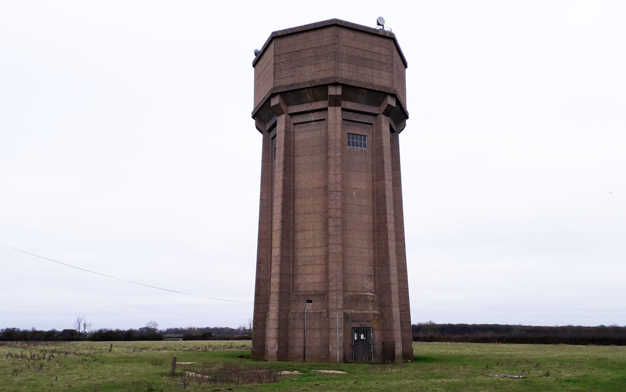 HALSE WATER TOWER. (15NS03) HALSE WATER TOWER. (15NS03)Halse is a village about three miles north-west of Brackley. The water tower lies about half a mile north-east of the village. It can be accessed via a bridleway past Halse Grange. It is a major local landmark and lies on a hill devoid of trees to conceal it. Grid Ref. 5708740782. It was built by Brackley Rural District Council in 1951. 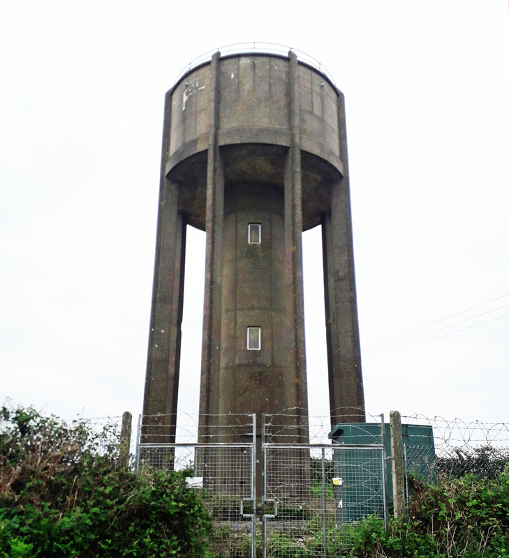 EVERDON STUBBS WATER TOWER. (15NS04) EVERDON STUBBS WATER TOWER. (15NS04)NN12 8HD. Near Farthigstone. Everdon Stubbs is a woodland area about 5 miles south-east of Daventry. The tower lies between Everdon and Heath Farm to the east. Grid Ref. 611565. It was the subject of a compulsory purchase order in 1953/4 by Mid Northamptonshire Water Board and was subsequently sold on in 2011. The tower is open for viewing at selected times. 5 West Haddon 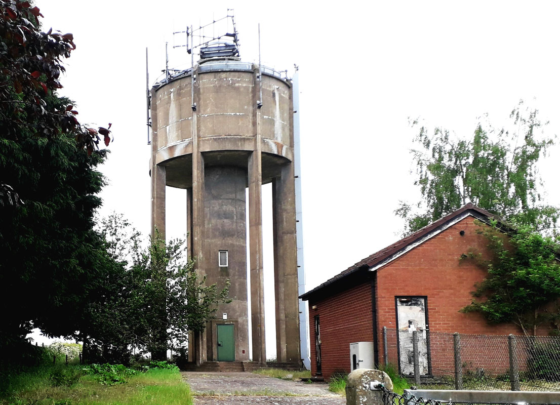 FLORE WATER TOWER. (15NS06) FLORE WATER TOWER. (15NS06)Hillside Road, Flore, NN7 4NA, on the western side of the village. Flore lies about 6 miles west of Northampton near junction 16 of the M1 motorway. Grid Ref. 6460. 7 East Haddon 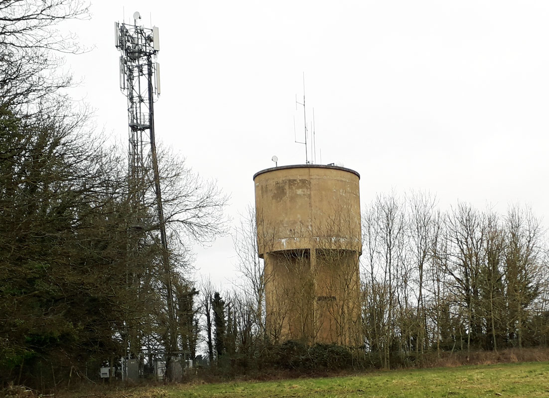 WHITTLEBURY WATER TOWER. (15NS08) WHITTLEBURY WATER TOWER. (15NS08)Kennel Road, Whittlebury. The tower lies on the western side of the A413 road between Buckingham and Towcester. Grid Ref. 690436. 9 Harpole 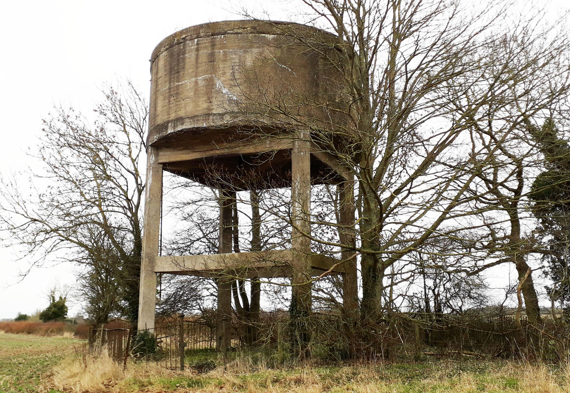 PAULERSPURY WATER TOWER. (15NS010) PAULERSPURY WATER TOWER. (15NS010)The village of Paulerspury lies about 3 miles south-east of Towcesster. To the west of the village is Pury End, a small hamlet where the water tower can be found. It is up a long half-mile track heading south-west and hidden in a clump of trees. Grid Ref. 756428. The tower was built in 1938 near a well on the western side of the parish supplying standpipes located at Pury End, Church End, Tews End and Plumpton End. 11 Brixworth 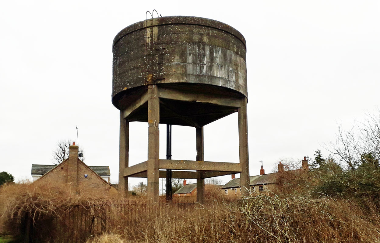 YARDLEY GOBION WATER TOWER. (15NS012) YARDLEY GOBION WATER TOWER. (15NS012)Moorend Road. The village lies on the A 508 road and the water tower is on the western perimeter of Yardley Gobion. In 1934 Towcester R.D.C. commissioned a new water supply system for the village at a then high cost of 1,388pounds 18s 8d. A local resident was appointed engineer/caretaker of the Waterworks which includede a 'Pumping Station', 'Water Tower' and 'Piping System to five Standpipes'. The tower had a capacity of 33,000 gallons. The most heavily used standpipe was situated at Church Bank adjacent to Church House. Today only the tower survives. Grid Ref. 759449. 13 Deanshanger Water Tower: SP 7640 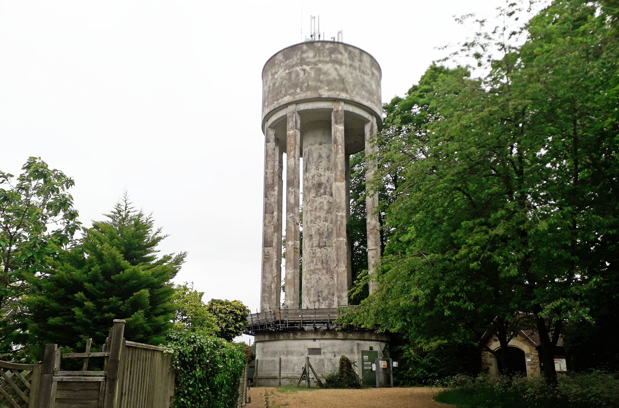 ROADE WATER TOWER. (15NS014) ROADE WATER TOWER. (15NS014)Manor Close. at the entrance to Roade Cemetery; just a few miles south of Northampton. This tower lies on the eastern side of Roade and can be viewed at a distance from the Northampton Road. Grid Ref. 76102 51779. Junction 15 on the M1 is nearby. Not to be confused with the Ashton Road tower on the south side of the village.(15NS055) This southern one ceased as a water tower in the early 1980s and was purchased for possible conversion to residential. 15 Boughton 16 Hardingstone 17 Harrington GONE 18 Stimpson Avenue, Northampton GONE 19 Dingley 20 Desborough 21 Brafield on the Green 22 Rothwell 23 Ecton 24 Broughton 24 Broughton GONE 25 Mears Ashby 26 Beanfield, Corby 1 & 2 27 Earls Barton 28 Great Doddington 29 Isham 30 Rockingham >br> 31 Willowbrook, Corby 32 Tanfields, Corby 33 Gretton 34 Stannion Lane, Corby 1 & 2 GONE 35 Wollaston 36 Finedon 37 Irchester GONE 38 Grafton Underwood 39 Manton, Rushden 40 Brigstock GONE 41 Woodford 42 Bedford Rd, Rushden 43 Collyweston 44 Denford Ash 45 Raunds GONE 46 Southwick 47 Hemington 48 Ashton Wold 49 Blisworth Rly. Stn. GONE 50 Roade(S) 51 Abington Park, Northampton 52 Castle Ashby 53 Corby Steelworks W 54 Corby Steelworks E 55 Ashton Road Roade. 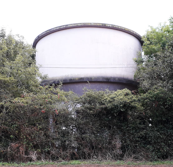
The above picture has come to light of a water tower in Warwickshire. Where is it? If you know do let us know. bruce.e.osborne@gmail.com REGION England - Central, WATER TOWER INTEREST |
||||
|