
HOME


|
HOME
|
|
|
|
|
|
P R O F I L E |
||||
|
  WONDERFUL WATER TOWERS IN BRITAIN
Barton map number 16
In order to display a database of water towers, Britain has been divided into county groups with each group on a separate web page. The starting point is the towers identified in Barton B. (2003) Water Towers of Britain, The Newcomen Society. This data has then been updated.
Website: Click Here ADDITIONAL INFORMATION Shropshire 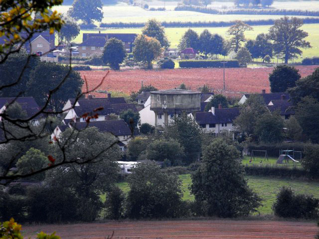 WILCOTT WATER TOWER(16SH01) WILCOTT WATER TOWER(16SH01)Wilcott, Nescliffe, just 2 miles north-west of Shrewsbury, just off the A5 road - photographed by Penny Mayes. 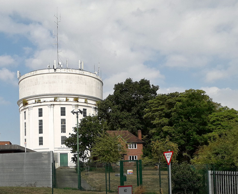 SHELTON WATER TOWER (16SH02) SHELTON WATER TOWER (16SH02)Shelton, just west of Shrewsbury. SY3 8BJ. This tower lies at the entrance to a military establishment on the A 458 road and is managed by Severn Trent Water. The name is over the door entrance. 3 Market Cross Shrewsbury LOST 4 St Mary's, Shrewsbury - originally located behind the building opposite the main entrance to the church, now long gone. 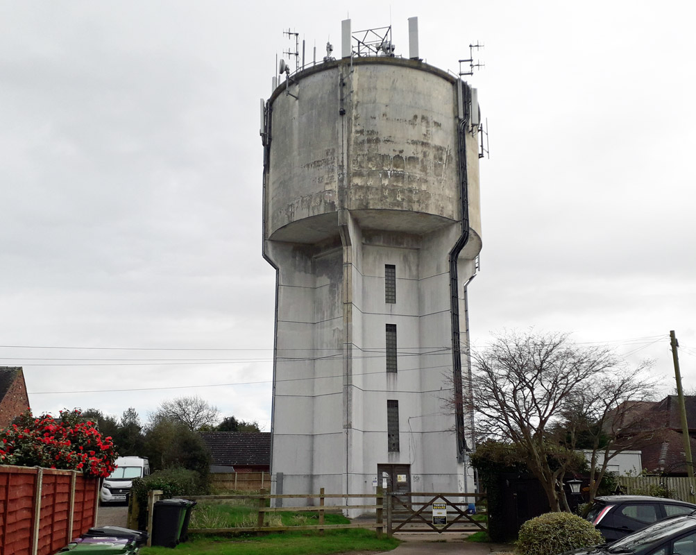 MARKET DRAYTON WATER TOWER(16SH04) MARKET DRAYTON WATER TOWER(16SH04)Tower Close, TF9 2AB. Just west of the A529, south of Market Drayton. From Prospect Road, turn right into Cemetery Road, then turn right into Tower Close. This Severn Trent water tower appears to have its priorities changed being more important as a transmission tower than a water tower. 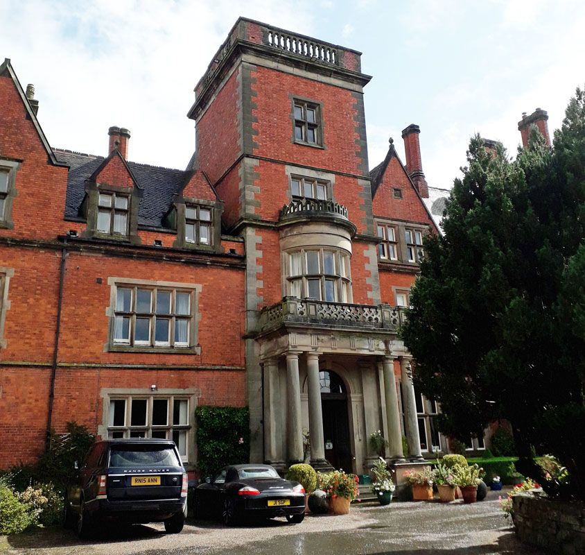 CHESWARDINE HALL WATER TOWER(16SH05) CHESWARDINE HALL WATER TOWER(16SH05)Located at the end of Church Lane, a short distance south of Chipnall, 4 miles south-east of Market Drayton, Staffs. TF9 2RQ. This stately home was built 1875-1880. It is now a nursing and residential care home. The water tower appears to be the centrepiece located over the front door entrance. Grid Ref. 725310. 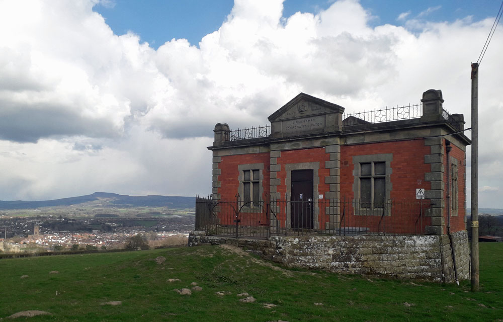 LUDLOW WATER TOWER (16SH06) LUDLOW WATER TOWER (16SH06)Whitcliffe, Ludlow, Shropshire. This Clee View tower is located on the hills overlooking Ludlow where an astounding view can be had of Clee Hill to the east beyond Ludlow town. The tower dates from 1902 when is was constructed as part of the Birmingham Water Corporation project to secure a water supply from the Elan Valley in Wales. This project, which commenced in the last years of the 19th century, has continued to supply water to this day. 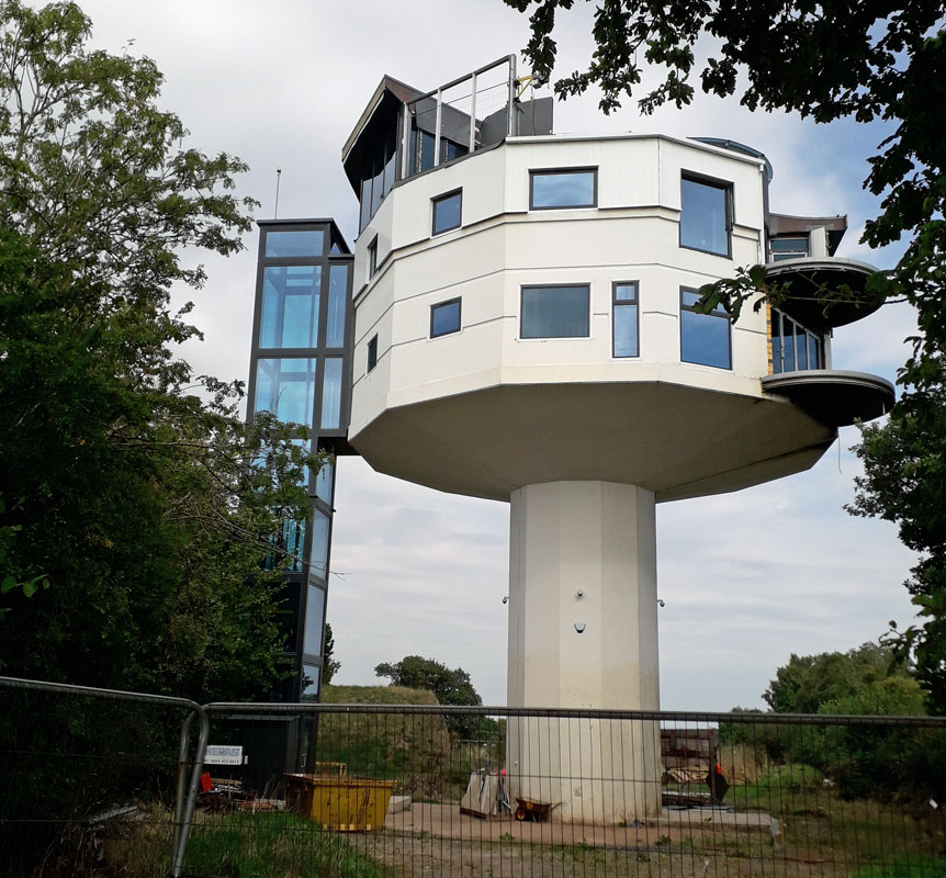 NETCHWOOD WATER TOWER (16SH07) NETCHWOOD WATER TOWER (16SH07)Lying about 4 miles west of Bridgenorth, this tower is located at Netchwood alongside a north - south country lane. WV16 6SE. It has imaginatively been converted to residential and at the time of viewing was nearing completion. The conversion was first promoted in 2012. 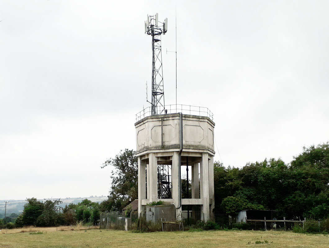 TASLEY WATER TOWER (16SH08) TASLEY WATER TOWER (16SH08)About a mile west of Bridgenorth lies the village of Tasley on a minor road off the A 458. The tower can be seen on the hill as you approach the village. The property comprises a prominent free-standing octagonal water tower. The elevated tank is supported on eight legs with a steel ladder running up one side to the dome of the tower where there is a railed perimeter. It is owned by Severn Trent Water and is disused. It is coming up for auction at the time of finding in 2022. 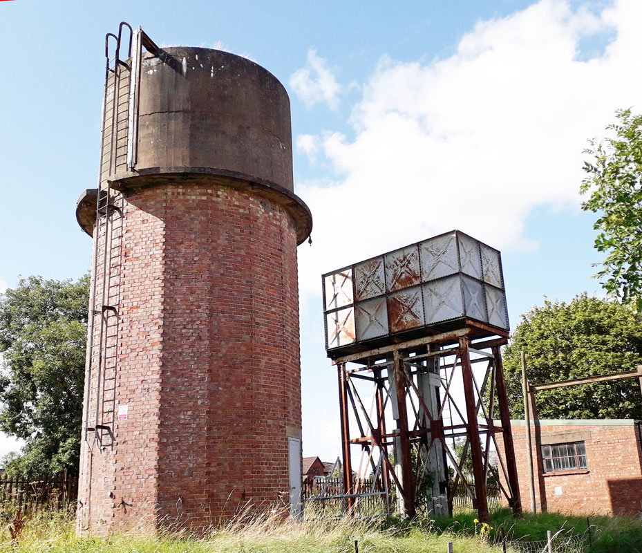 DITTON PRIORS WATER TOWERS (2) (16SH09) DITTON PRIORS WATER TOWERS (2) (16SH09)The two towers are located on what is now an industrial/trading estate at the end of Station Road, on the east side of Ditton Priors in South Shropshire near Bridgenorth. The site of the towers was formerly adjacent to the railway station, closed in 1938 and now demolished, which had two steel towers at the end of the platform. One of the present towers may be one of these towers. What is now the industrial estate was once a goods yard handling local building stone (dhustone) quarried nearby. The railway opened in 1908 and closed in the 1960s. During World War 2 a naval base was established here. Also, for a brief period in 1967 the American Army used the site as a base, having had difficulties with their location in France. This occupation ceased in 1968. Military occupation may have resulted in the construction of the brick water tower. 10 RAF Shawbury 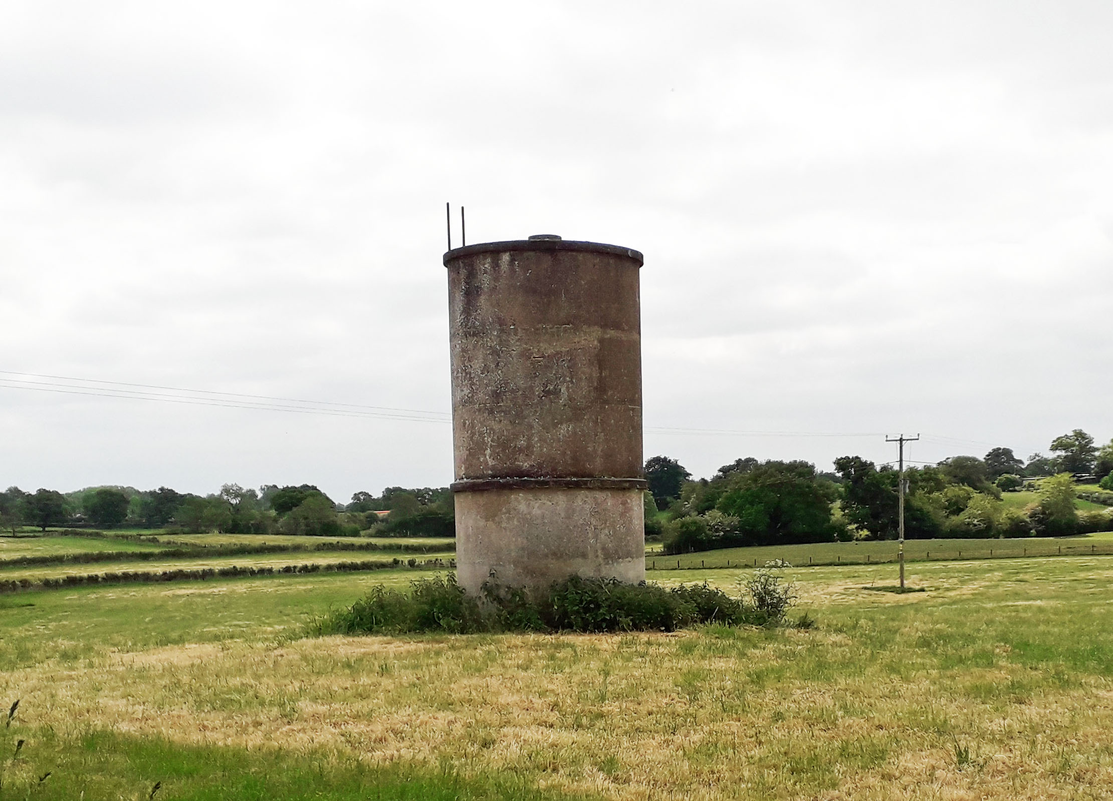 OLD WOODHOUSE WATER TOWER (16SH11) OLD WOODHOUSE WATER TOWER (16SH11)Old Woodhouse is a locality about 3 miles east of Whitchurch along the A 525 road. The water tower is at the junction of the A 525 with Dark Lane, a road going north just before Old Woodhouse if you are coming from the west. Grid Ref. 579421. The tower lies in the field to the north-east of the junction. 12 Lady Forester Hospital, Much Wenlock. The building survives as a Care Home for the Elderly in Farley Road, A4169, Much Wenlock. There is no sign of the water tower however. 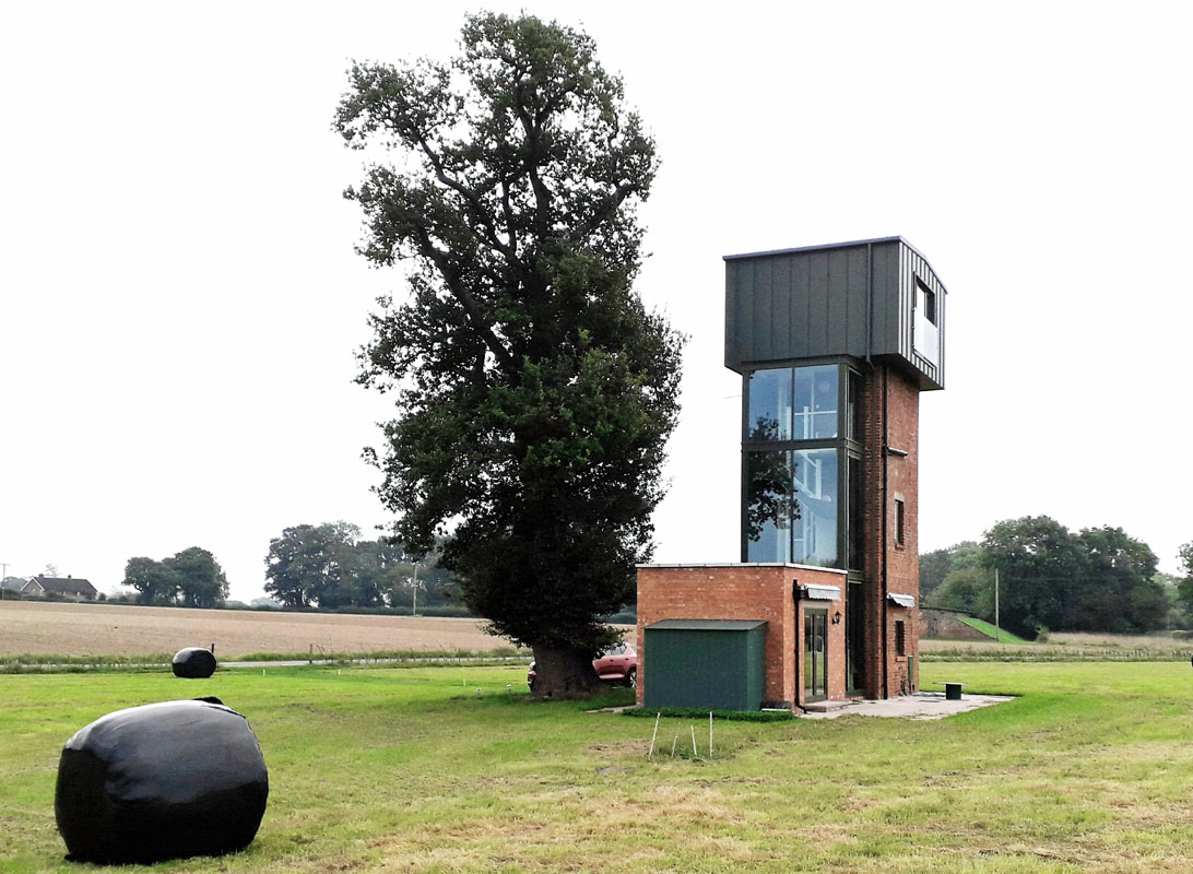 KINNERLEY WATER TOWER (16SH13) KINNERLEY WATER TOWER (16SH13)Vicarage Lane, SY10 8DJ. About 7 miles south of Oswestry. This is one of three similar towers in the area and originated from WW II when there was ammunition stored in many nearby locations. The tower supplied water for the steam train that linked the locations. In the 21st century it was converted to residential and a top floor added that replicated the original, long gone, tank. The conversion was completed in 2023. Grid ref. 333208. 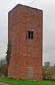 PEN-Y-PARK WATER TOWER (16SH14) PEN-Y-PARK WATER TOWER (16SH14)From Knockin take the B 3098 road towards Llanymynech. After about one mile take a turning on the left with large stones either side. The derelict tower is about 200 yards on the left. This is the second of three similar towers in the area and originated from WW II when there was ammunition stored in many nearby locations. Approximate grid ref. 310214. 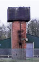 FARM HALL WATER TOWER (16SH15) FARM HALL WATER TOWER (16SH15)From Kinnerley centre take the road south past the school. After about a mile the road goes over a now defunct railway bridge. Just before this is a cross roads by a stream. The track to the right is private property and the gated water tower can be seen about 300 yards up this track, on the left. This is the third of three similar towers in the area and originated from WW II when there was ammunition stored in many nearby locations. The tower appears to be in use and still has the tank in place. Approximate grid ref. 337199.  RODEN WATER TOWER (16SH16) RODEN WATER TOWER (16SH16)Roden in Shropshire: this village was a major producer of greenhouse crops for the Co-operative Wholesale Society. The acreage under glass was extensive, but much has now been demolished. There are about 14 tanks marked on the OS maps in its heyday, of which at least three could be deemed towers. Two have been demolished. The one in the photo as far as I'm aware is still standing. It's located at grid reference SJ57393 12576. We wish to acknowledge and thank enthusiast James Went for these details. Staffordshire 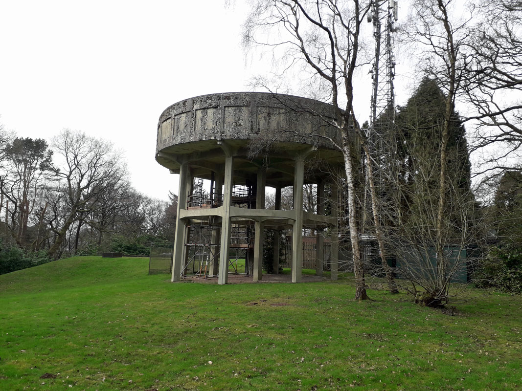 ASHLEY HEATH WATER TOWER (16ST01) ASHLEY HEATH WATER TOWER (16ST01)Tower Road, Ashley Heath, Staffs. Grid Ref. 74569 35745. This High concrete tower lies at the far end of Tower Road which is a road off the B5026 road; this B road is a turning off the A53 main road. The location is about 5 miles east of Market Drayton. It supposedly originated during World War II when munitions were stored in the locality. 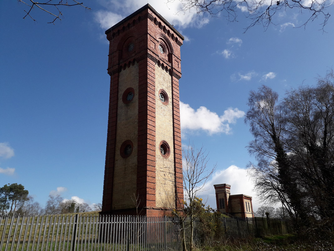 HANCHURCH WATER TOWER (16ST02) HANCHURCH WATER TOWER (16ST02)Harley Thorn Lane, Hanchurch Hills, just south-west of the M6 motorway Jn. 15. Staffordshire Potteries built this tower circa. 1890, to supply Newcastle under Lyme and Stoke-on-Trent to the north, in conjunction with the adjacent reservoir located as part of the overall development. Grid Ref. ST 840440. 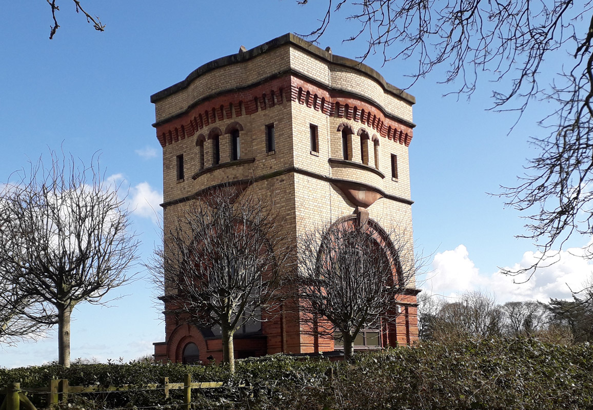 SWYNNERTON WATER TOWER (16ST03) SWYNNERTON WATER TOWER (16ST03)This tower is converted to private residential status albeit located alongside a Severn Trent reservoir. It lies about 4 miles west of Stone, in Stab Lane, ST15 0QD, about half a mile north of Swynnerton village. It dates from circa. 1890 and is Grade II listed. Grid Ref. ST 840440. 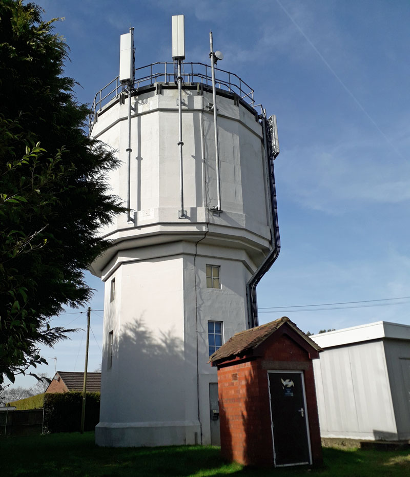 MEIR HEATH WATER TOWER (16ST04) MEIR HEATH WATER TOWER (16ST04)Common Lane, Meir Heath, Staffs., just south of Stoke on Trent. This round concrete tower lies in the centre of a hill top housing estate; not to be confused with another tower that lies a hundred yards away in a car park at the top of Windmill Hill. This second tower is a windmill tower adjacent to a public house of similar name. 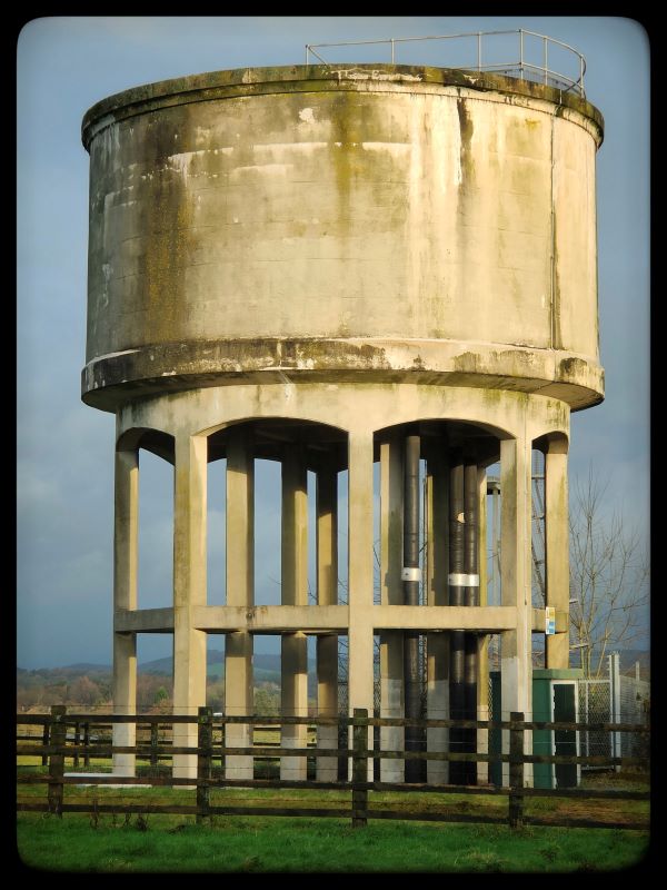 LONGSDON WATER TOWER (16ST05) LONGSDON WATER TOWER (16ST05)Location: School Lane, Longsdon. Grid Ref 954551. The tower dates from 1965-1970. Longsdon is about 1 mile south-west of Leek. Near the tower is Dunwood. This appears to be the alternative name for this tower. We acknowledge and thank local enthusiast Adam Brassey who supplied this picture and information. 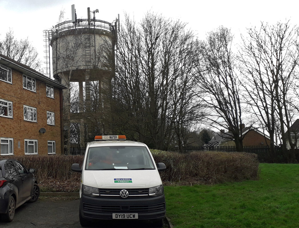 ESSINGTON 1 WATER TOWER (16ST06(1)) ESSINGTON 1 WATER TOWER (16ST06(1))Hill Street, Essington, Staffs. No longer a working water tower since the early 21st century. Local pressure to remove it. Now used for aerial masts. 6 Essington 2 7 Bednall GONE 8 Morrilow Heath 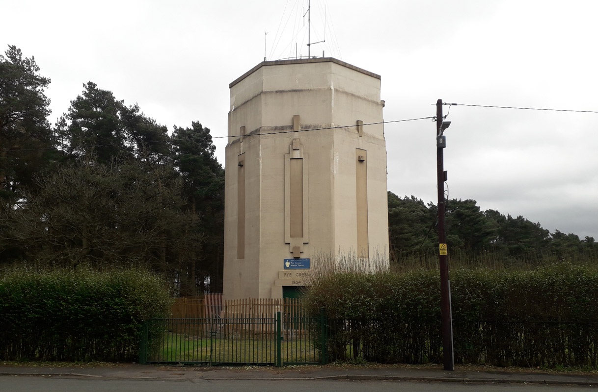 PYE GREEN WATER TOWER (16ST09) PYE GREEN WATER TOWER (16ST09)Hednesford, Staffs. WS12 4LL. 65 feet high and 800 feet above sea level; this tower can be seen at the hill top, northern end of Pye Green Road. It is operated by the South Staffordshire Water Company and has a date of 1934 over the entrance door. 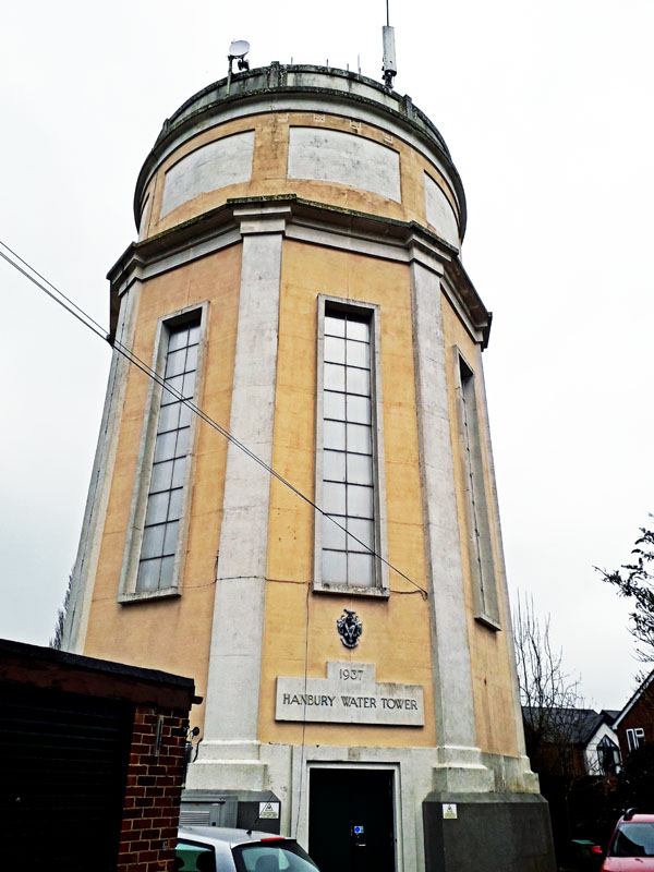 HANBURY WATER TOWER (16ST10) HANBURY WATER TOWER (16ST10)Church Lane. Built in 1936, this tower lies on Hanbury Hill, near the 13th century parish church, about 6 miles west north west of Burton On Trent. Grid Ref. 172 279. It is an impressive structure and is prominent in the village together with the local church of Saint Werburgh. 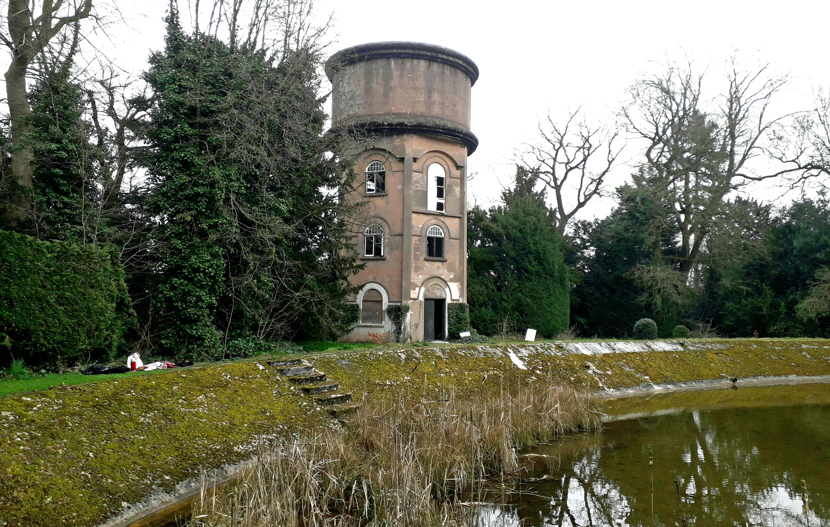 ROLLESTON ON DOVE WATER TOWER (16ST11) ROLLESTON ON DOVE WATER TOWER (16ST11)Church Road, Rolleston on Dove Hall estate, DE13 9DG, about 3 miles north east of Burton on Trent. The tower stands on the edge of a substantial open reservoir and was established for water supply to the estate about 1913. The Hall was accommodated by families such as the Moseleys. This included Sir Oswald Moseley. Water was pumped up from a deep well nearby. The Hall was demolished in 1928. The South Staffs Waterworks acquired the freehold of the land in 1932 and in 1982 it was passed to the local swimming club who used the open reservoir. The club ceased operation in 2003. Grid Ref. 22766 27988. Viewing access is difficult, however the tower is visible from the road. 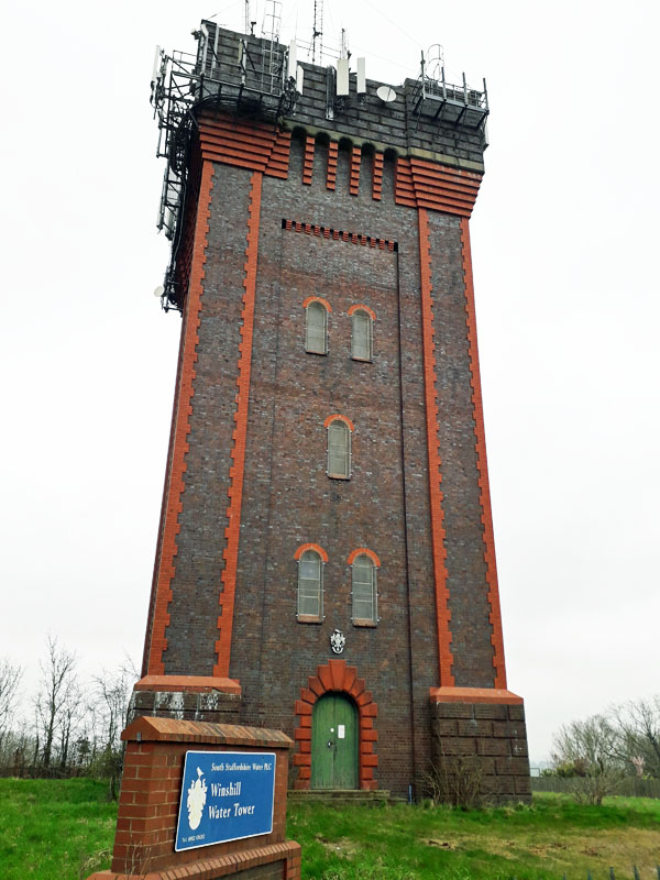 WINSHILL WATER TOWER (16ST12) WINSHILL WATER TOWER (16ST12)Also known as Waterloo Tower, Waterloo Clump. This tower overlooks Burton on Trent from the A50 road and hill to the east. As such it is a predominant landmark. Grid Ref. 265 229. It dates from 1907, following concern that the water pressure that existed at the time with the South Staffordshire Waterworks Company supply was deficient. The water tank, at a height of 80 feet, ceased supplying the locality in the latter years of the 20th century. 13 Michelin, Stoke on Trent GONE  ST. EDWARD'S HOSPITAL WATER TOWER (16ST14) ST. EDWARD'S HOSPITAL WATER TOWER (16ST14)Leek Road, Cheddleton. Location: About 3 miles south of Leek, Grid Ref 975537. Originally known as Cheddleton Mental Hospital, it was a good example of a self contained asylum village. It was renamed after World War II by the NHS and finally closed in 2002. Subsequent residential development has resulted in the water tower being preserved. We acknowledge and thank local enthusiast Adam Brassey who supplied this picture. 15 Burton Workhouse 1 & 2 GONE 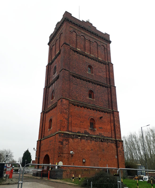 WASHLANDS WATER TOWER (16ST16) WASHLANDS WATER TOWER (16ST16)Burton on Trent, Meadowside Drive. Also known as Bass Water Tower, this building is 37 meters high. Formally part of a brewery, it is hoped to convert it to a tourist attraction. 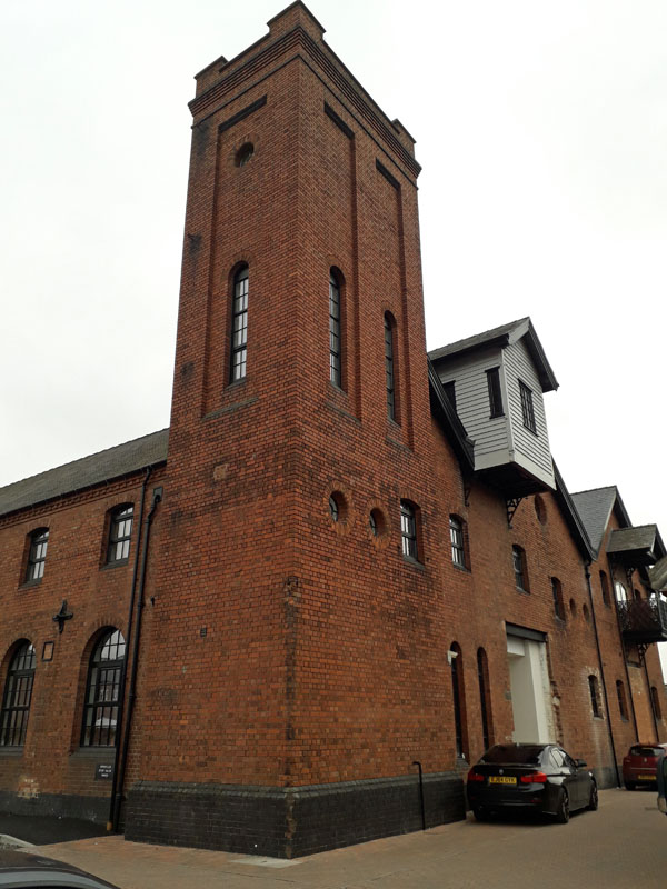 PLOUGH MALTINGS WATER TOWER (16ST17) PLOUGH MALTINGS WATER TOWER (16ST17)Burton on Trent, Horninglow Street. A 19th century tower now Grade II listed. Formerly a brewery it is now residential apartments. 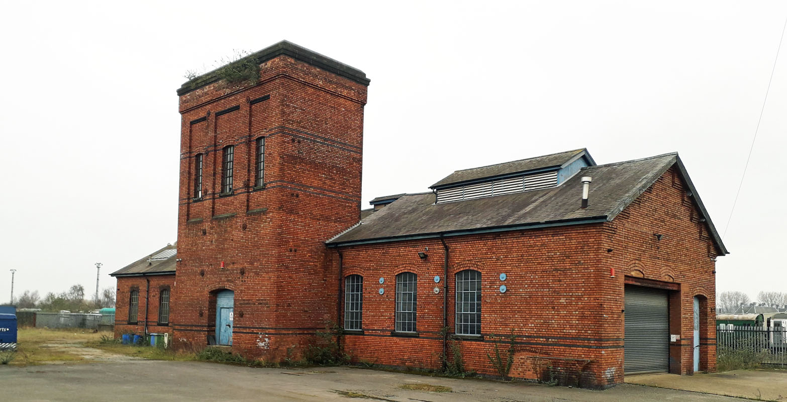 RAILWAY WATER TOWER (16ST18) RAILWAY WATER TOWER (16ST18)Burton on Trent. Once a necessity for steam locomotives, this redundant tower lies on the main line railway track not far from the main station. The best way to see it is from a train that is passing through Burton on Trent. An alternative is to peer through building premises in the Roman Way/Derby Road area in the town center. 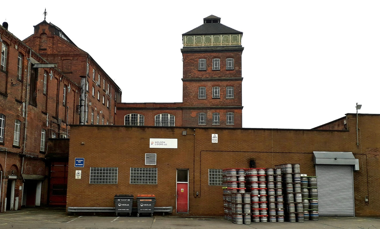 MOLSON COORS WATER TOWER (16ST19) MOLSON COORS WATER TOWER (16ST19)Molson Coors, Burton on Trent. This tower lies behind the Guildhall and the company Molson Coors continues to brew beers locally.  YARNFIELD PARK WATER TOWER (16ST20) YARNFIELD PARK WATER TOWER (16ST20)Conference Centre, on the northern side of Yarnfield, just west of Stone. The GPO took over three wartime hostels in 1947 at Yarnfield, Staffordshire to establish a central training school. These buildings were eventually replaced between 1967 and 1969 by which time the GPO had become the PO. Training in telephony, motor transport and mechanised mail handling took place on the site until telephony was separated in 1969, probably taking a year or two to be fully implemented. The training centre is now a general conference centre named Yarnfield Park but no longer owned by BT. The water tower was built sometime between 1967 and 1969. Grid Ref. SJ86742 33245. We wish to acknowledge and thank enthusiast James Went for these details.  TRINITY HOUSE WATER TOWER (16ST21) TRINITY HOUSE WATER TOWER (16ST21)Many of the larger schools built in the 1960s had water towers. Examples of such include several in Staffordshire - Stone, Stafford and Norton Canes (near Cannock). All buildings are now demolished and a new school has been built on site. There were originally two schools, the Graham Balfour Grammar School and the Trinity Fields Secondary Modern School, co-sited with a view to them becoming comprehensive in the future. Trinity Fields is thought to date to as early as c.1958 or 1959. Graham Balfour was built c.1961. Each school had identical water towers, with hardwood cladding around the tanks. The Graham Balfour tower (off to the right of the photograph) was located at grid reference SJ 91639 25650. In the photo itself, the buildings in the foreground are Graham Balfour, but the water tower is that of Trinity Fields. Frustratingly, the Trinity Fields tower isn't marked on the 1:1250 or 1:2500 OS maps, whereas the Graham Balfour one is. We wish to acknowledge and thank enthusiast James Went for these details. CHESHIRE JOINT SANATORIUM WATER TOWER (16ST22)Loggerheads, Staffordshire: This TB Sanatorium was built c.1922 and opened in 1923. It closed in 1969 when the last two patients were discharged, and demolished in 1977. The water tower (52' high according to one source) was located at grid reference SJ73537 35585. We wish to acknowledge and thank enthusiast James Went for these details. West Midlands 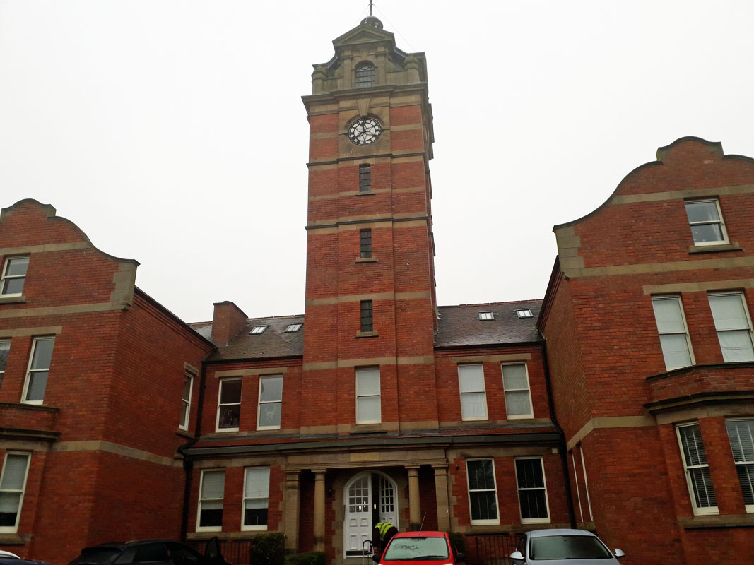 WORDSLEY HOSPITAL WATER TOWER (16WM01) WORDSLEY HOSPITAL WATER TOWER (16WM01)Tower Lodge. Wordsley lies to the north of Stourbridge, west of Birmingham. The tower is located on the northern side of Wordsley to the east of the main A491 road. Formerly part of Worsley Hospital, this tower survived the closing of the hospital and a period of dereliction before a new role was established with the conversion of the estate to residential housing. Grid Ref. 894875. This is not to be confused with Wordsley High Acres Water Tower which is a privately owned concrete tower with antennae masts. 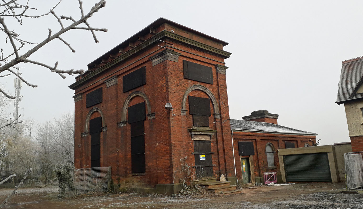 GOLDTHORN HILL WATER TOWER (16WM02) GOLDTHORN HILL WATER TOWER (16WM02)WV2 3JA. Located at the top of Goldthorn Hill. This tower is at present derelict (2023) as the site overall awaits redevelopment. It dates from 1851 and was a pumping station utilising the water from local deep wells to supply the local community. It is Grade II listed. 3 Turners Hill, Rowley Regis GONE 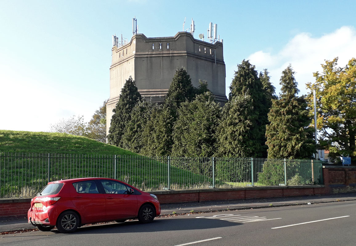 WARLEY WATER TOWER (16WM04) WARLEY WATER TOWER (16WM04)This magnificent tower stands at the top of a hill and is visible for some distance. It is located in a much larger working site of the local water company in Harbourne Road, B68 9JG. It lies just inside the West Midlands region, to the south near the border with Hereford and Worcester. It is operated by South Staffordshire Water. 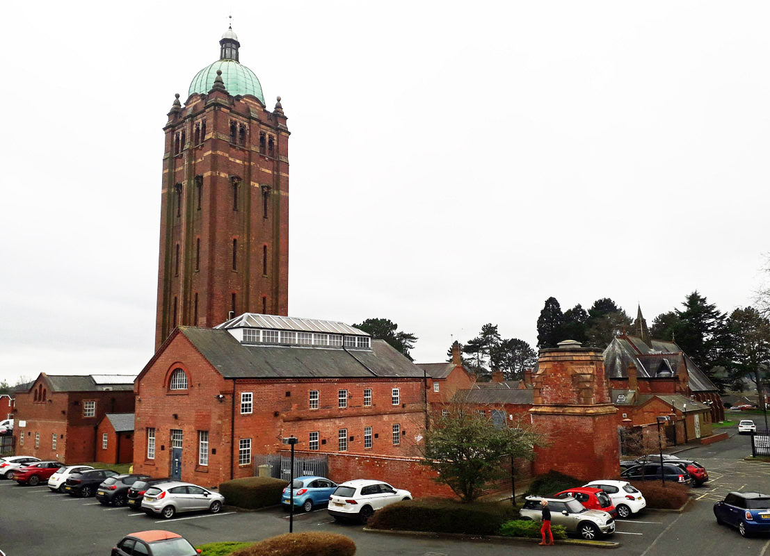 HOLLYMOOR HOSPITAL WATER TOWER (16WM05) HOLLYMOOR HOSPITAL WATER TOWER (16WM05)Sovereign Heights B31 5DX. No longer a working water tower, Hollymoor Hospital remains a working medical centre in Holymoor Way, Frankley, West Midlands. The tower is Grade II listed and formerly served the hospital/asylum. > 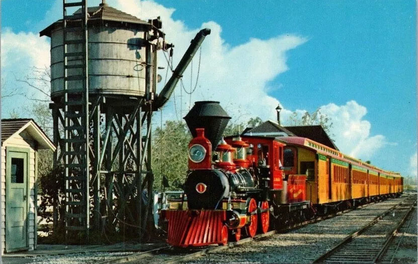
The above illustration is of an early water tower, location suspected of being Disneyland. REGION England - Central, WATER TOWER INTEREST |
||||
|