
HOME


|
HOME
|
|
|
|
|
|
P R O F I L E |
||||
|
  WONDERFUL WATER TOWERS IN BRITAIN
Barton map number 05
In order to display a database of water towers, Britain has been divided into county groups with each group on a separate web page. The starting point is the towers identified in Barton B. (2003) Water Towers of Britain, The Newcomen Society. This data has then been updated.
Website: Click Here ADDITIONAL INFORMATION Greater London 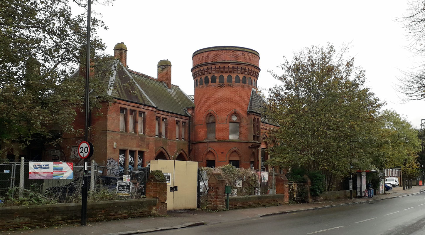 LADYWELL BATHS WATER TOWER (05GL00) LADYWELL BATHS WATER TOWER (05GL00)Ladywell Road, Ladywell, Lewisham. SE13 7UW. This property, which is currently derelict (2023), was once a public bath house with two swimming pools and individual bath facilities for the public to use, in the absence of bathrooms at home. As early as 1472 a spring was recorded in Ladywell Road. It was called Our Lady's Well because of its healing powers and was visited by pilgrims on their way to Canterbury. This provided a reason for siting the baths here. The building in Grade II listed and restoration was approved by the Council in 2022. Although its original use is now obsolete, it was envisaged as a public recreation centre, with the swimming pool converted to a cinema and the remainder being used for a variety of public functions. The building dates from 1884 and is structurally still in sound condition in spite of being damaged by fire and timber decay over the years and the tower missing its original conical roof. Grid Ref. 375748. For an update on progress with restoration go to: https://www.bbc.co.uk/news/uk-england-london-66985435 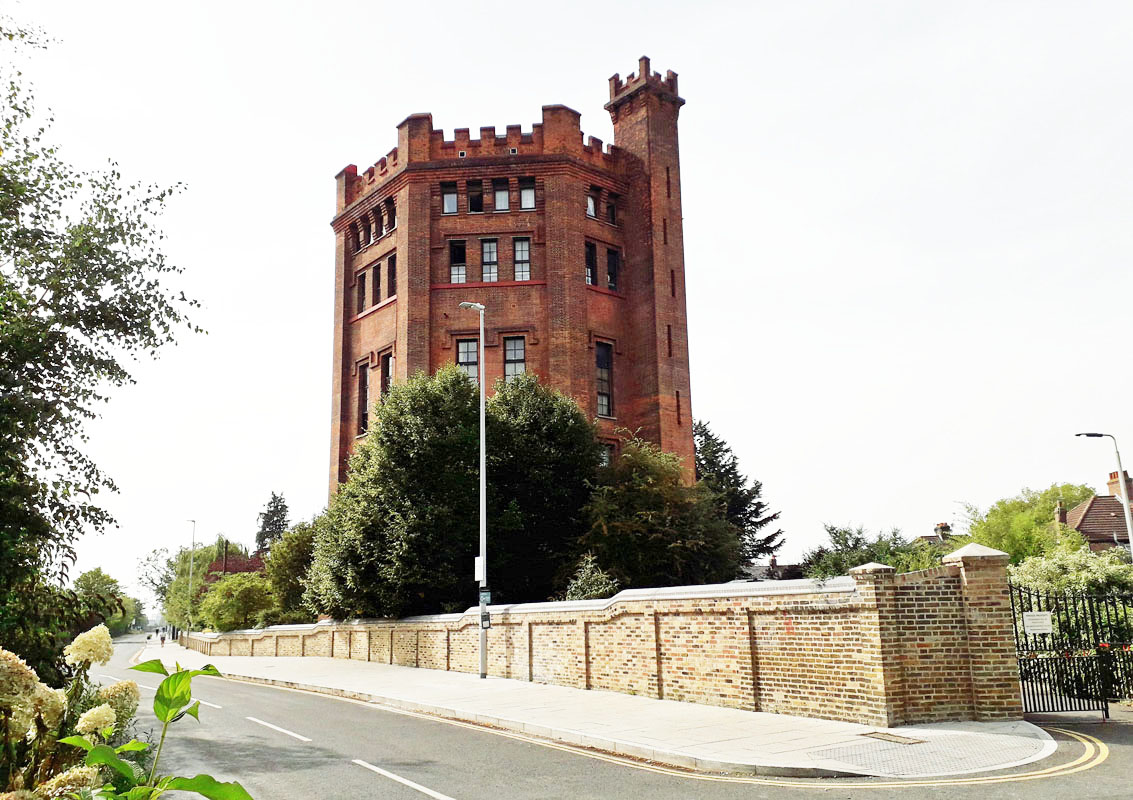 SOUTHALL CASTLE WATER TOWER (05GL01) SOUTHALL CASTLE WATER TOWER (05GL01)The Crescent, Southall. UB1 1QU. This, now residential water tower is located at 1 The Straight and is integral with a modern day development of the area by Berkeley Homes. It lies alongside the railway in the centre of Southall and is known as Southall's Castle. The tower was built 1895-1903 but received criticism of design by Queen Victoria. As a result it was restyled with the brickwork exterior that we see today. It originally served the adjacent railway steam locomotives but was decommissioned in the 1960s. It is Grade II listed. 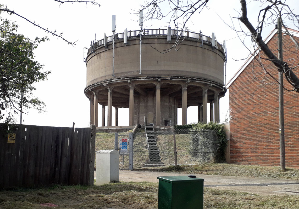 ALLENBY ROAD WATER TOWER (05GL02) ALLENBY ROAD WATER TOWER (05GL02)Southall, Greater London. This tower is located near the junction with Avon Road, north of Southall. The structure dates from the inter-war years when housing estates were built in the locality. Before the houses were built Allenby Road was known as Muddy Lane. 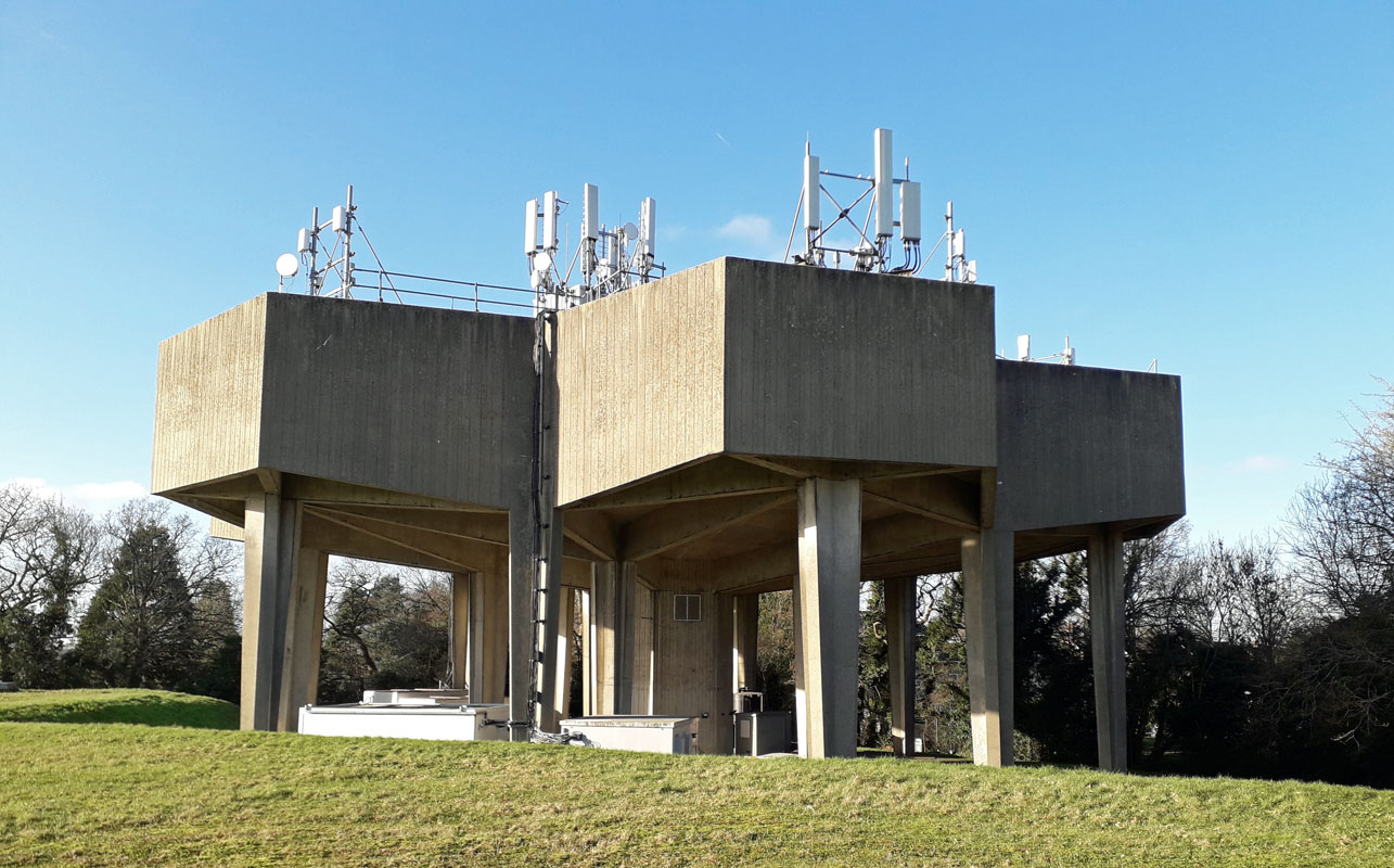 ARKLEY WATER TOWER (05GL03) ARKLEY WATER TOWER (05GL03)Located in Rowley Green Road, Arkley, this 1965 water tower is distinct with its box like concrete structures. It lies a mile or so on the western side of Barnet and is in use as part of a large water storage facility which includes underground reservoirs. Grid Ref. 219957. To access the locality take junction 23 exit from the M25 and head south for about 4 miles. 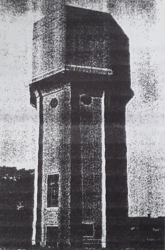 GRENNELL WATER TOWER (05GL04) GRENNELL WATER TOWER (05GL04)Great Grennell Hill, Benhilton, SM1 3DY. Built in 1934, this concrete water tower was erected for the new St Helier estate in Sutton by the Sutton District Water Company. However it failed its acceptance trials and was never put to use due to hydraulic problems. It was demolished shortly after WW II. Greenshaw High School, built in the 1960s, now locates on the water tower site in Grennell Road. 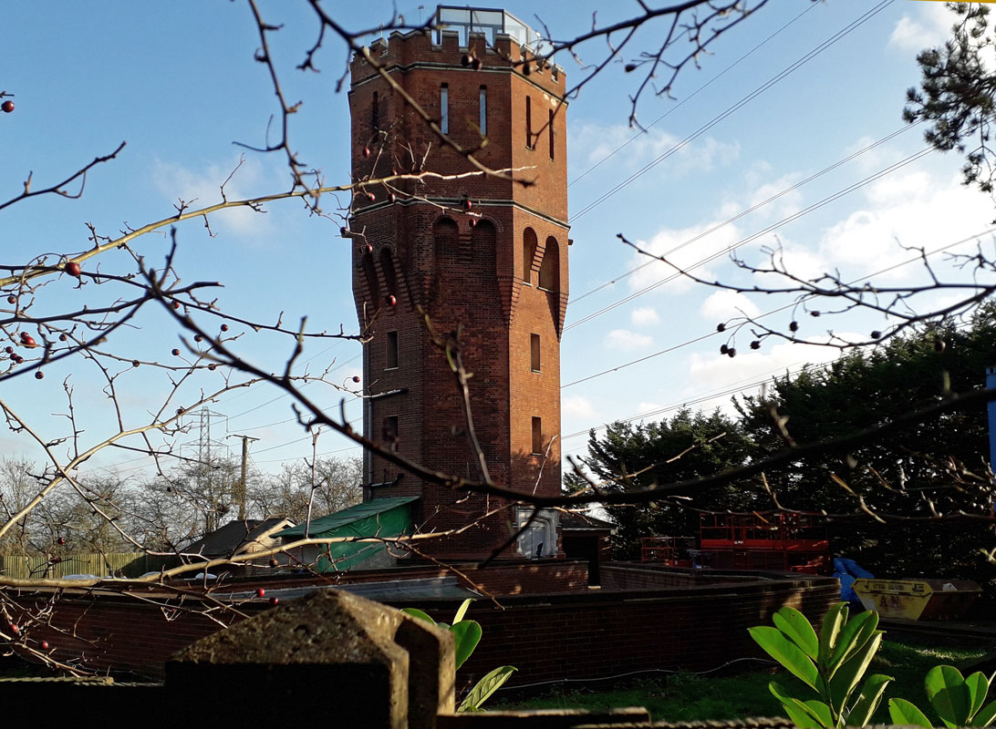 PLUMRIDGE HILL WATER TOWER (05GL05) PLUMRIDGE HILL WATER TOWER (05GL05)Built in 1913 by the Enfield Local Board and now residential, this tower is situated just south of the M25 motorway. To view it take junction 24 off the motorway and head east along the A1005 towards Enfield. The tower is about one mile from the motorway junction on the left at Plumridge Hill. Grid Ref. 275998. It is located in an industrial yard and access is restricted. 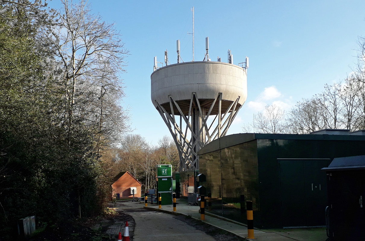 COCKFOSTERS WATER TOWER (05GL06) COCKFOSTERS WATER TOWER (05GL06)This tower is located about 4 miles south of junction 24 of the M25 motorway. Take the A111 Cockfosters Road and the tower can be seen on the left as you enter the township of Cockfosters. Grid Ref. 279973. Situated adjacent to the Cockfosters Reservoir in north London, on the edge of Trent Park, it is known for its supporting hyperboloid lattice of reinforced concrete. The tower was architecturally designed in conjunction with J.W. Milne, chief engineer of the Lee Valley Water Company and dates from 1968. It was later owned by Three Valley Water and Veolia Water and subsequently by Affinity Water. It has a capacity of 1,130 cubic meters. Now it is located in a commercial yard and access is restricted. 7 Villiers St, London. Investigation has revealed no apparent water tower. 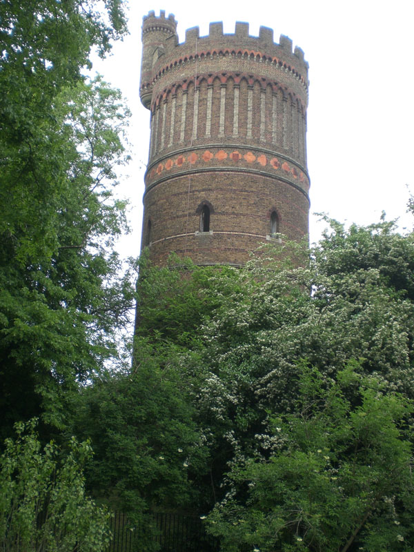 PARK HILL TOWER CROYDON (05GL08) PARK HILL TOWER CROYDON (05GL08)Park Hill, Croydon, South London. This 125 foot high Water Tower was constructed at Park Hill in 1867. Unfortunately provisions for supplying water locally still proved inadequate. This site in central Croydon was eventually abandoned in 1923. The tower had been opened to the public as a viewing platform in 1889. The tower survives in a public park to this day, albeit disused. Click right to see more.  CRYSTAL PALACE WATER TOWERS AND TANK (05GL09) CRYSTAL PALACE WATER TOWERS AND TANK (05GL09)Anerley, South London. After the 1851 Great Exhibition in Hyde Park, the Crystal Palace was relocated to South London where it overlooked the valley of the Norbury Brook and River Graveney. In the surrounding park were numerous water features and fountains, many of which survive to this day. Two similar 86 meter tall water towers were included in the rebuilding of the Crystal Palace. It continued to stun visitors until in 1936 the main building burnt down. The two towers and associated tank that supplied the numerous fountains survived the great fire that destroyed the palace. The towers were eventually removed in World War II to prevent them being used as a navigation aid by enemy aircraft. Click left to view the famous Schweppes Fountain at the palace and details of the water towers. 10 Heathfield, Croydon. SEE ADDINGTON BELOW. 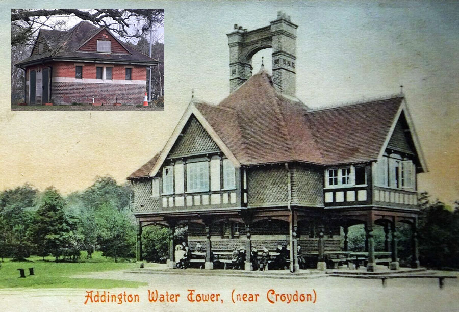
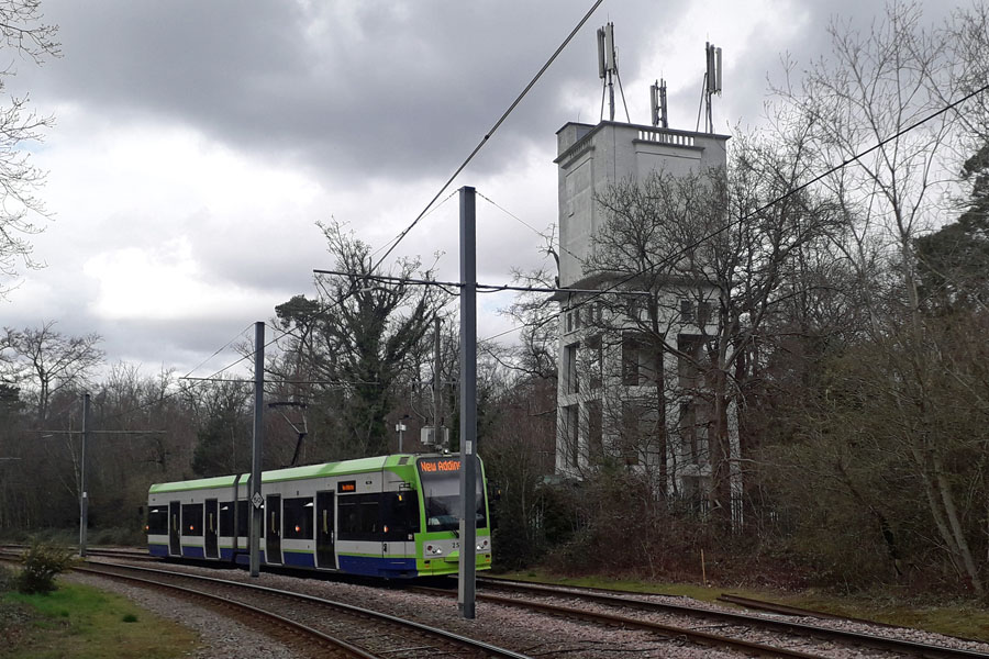 ADDINGTON WATER TOWER (05GL10) Coombe Lane, Addington Hills, Croydon. Lying about one mile east of Croydon, the Addington Hills provided an ideal location to establish a reservoir and water tower to supply the ever growing populace of Croydon. Addington Reservoir was built in 1888 and the Valve House was initially open to the public with refreshments being served from the ground floor and a residence above. This was known as Addington Water Tower at the time. An outbreak of Typhoid in 1937 was traced to the reservoir and the cafe was quickly closed and the area fenced off. The facility supplemented the Park Hill tower in Croydon. Subsequently a concrete tower was added nearby adjacent to the tram line. The reservoir and Valve House continue to supplement the overall facility. Click the pictures for more details. 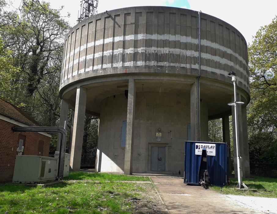 FOXEARTH WATER TOWER (05GL11) FOXEARTH WATER TOWER (05GL11)Littleheath Wood, up a small track opposite 80 Edgecombe (road), South Croydon. CR2 8AA. Also known as Littleheath tower, it lies on the eastern edge of the woods. The tower was built during the 1950s and is operated by Thames Water. The woods are located in Selsdon bounded by Littleheath Road, Foxearth Road, Croham Valley Road and Edgecombe. Click right to see more.  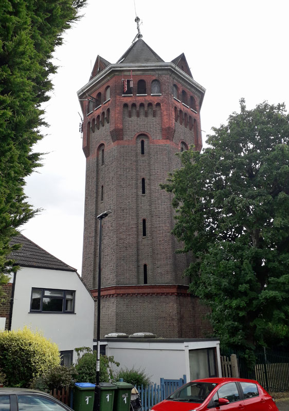 SHOOTERS HILL WATER TOWERS, GREENWICH (05GL12) SHOOTERS HILL WATER TOWERS, GREENWICH (05GL12)There are two water towers adjacent to the A207, Shooters Hill; both are near and visible from the main road. The first, most westerly tower, is in Elizabeth Fry Way off Bell Street SE18 4JY. This tower was converted to residential use in the early years of the 21st century. The second is located in the southerly end of Cleanthus Road. This tower is operated by Thames Water. Click left or right to see more.  ILFORD WATER TOWER (05GL13) ILFORD WATER TOWER (05GL13)East Ham Depot. The Ilford water tower was built in 1934 to maintain water pressure in the town of Romford near by. If viewed from Aldborough Road, the tower is actually much closer to Seven Kings than Ilford. It is located where what was once the site of Seven Kings Curve railway linking the Great Eastern main line to the Fairlop Loop to Woodford, diverging just west of the nearby bridge and passing very close to the water tower. The curve was abandoned in 1956, and the adjacent New Shed was completed in 1959. To continue your voyage of discovery click right.  HAVERING WATER TOWER (05GL14) HAVERING WATER TOWER (05GL14)Broxhill Road, Havering - atte - Bower, Essex. This tower is located in the north-west of the London area. It was built for the South Essex Waterworks Company in 1931, using reinforced concrete to designs by L. G. Mouchel & Partners. Grid Ref. TQ 51710 93129. It is 24 metres high, holding approximately 150,000 gallons of water. To continue your voyage of discovery click left. 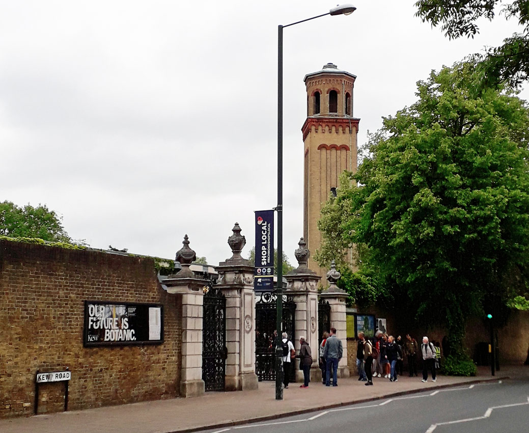 KEW GARDENS WATER TOWER (05GL15) KEW GARDENS WATER TOWER (05GL15)Victoria Gate, Royal Botanic Gardens, Kew Road, Kew, Greater London. This tower dominates the landscape at one of the main public entrances to Kew Gardens. It supplied water to the greenhouses which house many of Kew's rare and fascinating species. Dating from 1848, it is 32.42m (107ft) high and was originally designed as a water tower and chimney for the Palm House.   CARSHALTON WATER TOWER AND BAGNIO (05GL16) CARSHALTON WATER TOWER AND BAGNIO (05GL16)Carshalton House, Carshalton, Greater London/Surrey. The Bagnio Tower building was erected between 1716 and 1721 by Sir John Fellowes, in the grounds Carshalton House. The source of water was a spring in the grounds of Carshalton House which fed the River Wandle. Within the building a "water engine" (water wheel) pumped water to the tower. The pumped spring water in turn fed the Bagnio as well as the main mansion. Click the picture for more details. 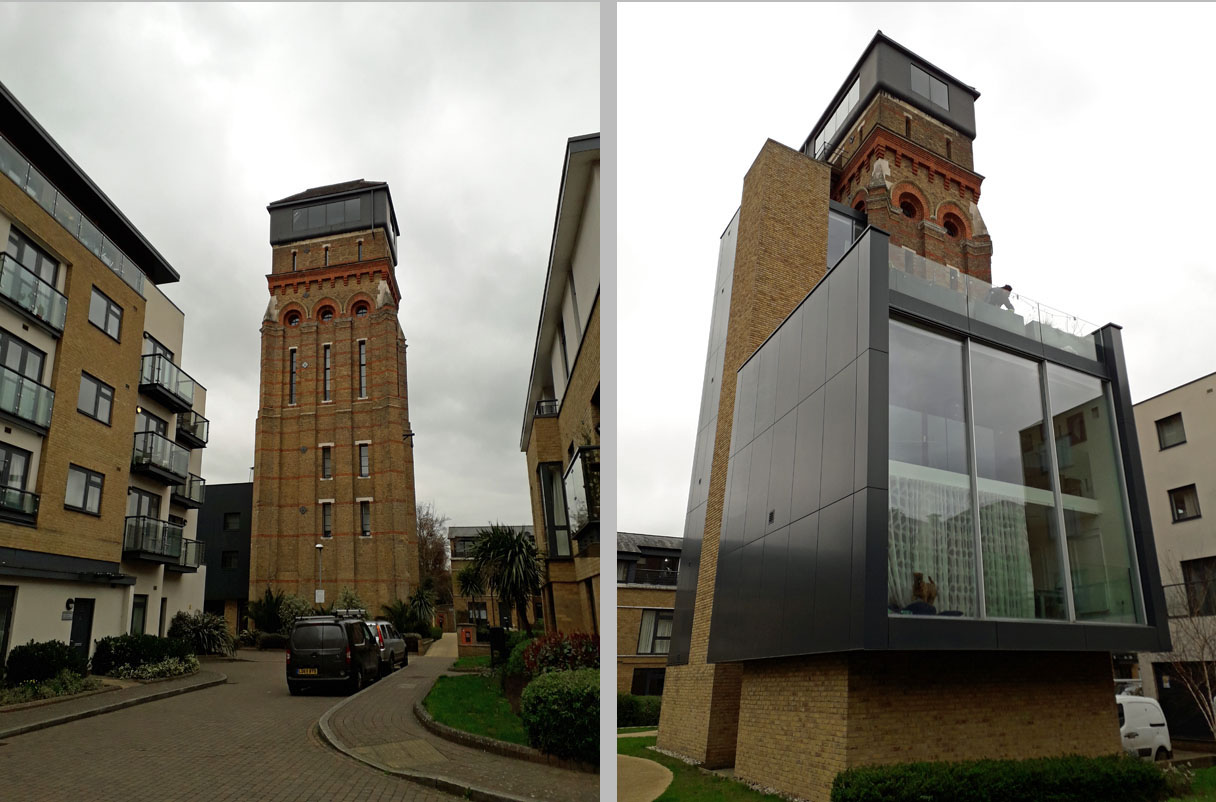 LAMBETH WORKHOUSE WATER TOWER (05GL17) LAMBETH WORKHOUSE WATER TOWER (05GL17)Dugard Way, London. SE11 4TH. This tower was built in 1867 to supply water to the adjacent Lambeth Workhouse. It lies a short distance south-west of the Elephant and Castle. The whole area was redeveloped in the 21st century and the tower site purchased by Leigh Osborne and Graham Voce in 2011. It was then stunningly converted to residential and remains a spectacular local landmark to this day, having appeared on the TV program Grand Designs. 18 Waterloo Station 19 Ilford MPD GONE 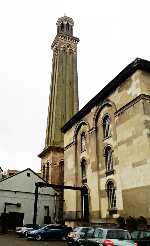 KEW BRIDGE WATER TOWER (05GL19) KEW BRIDGE WATER TOWER (05GL19)Green Dragon Lane, Brentford, TW8 0EN. Visible on the skyline as you cross Kew Bridge over the River Thames from south to north, this tower and associated buildings was formerly part of a major waterworks supplying local communities. It is now the home of the London Museum of Water and Steam and is open to the public on specified days. The museum contains the largest collection of pumping engines in the world which can be seen still working at various times throughout the year.  PERIVALE WATER TOWER (05GL20) Sanderson's wallpapers factory, Western Avenue/Horsenden Lane, Perival, Ealing. Founded in 1860, the Perival premises dates from 1929. Initially it employed about 900 people but this had nearly doubled by 1963, by which time it occupied over 10 acres.  CULVERS WATER TOWER (05GL21) Access via Almond Avenue to the tower, located at the junction of Culvers Avenue/Green Wrythe Lane, Carshalton, Greater London/Surrey. This tower was built circa. 1875 and held water from a local artesian well for distribution to the Culvers Estate. Subsequently the tank was removed and the premises converted to residential. Click the picture for more details.  HELLINGDON WATER TOWER (05GL22) HELLINGDON WATER TOWER (05GL22)Also known as Uxbridge Common Water Tower. This tower lies just off Junction 16 of the M25 motorway. UB8 1XS, in Water Tower Close. The site is west of Uxbridge Common, just north of Uxbridge. It dates from 1907 and was built by the local Rickmansworth and Uxbridge Valley Water Works. Once holding 80,000 gallons of water, it is now residential flats having been sold in 1980 for conversion. Grid Ref TQ 06017 85191. 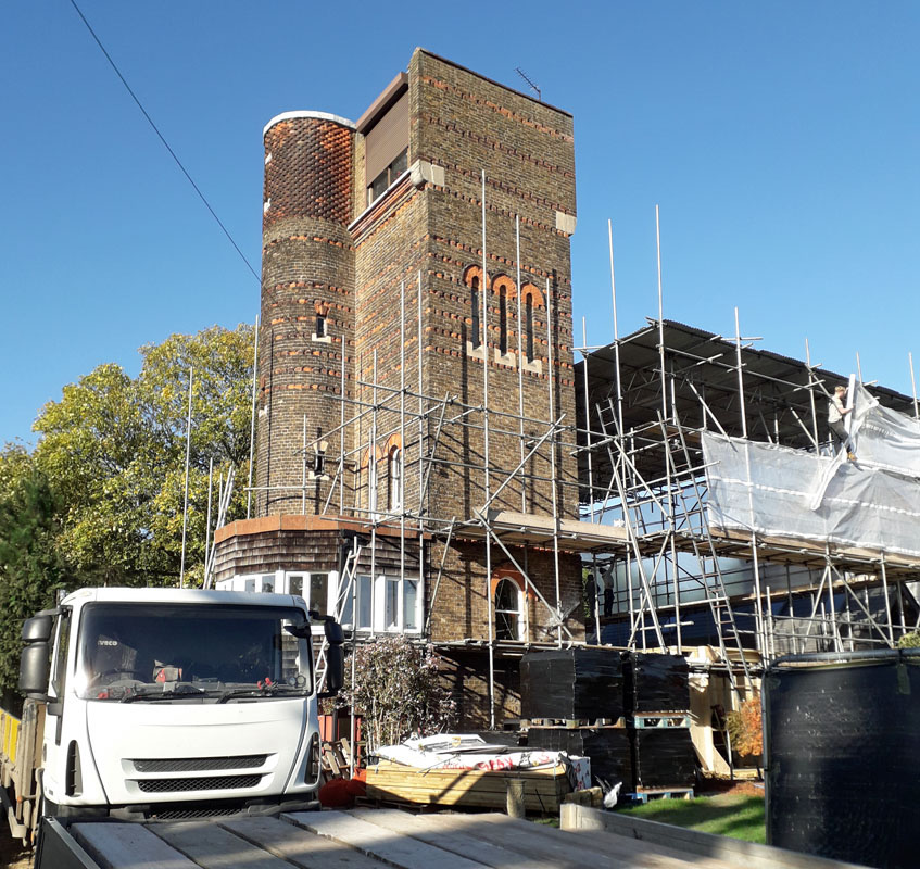 WINCHMORE HILL WATER TOWER (05GL23) WINCHMORE HILL WATER TOWER (05GL23)Quakers Walk, Winchmore Hill, N21 2DE. south-west of Enfield. This tower was converted to residential by an architect and his wife who purchased it in 1966 and lived here for 50 years or thereabouts. It was then put on the market for one million pounds and is now being embellished further (2024). It is six storey high and Grade II listed. Click the picture for more details. 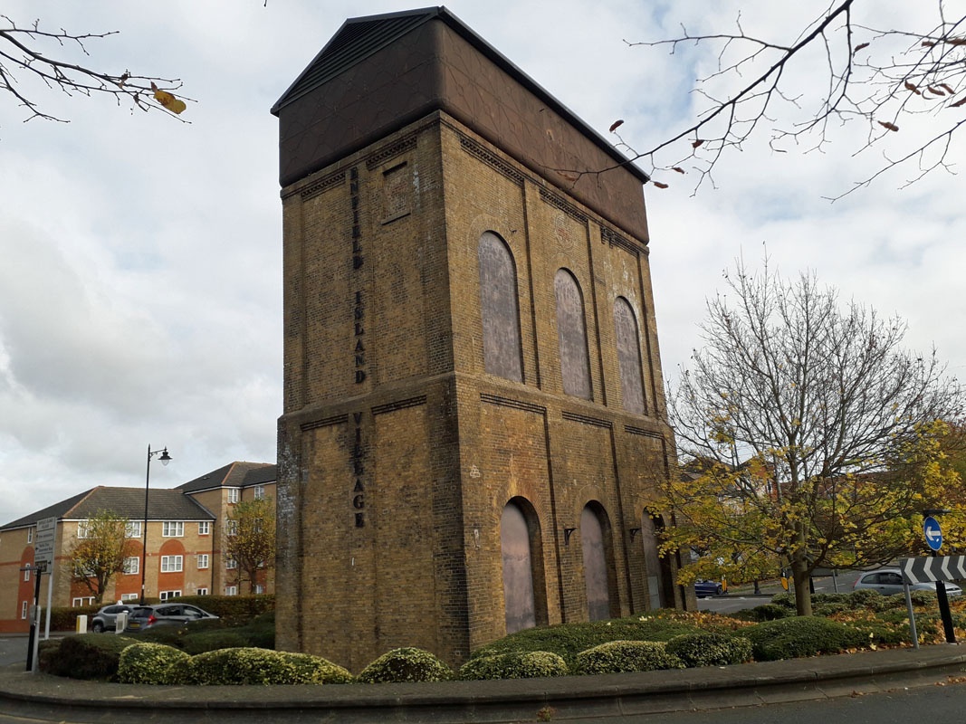 LEE-ENFIELD WATER TOWER (05GL24) LEE-ENFIELD WATER TOWER (05GL24)Island Village, Smeaton Road, EN3 6GT. north-east of Enfield. This tower lies at the entrance to a modern housing estate that replaced the earlier industrial use of the site in the River Lee Navigation valley. It formed part of an armaments works known as the Royal Small Arms Factory which closed in 1988. Famous amongst it products was the Lee-Enfield rifle, named after the tower location! Take junction 25 south off the M25 and turn left on to the A1055. The road turns south after a mile or so and the estate lies about another mile on the right. . 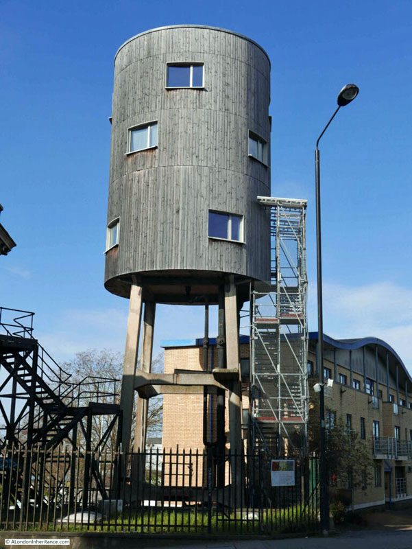 LADBROOK GROVE WATER TOWER (05GL25) LADBROOK GROVE WATER TOWER (05GL25)Norland Road, London, W11 4TR. Built in 1930 as a precautionary measure should fire break out in the adjacent gas works. The tank held 5,000 gallons. It lies west of Paddington adjacent to the Grand Union Canal. The designer, when converted to residential, was Tom Dixon, who purchased it in 2005. It is 60 feet high. Surrey 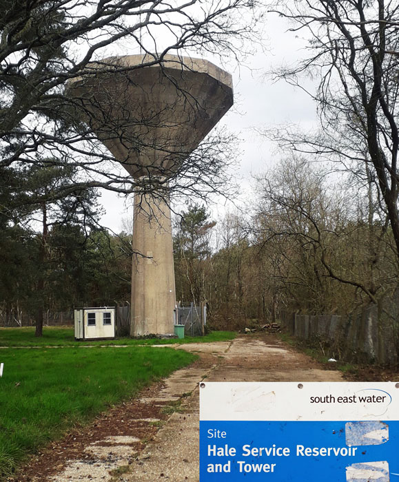 HALE WATER TOWER (05SY01) HALE WATER TOWER (05SY01)Hale, Near Farnham. This tower is located on the A287 Odiham Road north of Farnham, near the junction with Folly Hill. It is managed by South East Water. 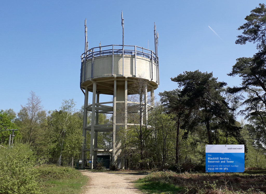 BLACKHILL WATER TOWER (05SY02) BLACKHILL WATER TOWER (05SY02)Camberley, Surrey. GU15 1PS. Located just off the M3 junction 3, this impressive tower is accessible along a short walk through woods. Take the A322 north-west from jn.3. Take a left turn on to the A30 after half a mile. After about 1 mile take the Moultway B3015 south. There is a car park on the left about halfway to the point where the road crosses the M3. The tower is a short distance straight along the track through the trees from the car park. Built in 1923 it stores 200,000 gallons. 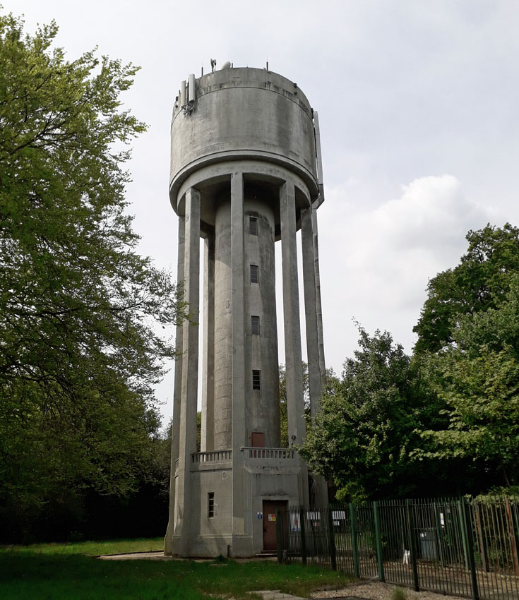 PRIORSFIELD WATER TOWER (05SY03) PRIORSFIELD WATER TOWER (05SY03)Priors Wood, Priorsfield Road, Hurtmore, Godalming, Surrey. GU7 2RQ. SU952461. This water tower is operated by Thames Water.  GODALMING WATER TOWER (05SY04) GODALMING WATER TOWER (05SY04)The Water Tower, Knoll Road, Godalming, Surrey. GU7 2EJ. A water tower built circa. 1880. Originally owned by the Godalming and Farncombe Water Company, it was sold in 1985. The tower is Grade II listed and remains a domestic residence. The Frith Hill Reservoir and Water Tower where it is located, were opened on August 3rd, 1880 by Lord Midleton of Peper Harow. The water tower, 75 feet tall and holding 28,000 gallons, provided a supply to Frith Hill, Hurtmore and Shackleford.  MUNSTEAD WATER TOWER (05SY05) Munstead Heath Road, Godalming, GU8 4AR. Brick-built and 130ft high, it was erected in 1898 to supply water to Munstead and neighbouring villages and was in use for approximately 70 years. It was bought at auction by architect Elspeth Beard in 1989 and converted to residential. She continues to occupy it to this day.  ST GEORGE'S HILL WATER TOWER (05SY06) ST GEORGE'S HILL WATER TOWER (05SY06)Whiteley Village, Elmbridge, Surrey, KT13, just south of Weybridge. Grid ref. TQ 085 626. This 1914 tower is Grade !! listed but being located on a private residential estate is difficult to obtain access to. By clicking on the picture left you can access Wikimedia Commons web site with an illustration. 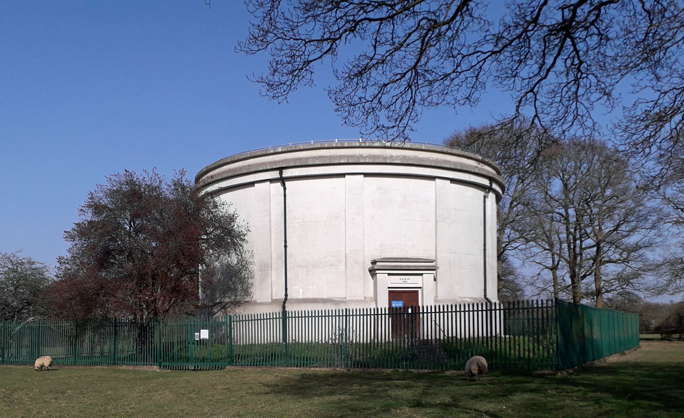 RUSPER WATER TOWER (05SY07) RUSPER WATER TOWER (05SY07)Rusper, Surrey. Take the Newdigate Road into Rusper and just outside the village you will see the water tower to your right. It is part of the Sutton and East Surrey Water Company's supply network. This huge free-standing concrete tank was built in 1930. In 2009 it was refurbished.  BUCKLAND WATER TOWER (05SY08) BUCKLAND WATER TOWER (05SY08)Buckland village green, Betchworth, Surrey. This black towered barn, now called The Towered Barn, lies near the village pond. In 1860 it was used as the village church during the restoration of the local church, also by the green. The tower is in fact a water tower used by the local community for many years. It is fed by the same water source that fills the village pond. The premises are now residential.  TADWORTH WATER TOWER (05SY09) TADWORTH WATER TOWER (05SY09)Tower House, Tower Road, Tadworth, Surrey. A water tower built in 1898 on the wrong hill. Shortly afterwards the Sutton District Water Company extended their coverage and had to build a tower on nearby Colley Hill to achieve distribution of water to its highest consumers. The tank is now gone and the tower a domestic residence. It has been occupied by Dr Osborne for more that 50 years who has carried out extensive renovation. Click the picture or read for more details: Osborne B. E. (2015) "Tadworth, the Village on the Downs", Cora Weaver, Malvern. 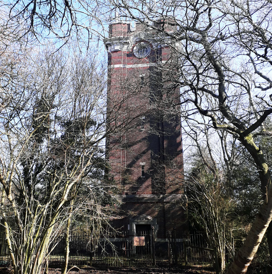 COLLEY HILL WATER TOWER (05SY10) COLLEY HILL WATER TOWER (05SY10)The Water Tower, Colley Hill, Surrey. High on the North Downs and now adjacent to the M25, this tower was built in 1911 to replace the tower built on the wrong hill at Tadworth. It was built and operated by the Sutton District Water Company with W Vaux-Graham the project chief engineer. It still functions as a water tower. 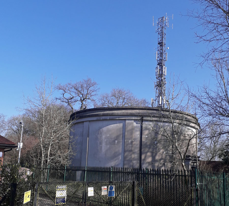 MARGERY WOOD WATER TOWER (05SY11) MARGERY WOOD WATER TOWER (05SY11)Located at the top of Reigate Hill in Surrey on the crest of the North Downs, this tower has a drinking water storage capacity of 1.2 million litres for distribution to the residents and businesses in Tadworth and Reigate. The south-east has about 50% less rainfall than the rest of the UK and is defined as water stressed by Sutton and East Surrey Water of Redhill who operate this tower. The tower has two entrance doors, one to the north and one to the south. These give access to the gound floor, the tank being above. It was built in 1924 as indicated above the doors. Grid ref. 253522. To access the property take the lane south that goes from the roundabout at the top of Reigate Hill west along the summit of the North Downs. 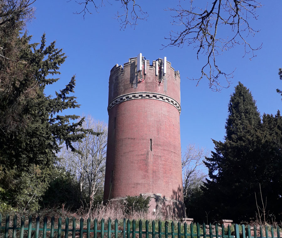 GRAVELLY TOWER (05SY12) GRAVELLY TOWER (05SY12)Godstone, Surrey. TQ 33717 53227. This tower is located on the North Downs ridge near Caterham. Like many, this one has found a new use in recent times for mobile phone masts. It appears on 1912 map, but not 1896. Gravel extraction was once a local industry. 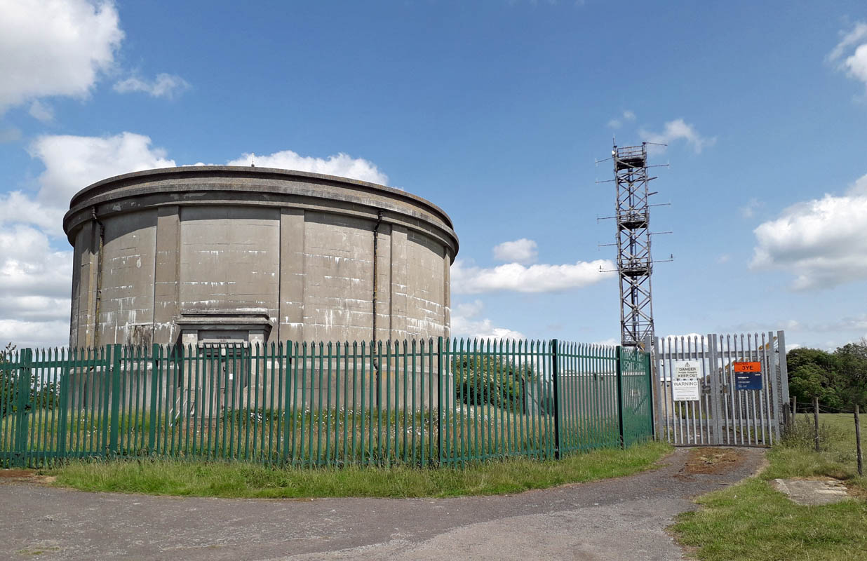 WOLDINGHAM WATER TOWER (05SY13) WOLDINGHAM WATER TOWER (05SY13)Botley Hill, Nr Warlingham, Surrey. grid. ref. 386552, Built by the East Surrey Water Co. in 1931, this tower is at the highest point on the North Downs ridge, a couple of miles north of Oxted. Over the door the date on a panel confirms ESWCo 1931.  BAGSHOT PARK WATER TOWER (05SY14) BAGSHOT PARK WATER TOWER (05SY14)Located to the west of Bagshot in Surrey, this Royal Residence is a mere 10 miles from Windsor Castle, home of the Royal Family. Grid Ref SU 91 64. The illustration right is the main entrance on the A30 road GU19 5HH. For 500 years it has been a residence and was gifted to Prince Andrew and Sophie, Countess of Wessex on their wedding. Over the centuries it has been subject to modification and rebuilding. The water tower remains an integral part of the structure and initially did not have the pyramid roof present today. It is all part of the extensive Crown Estate and does not have public access. Illustrations of the Mansion overlooked by the integral tower are available on web sites and by clicking right, access to such a web site is available; view picture 3. 15 King Edwards School, Witley GONE  WARLINGHAM WATER TOWER (05SY16) WARLINGHAM WATER TOWER (05SY16)Great Park, Chelsham Road, Warlingham, Surrey. Formerly in the grounds of Warlingham Park Mental Hospital which closed in 1999. The tower was built in 1903 and refurbished in 2012. It now lies in the centre of a substantial residential estate. 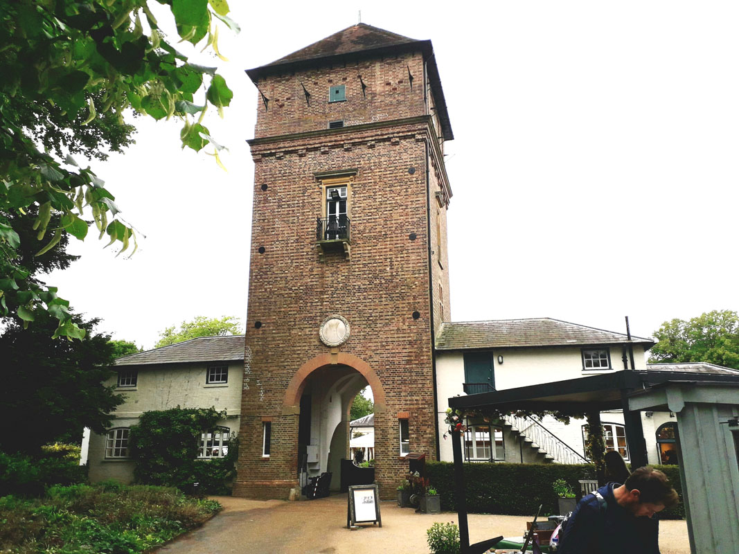
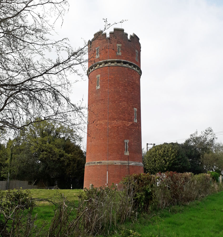
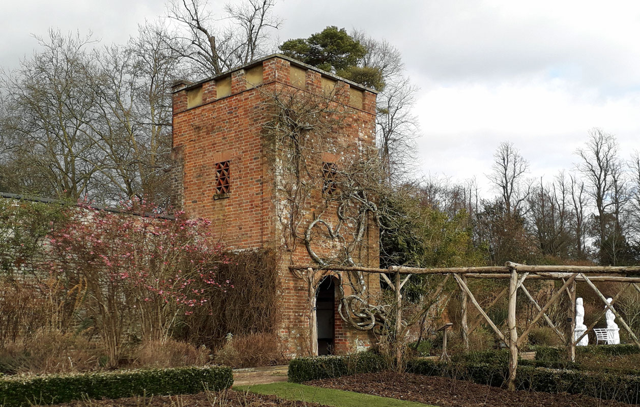 POLESDEN LACEY WATER TOWERS (05SY17) POLESDEN LACEY WATER TOWERS (05SY17)Two towers are located at Polesden Lacey, in the National Trust property near Guidford. The first is the Reception Building, built over 120 years ago by Ambrose Poynter. (illustrated right) This tower originally supplied water to the main mansion and estate buildings. It has been recently renovated with swift nesting boxes to support the declining UK swift populations. The second tower lies in the rose garden as illustrated left. It now provides a shelter for visitors. The original purpose of both towers was to service the water supply system for the estate.  ALBURY WATER TOWER (05SY18) Albury Eastate, Albury, Nr. Guildford. GU5 9AF. Early pictures see this tower as a metal square tank on legs positioned on the right of a track probably up the hill at the rear of Western Yard. However recent investigation has not confirmed its existence and so the metal structure may well have been removed. In Western Yard however, at the address indicated above, is an older brick tower. This could easily be seen as a water tower predating the metal tank. Now described as a pigeon loft it was restored in 1980.  BETCHWORTH WATER TOWER (05SY19) BETCHWORTH WATER TOWER (05SY19)Located at the foot of the North Downs between Reigate and Dorking. At the bottom of Pebblecombe Hill turn right immediately before Betchworth Station level crossing in Surrey. This leads to the former lime works and the quarry with its 6 lime kilns. This closed in the 1930s but a brick tower remains. This is assumed to be a water tower but the iron stoke doors in its lower part could probably be to stop the water freezing in winter rather than for lime production. 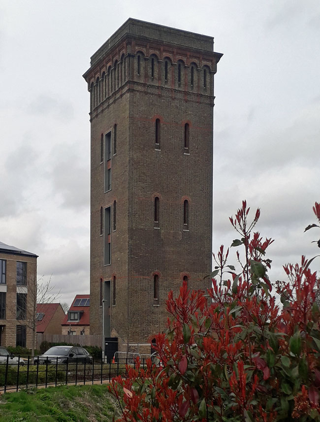 CANE HILL ASYLUM WATER TOWER (05SY20) Cane Hill, Couldsdon, Surrey. Take Cane Hill Drive, west from the A23 roundabout at Couldsdon; at the top, the tower is sited at 11 Chaplin Place. The former mental hospital was built in two stages between 1882 and 1888. Demolition of Cane Hill Asylum started in March 2008 and was completed by the end of 2010. The surviving 32 meter water tower was then converted into a 7 storey home. In addition, some of the former hospital buildings were converted into flats as part of a large scale residential development. The tower was sold for �2.4m as residential conversion was completed. Click the picture right. 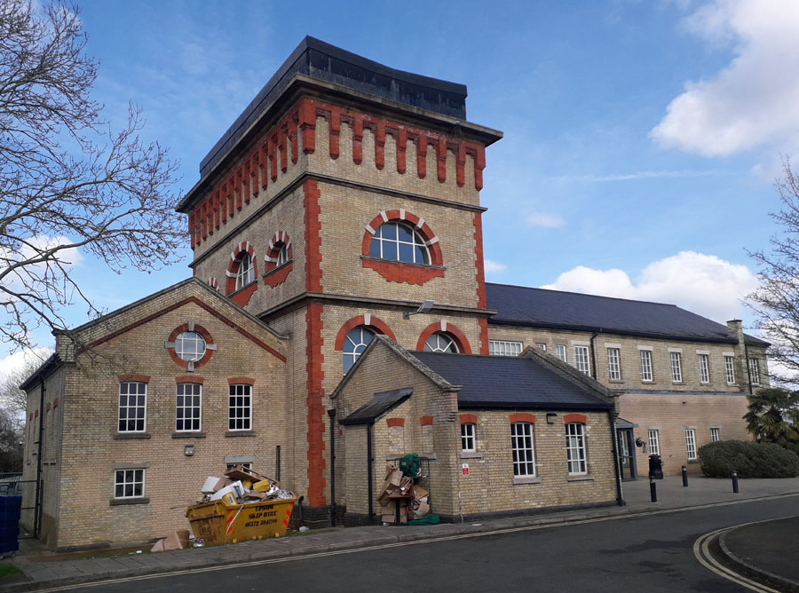 HORTON PARK WATER TOWER (05SY21) HORTON PARK WATER TOWER (05SY21)Horton Road, Epsom, Surrey. The 20th century cluster of hospitals east of Epsom required services and this facility was built for water, gas and electricity supply. Clean water was supplied from a 400-foot borehole (steel-lined to stop contamination) within the grounds. The 1930s saw the direct current electrical generators in the facility dismantled and all the hospitals in the cluster connected to the alternating current of the National Grid. In 1960 a Central Boiler House was opened on the site to supply high-pressure steam to all the hospitals for heating. Following closure of the hospitals, it is now a Fitness Centre.  HORTON TOWER (05SY22) Cavendish Walk, Epsom, Surrey. Located to the east of the town on the former hospital complex, Horton Hospital closed in 1992 after 95 years. The area was redeveloped as modern residential dwellings with the 12 storey water tower remaining as an iconic landmark. Having survived the demolition, the question of the tower's future raised a controversial dilemma that the conservationists lost in 2011. Now the tower has gone but is not forgotten. 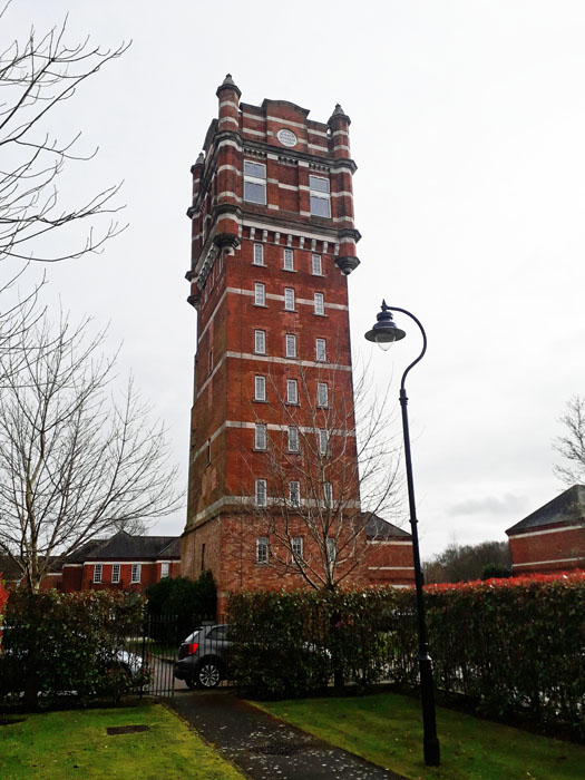 NETHERNE WATER TOWER (05SY23) The Tower, Wallace Square, Netherne on the Hill, Surrey. Netherne Asylum was a psychiatric hospital in Hooley. Founded in 1905, Netherne gained a reputation as a pioneering force in the treatment of mental illness. The hospital finally closed in 1994 however its water tower remains a local landmark now surrounded by new residential development. See picture. 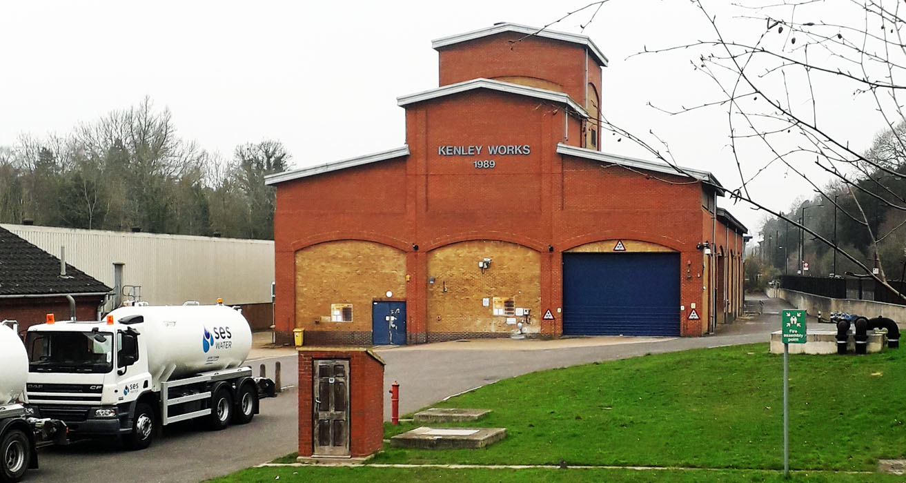 KENLEY WATER TOWER (05SY24) KENLEY WATER TOWER (05SY24)Godstone Rd, Kenley CR8 5AE, Surrey. Located on the road towards Caterham from Purley, this is part of the Water Treatment Works operated by SES Water Redhill. It was built in 1989 on the site of the old Kenley Water Works and fed by springs from the North Downs aquifer, in the valley in which it is sited. 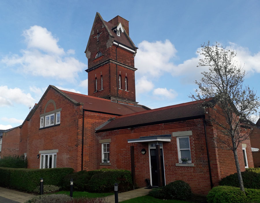 ST EBBAS WATER TOWER (05SY25) ST EBBAS WATER TOWER (05SY25)Hook Road, Epsom, Surrey. KT19 8LX. This tower once was the water source for St Ebbas Hospital. The Hospital opened in 1904 and was formerly Ewell Epileptic Colony (1904 to 1918) and later Ewell Mental Hospital (1927 to 1938). It is now St Ebbas for patients with mental handicap. The tower buildings were converted to residential in 2014 and include the original Water Tower which has been sympathetically restored. See picture. 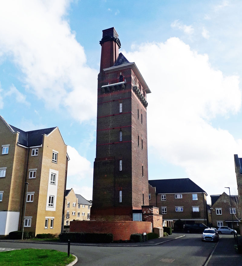 WEST PARK ASYLUM WATER TOWER now NOBLE PARK WATER TOWER (05SY26) WEST PARK ASYLUM WATER TOWER now NOBLE PARK WATER TOWER (05SY26)KT19 8NX. West Park Road, Epsom, Surrey. Once this tower was situated in the extensive West Park Hospital, one of a number of health institutions east of Epsom town. Work on building West Park Asylum was halted because of the outbreak of the First World War when the Canadian Military took over the buildings that had been completed. It was not fully completed until 1921. Now redeveloped, the tower finds itself in the center of a modern housing estate called Nobel Park, Sherwood Way, just off Horton Lane. See picture. 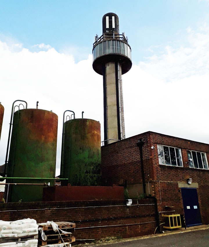 RED LION WATER TOWER (05SY27) RED LION WATER TOWER (05SY27)Tolworth Hospital, Red Lion Road, Surbiton, Surrey. KT6 7QU. This tower can be found in the works department of this working hospital. Confirmation is being sought that it is a water tower. The hospital has a long history since being completed in 1889, going from isolation hospital to geriatric to mental hospital. 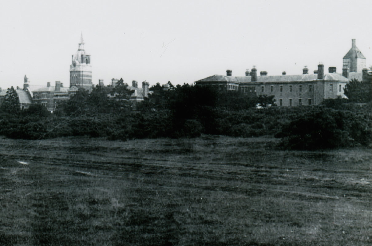 BELMONT ASYLUM WATER TOWER (05SY28) BELMONT ASYLUM WATER TOWER (05SY28)The water tower was part of the infrastructure of the Belmont Asylum, a mental home for serious cases requiring isolation from the community at large. Along with the clock tower, the two structures were landmarks high on the downs near Belmont, just south of Sutton in Surrey. A granite track that connected the main asylum entrance to the station goods yard at Belmont ensured a supply of coal for heating the inmates. Today the towers have gone, and since 1989 the site is the location of Downview Prison. Sutton Ln, SM2 5PD. 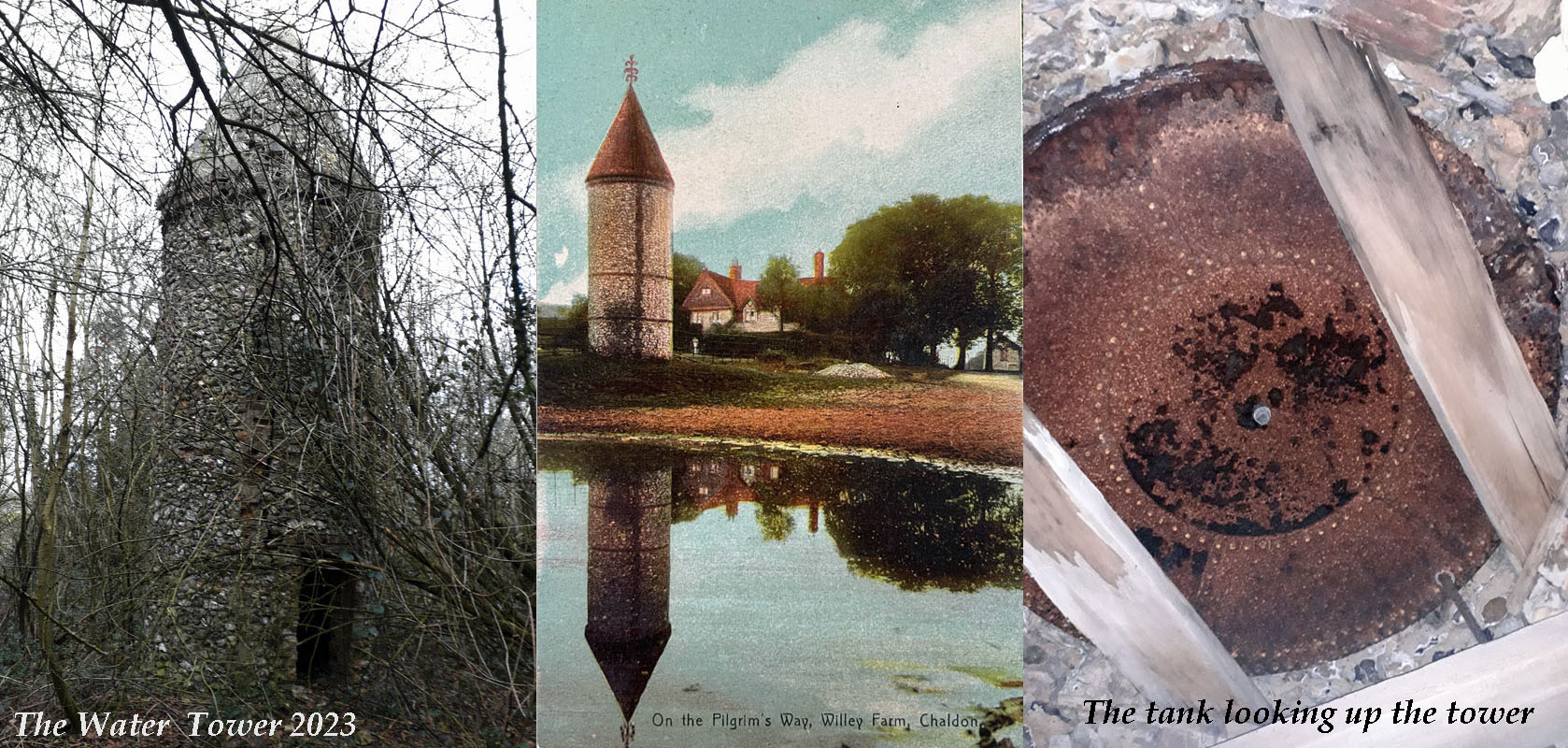 WILLEY FARM WATER TOWER (05SY29) WILLEY FARM WATER TOWER (05SY29)Willey Farm Lane, Chaldon, Surrey. CR3 5DX. This tower is today in a dilapidated state after having once been an attractive feature by a lake and farm house. It can be seen in the wood at the top of the lane. Once it featured on a local popular postcard. Today the lake is full of fallen timber and not accessible and many believe the water tower has gone. Willey Park Farmhouse is a Grade II listed building within the North Downs AOND. 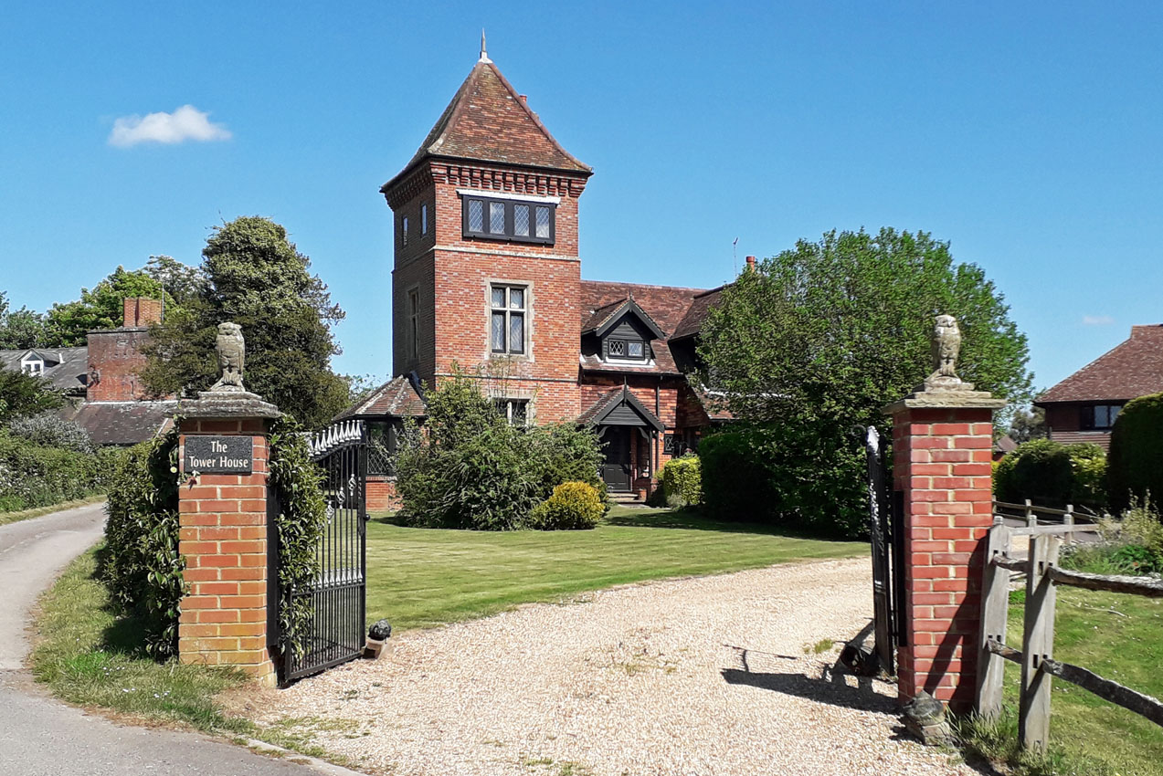 BROADWOOD WATER TOWER (05SY30) BROADWOOD WATER TOWER (05SY30)Tower House, Lyne House Estate, off the Rusper Road, Capel, Surrey. This 19th century Grade II listed water tower once supplied the Broadwood Estate but is now converted to residential use. Advertised for sale in 2023 at �935,000.00. 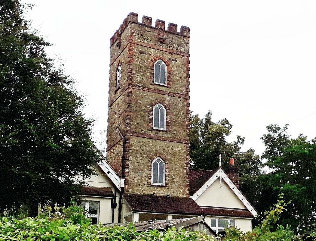 DORKING WATER TOWER (05SY31) DORKING WATER TOWER (05SY31)Tower Hill Road, Dorking. This tower dates from 1829 when it was built by Arthur Dendy. an English zoologist known for his work on marine sponges and terrestrial invertebrates. He was in turn professor of zoology in New Zealand, in South Africa and finally at King's College London. He was a Fellow of the Royal Society. The tower is grade II listed and is converted to residential. Grid Ref. 168485. It appears to be on land that was formerly the Treeshurst Estate and was likely an early water tower supplying Dendy family residences nearby. It was subsequently replaced by a ground reservoir in the immediate vicinity as the local population expanded. 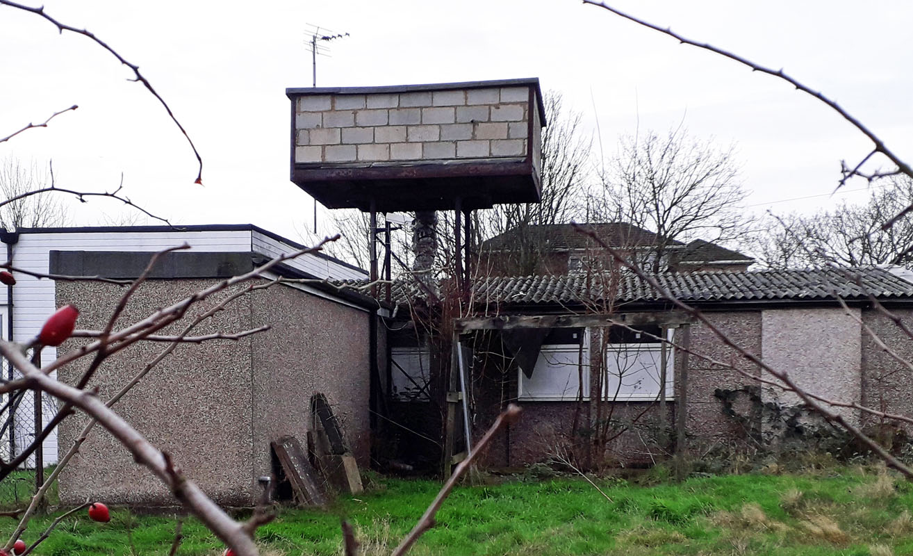 TATTENHAM ESTATE WATER TOWER (05SY32) TATTENHAM ESTATE WATER TOWER (05SY32)Preston Manor Road, Tadworth, Surrey. This area of the North Downs was extensively developed in the latter half of the 20th century. Justification for this encroachment on green land was to provide homes for those homeless as a result of World War II. The tower appears to be a contrasting hilltop landmark from earlier that has survived this transformation of the landscape into a massive residential area. Surrounded by more recent buildings and infrastructure, it lies alongside the modern Tadworth Leisure and Community Centre with it's adjacent open spaces, set aside for sports and similar activities. 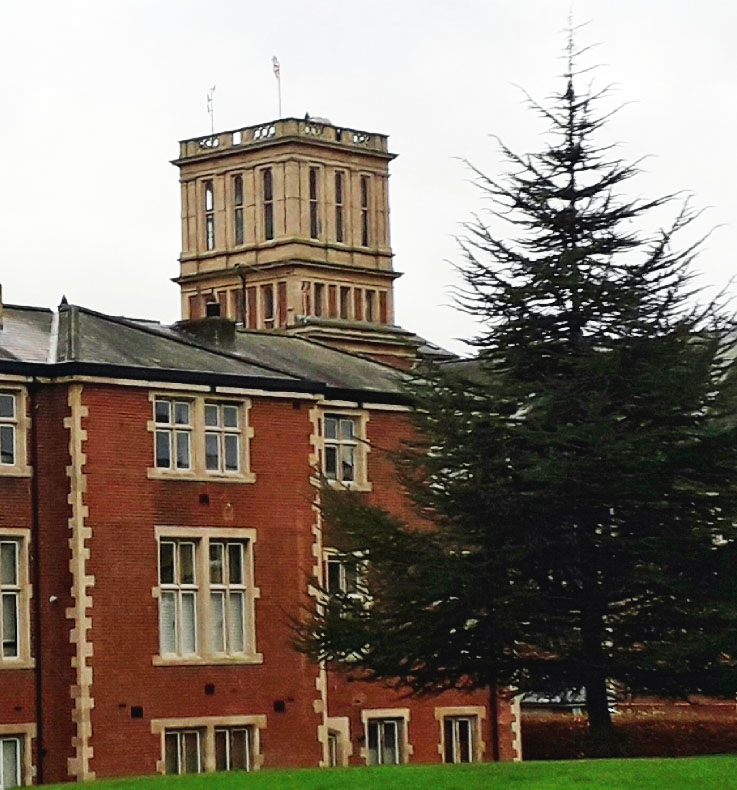 EARLSWOOD WATER TOWER (05SY33) EARLSWOOD WATER TOWER (05SY33)The Royal Earlswood Hospital, formerly The Asylum for Idiots, Earlswood, Redhill, Surrey. Founded in 1847, initially in Highgate, the institution was to last nearly 150 years. The move to Earlswood, two miles south of Redhill town centre, took place in 1855. In 1862 Queen Victoria conferred a Royal Charter and it became known as the Royal Earlswood Asylum. A number of buildings are listed, having survived what has become a modern housing estate. Grid Ref. 281487. (immediately south of Earlswood railway station). The tower formed the architectural centre-piece of the original hospital. West Sussex 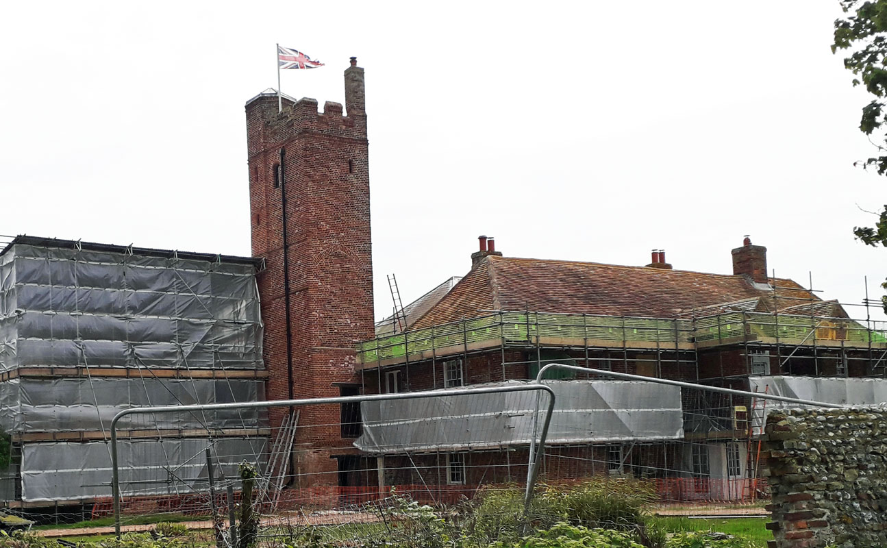 WITTERING WATER TOWER (05WS01) WITTERING WATER TOWER (05WS01)Cakeham Farm, West Wittering. Built for Cakeham Manor, this Grade II listed water tower was used as a lookout station during the Second World War. The tank is long gone and at the time of writing (2023) it was being converted to residential. Grid Ref. 785975. 2 Selsey GONE 3 Bognor Regis GONE 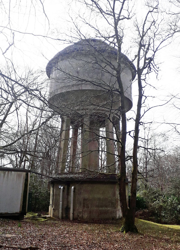 COLGATE WATER TOWER (05WS04) COLGATE WATER TOWER (05WS04)Tower Road, Colgate, Near Horsham, West Sussex. RH12 4SX This concrete water tower is built near to the highest point on Beacon Hill (146m above sea level) just outside the village.  PEASE POTTAGE WATER TOWER (05WS05) PEASE POTTAGE WATER TOWER (05WS05)Parish Lane, Pease Pottage, West Sussex. RH10 5NY. This remarkable conversion of a disused water tower is now a freehold, detached house. Planning permission was given circa. 2016 for the conversion from a plain circular structure without decoration or windows.  WARNINGLID WATER TOWER (05WS06) WARNINGLID WATER TOWER (05WS06)This tower is located on the west side of Colwood Lane, south of Warninglid, Mid Sussex. RH17 5UQ. TQ 25667 25031. Sited just outside the village alongside Colwood Court and opposite Playdells Farm, this daunting structure is in the care of South East Water. It not only provides a flow of water to surrounding properties but also supports aerials for mobile phones. See picture. 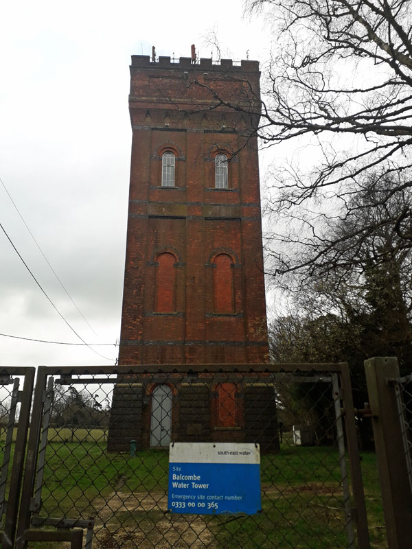 BALCOMBE WATER TOWER (05WS07) BALCOMBE WATER TOWER (05WS07)High Beeches Lane, Handcross, West Sussex. RH17 6JX. A late 19th century tower now Grade II listed. Can be viewed from High Beeches Lane in Slaugham parish. TQ 2837530991. Now managed by South East Water.  BURGESS HILL WATER TOWER (05WS08) It lies to your right after about half a mile, if you take the Keymer Road from Burgess Hill Railway Station. It is a 250,000 gallon water tower built in 1956 and can be seen in the distance from the roundabout on the London Road at Burgess Hill. It is operated by South East Water. In 2019 a planning application was submitted for 33 new homes right next to the Batchelors Farm Nature Reserve in Burgess Hill. Land at the site of Batchelors Farmhouse is situated off Keymer Road, right next to the iconic Water Tower. Click the picture.  HAYWARDS HEATH WATER TOWER. (1) (05WS09) Princess Royal Hospital, Haywards Heath, just off the A272 road, it lies in the grounds of what was formerly a Mental Hospital dating from 1859, which finally closed in 1995. The site became the University Hospitals, Sussex NHS Foundation Trust, Sussex. The present red brick water tower appears to date from 1908 and is Grade II listed. See (05WS23) also. Grid Ref. 342229. 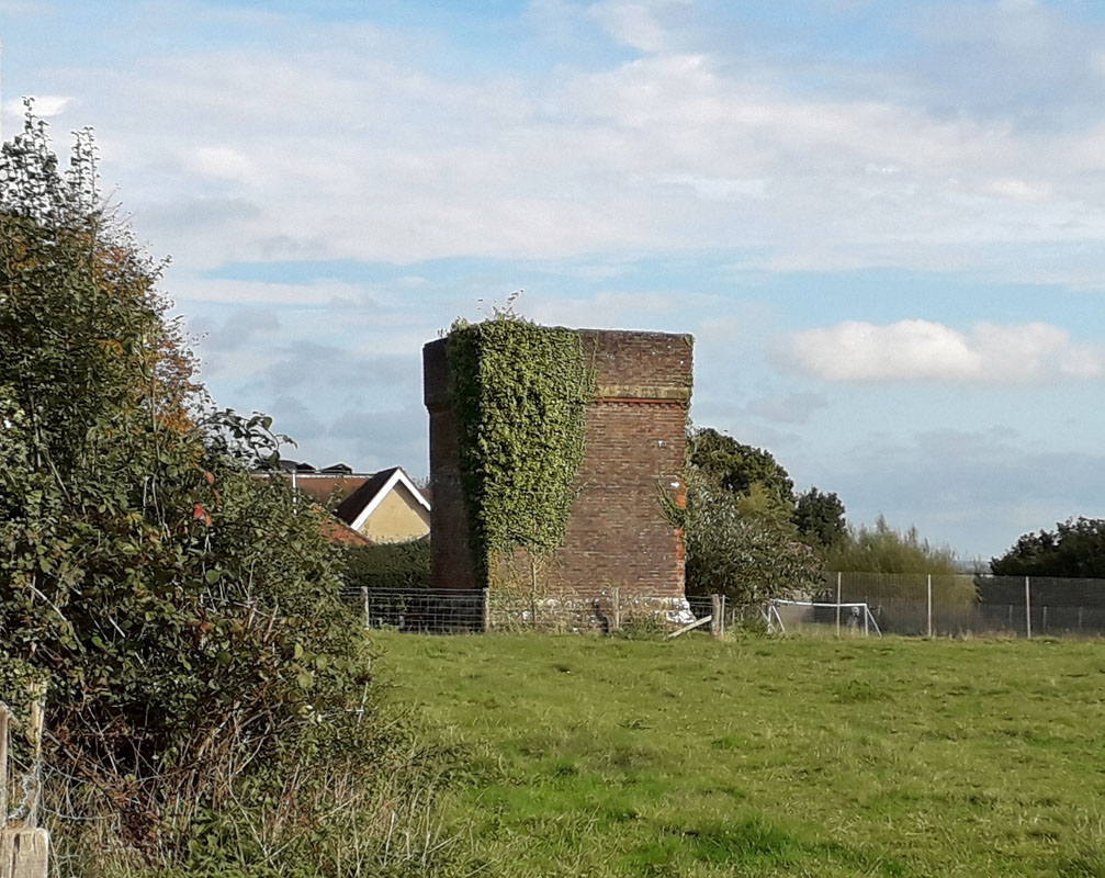 TURNERS HILL WATER TOWER. (05WS10) This tower is located on the left up North Street in Turners Hill, just after the junction with the B2110. It appears disused and was likely supplying a few local buildings only. Next door is the Primary School. Grid. ref. 340 359 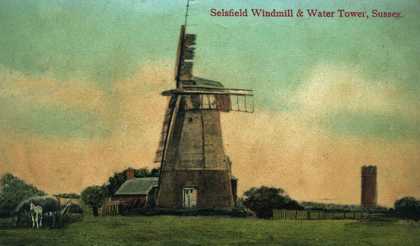
 SELSFIELD WATER TOWER (05WS11) SELSFIELD WATER TOWER (05WS11)Selsfield Common, West Hoathly, Sussex. This tower was built in 1903 as a metaphor for a castle. The earlier picture left is from a vintage postcard. It is now Grade II listed. The water tower is still in use today and can be reached by foot along the wooded lane adjoining The Old Granary. The seven acres of woodland has been in the possession of The National Trust since it was donated, in 1912, by Lord Arthur Hill of Old House. In 1914, the West Hoathly Parish council entered into an agreement with the National Trust to maintain the area as an open space and to preserve its natural aspect. Although part of West Hoathly Parish, Selsfield Common is closer to Turners Hill. 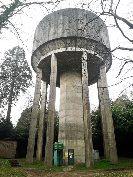 TILKHURST WATER TOWER (05WS12) TILKHURST WATER TOWER (05WS12)Located on the roads between Felbridge and Turners Hill, on the right about half way, near Tilkhurst Farm. It is a large concrete structure operated by SES Water. The Sutton and East Surrey Water plc was rebranded to SES Water plc in February 2017 and is now trading as SES Water. 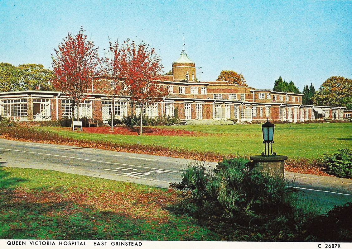 PLACELANDS WATER TOWER (05WS13) PLACELANDS WATER TOWER (05WS13)Now demolished, it was located to the east of East Grinstead town centre in the vicinity of Tower Close. Placelands covered much of the land on the eastern side of the London Road as you approach East Grinstead from the north-west on the A22. History records that it was a beautiful house standing in its own delightful grounds before development of the London Road in the vicinity of the Cooperative Stores and King Georges Field. The land comprised a barn and 4 plots amounting to 8 acres in 1736. The house was built by Nicholas Firminger after acquiring the estate in 1785 and before his death in 1799. Earlier it was formerly a manor known also by the names of Harkenden, Haskenden and Stone Rocks. All was contained within the parish of East Grinstead and is mentioned in late medieval records. There was also once a religious house known as East Grinstead Place, situated possibly in or near the land between Whitehall-parade and Placeland stables. From this was evidently derived the name Placeland. Placeland for many years belonged to the Hastie family. In its latter years it was used as a preparatory school. The East Grinstead Gas Light and Coke Company was formed in 1855. In 1878 it became the East Grinstead Gas and Water Company when powers were taken for the supply of water to the area. They were responsible for the water tower. The Placeland's private water undertaking was taken over in 1942. Today there is little to be traced of this original landscape as a result of extensive redevelopment of both buildings and roads. This is apart from King Georges Field which is now open land as part of a sports and leisure centre. There is no trace of a water tower apart from road names between Moat Road and the railway. HOWEVER, the Queen Victoria Hospital Jubilee Centre in East Grinstead RH19 3DZ, has a water tower like structure. On the roof is the staff of Asclepius, the Greek god of medicine, pointing skyward. So we have added a picture of this to this data record. Loose one and gain one! (Click left just above) 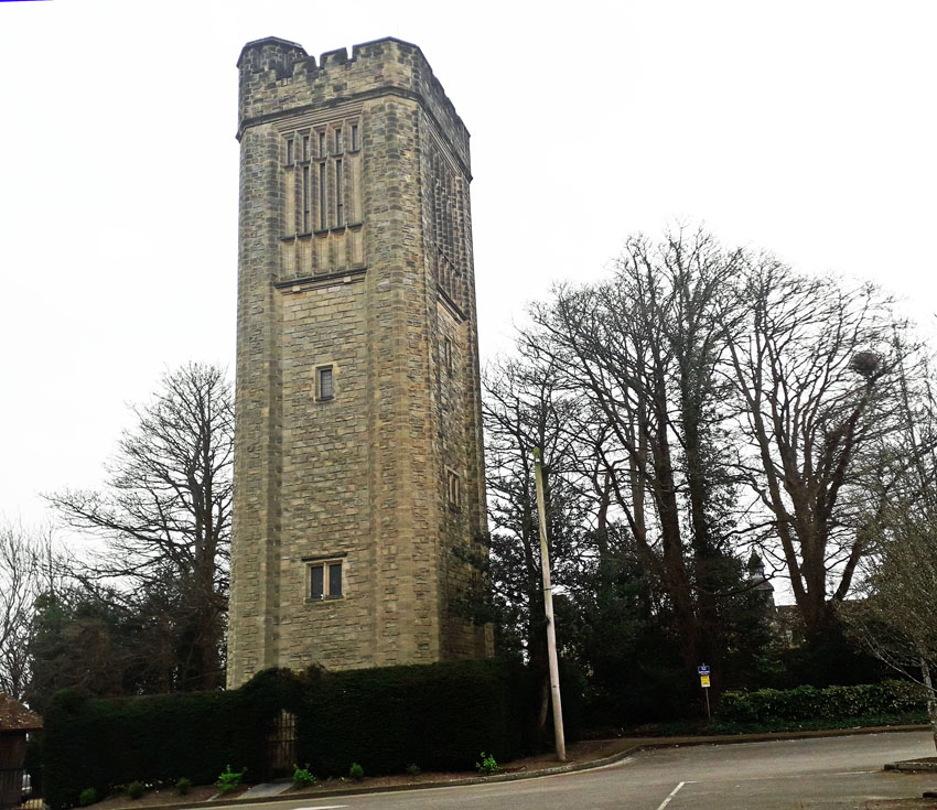 SACKVILLE WATER TOWER (05WS14) SACKVILLE WATER TOWER (05WS14)College Lane, East Grinstead. Earlier known as Chequermead Tower. This tower was converted to 7 storey residential as a project by architect Elspeth Beard. It is a Grade II Listed building constructed in 1914 by W. Vaux-Graham, an engineer with the local water board. He was a water engineer previously from the Sutton District Water Company in Surrey when they constructed the Tadworth Tower in 1898. The tower is 80 feet high and built of sandstone and consisted of a single void, up to the base of the old tank which occupied the uppermost section of the tower. Visual viewing is good from the Church Lane car park. Grid Ref. 397384. 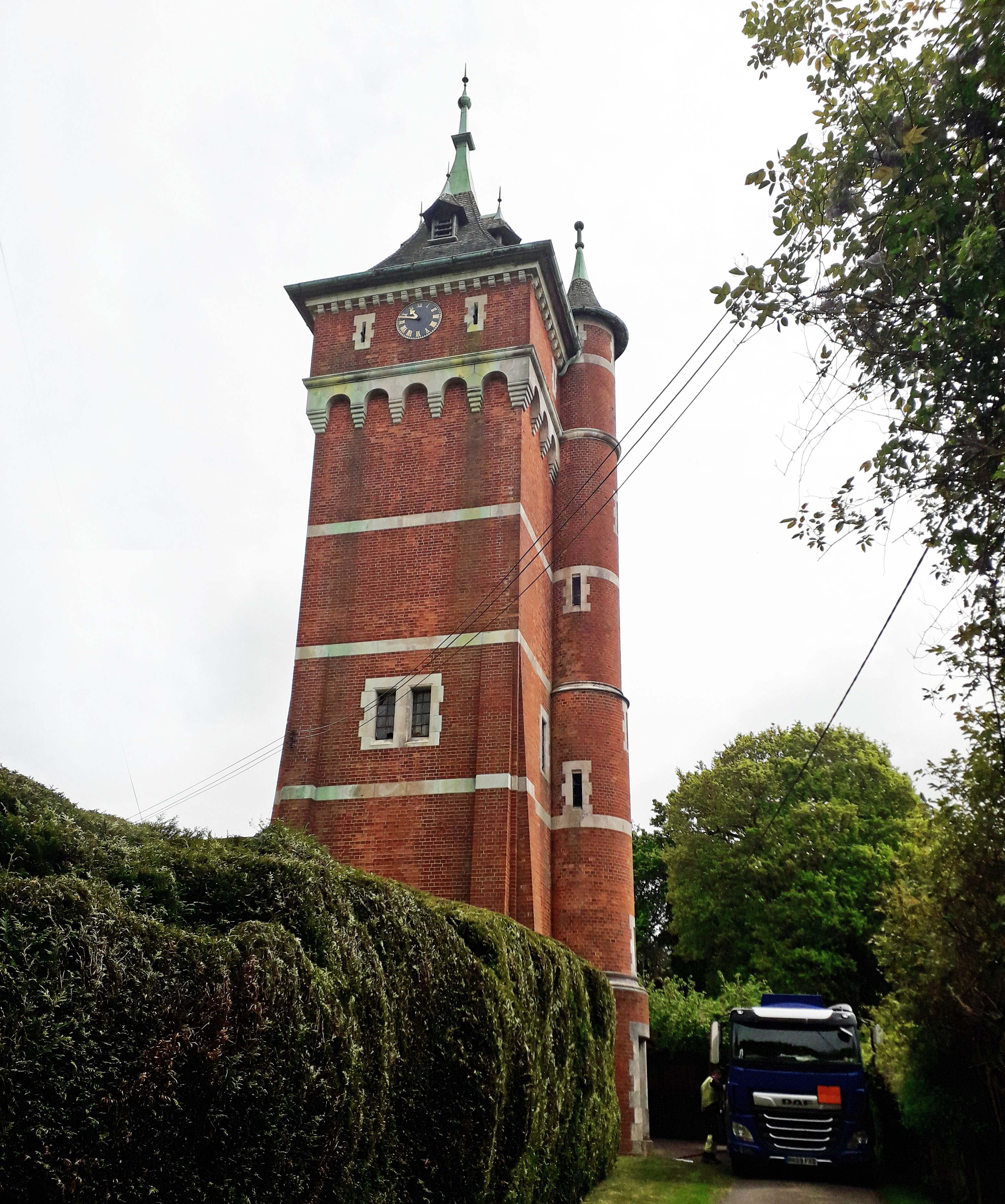 WARNHAM LODGE WATER TOWER (05WS15) WARNHAM LODGE WATER TOWER (05WS15)Northlands Road/Mayes Lane, Horsham. RH12 3SG. This astounding brick tower was built in 1890 as a water tower to service the new estate. Subsequently it became redundant and was integrated into the Warnham Lodge estate as a landmark building. It has two high rooms but is not fully residential. Grade II listed. 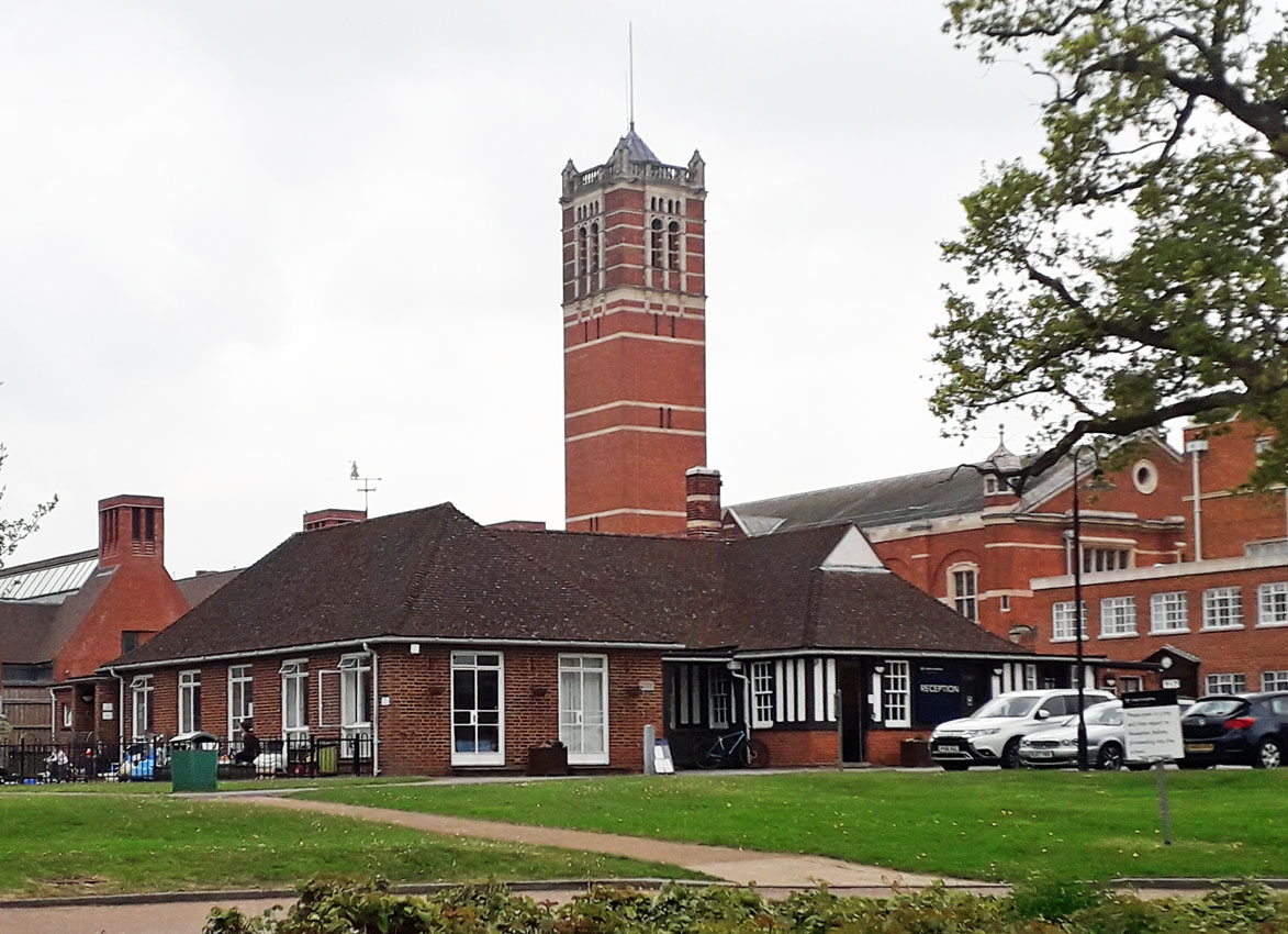 CHRISTS HOSPITAL SCHOOL WATER TOWER (05WS16) CHRISTS HOSPITAL SCHOOL WATER TOWER (05WS16)The extensive school is located at RH13 0LJ near Horsham in West Sussex. The tower can be seen from the perimeter of the school grounds. First founded in the 17th Century by King Edward VI, this historic private boarding school tower is of Victorian red brick construction. The water was sourced from an artesian well in Sharpenhurst Hill. Grade II listed. 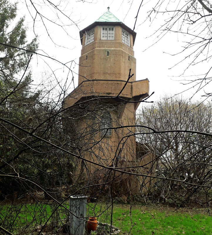 WAPPINGTHORN WATER TOWER (05WS17) WAPPINGTHORN WATER TOWER (05WS17)Steyning, West Sussex. BN44 3AA. This unusual concrete tower with its external spiral staircase is now residential. Head north from Steyning on the B2135. After about a mile, the tower lies up a track to the left just before Wappingthorn Wood. It was constructed as an ornamental folly/water tower, with an observatory, in about 1930 for Sir Arthur Howard as part of the Wappingthorn Estate. It is Grade II listed. Click left to see more. 18 Lancing Railway Station - disappeared without trace. 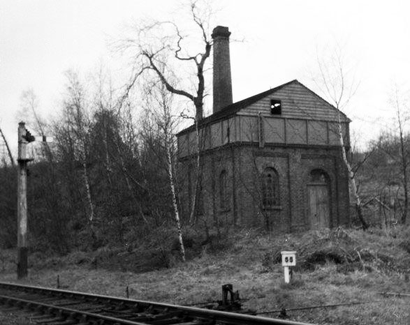 PETWORTH STATION WATER TOWER (05WS19) PETWORTH STATION WATER TOWER (05WS19)Petworth, West Sussex. GU28 0JF. This station once functioned for passengers of the east/west railway which closed in the 20th century. Now it is a combination of stylish hotel accommodation, enhanced with its collection of vintage railway carriages. The railway water tower was sited on the eastern side of the station towards Fittleworth. It has also gone, replaced by an industrial estate. 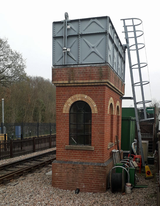 STATION WATER TOWER (05WS19) STATION WATER TOWER (05WS19)Bluebell Railway Platform, East Grinstead Station, West Sussex. It is only in 2013 that the Bluebell Railway line was extended to join the main line at East Grinstead Station. This water tower was constructed at this time to a similar style as vintage towers elsewhere. 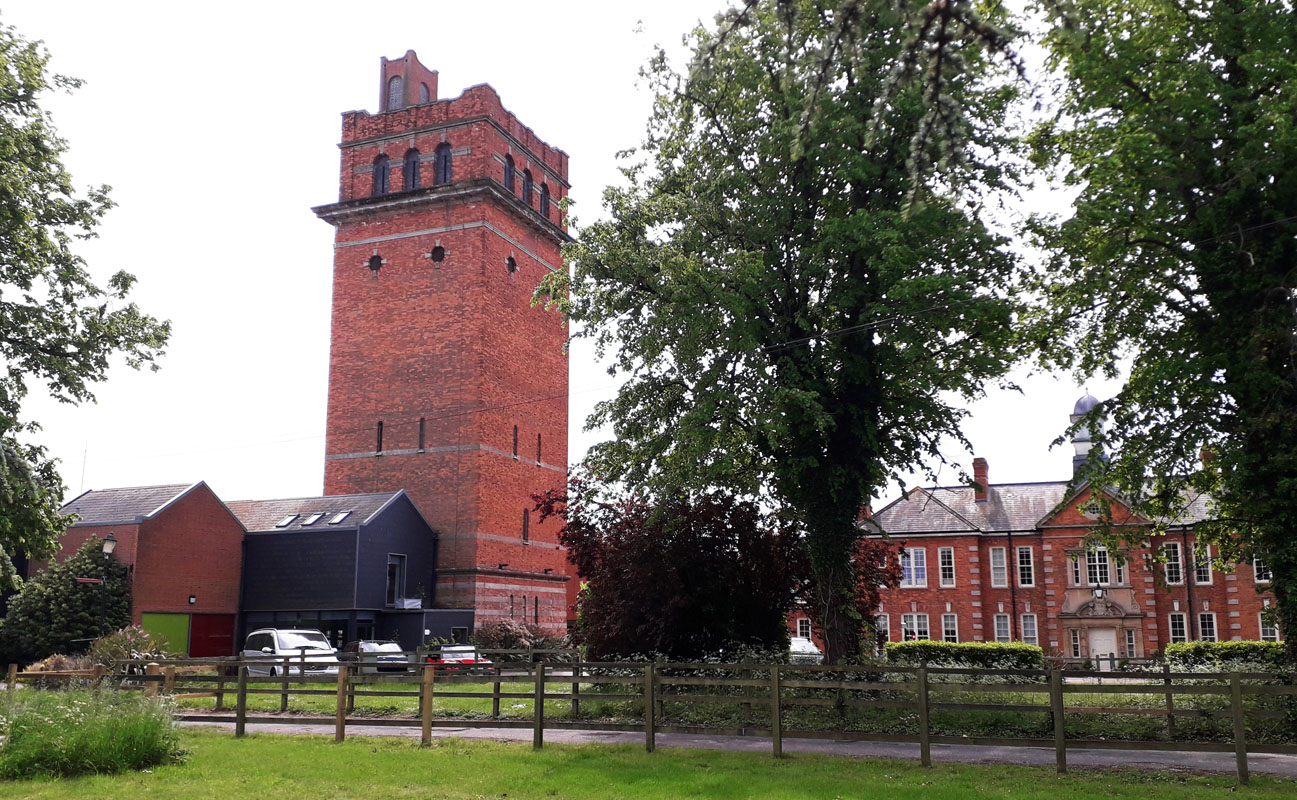 GRAYLINGWELL PARK WATER TOWER (05WS20) GRAYLINGWELL PARK WATER TOWER (05WS20)Graylingwell Park, Blomfield Drive, Chichester. PO19 6BZ. West Sussex. The land changed hands in 1894 and then between 1895 and 1897 a mental hospital was built here under the guidance of architect Sir Arthur Blomfield. It housed 315 patients. Part was used during the Great War for treating neurosis and again used for soldiers in the 1939-1943 war. In 1948 it was taken over by the National Health Service. Later in 1964, farming activities for patients ceased. Thereafter the hospital closed and the tower became an electricity generating plant for new local housing. 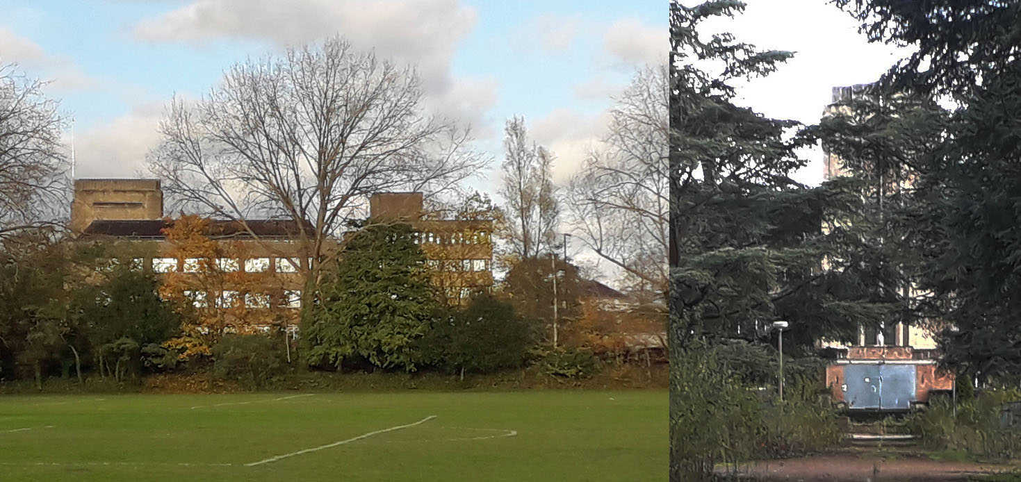 HORSHAM TOWER HILL (05WS21) HORSHAM TOWER HILL (05WS21)Horsham is an historic market town in West Sussex to the north of the county and about 5 miles east of Crawley. The south east of Horsham includes an area known as Tower Hill. At Tower Hill, is a spring. Emanating from the limestone strata, it encrusts by depositing a small portion of carbonate of lime with which it is impregnated, wherever it flows. There is no apparent active tower on Tower Hill. However the WSCC Enterprise Park is in the Tower Hill locality. This area is closed and due for redevelopment. Within it are buildings including several towers. POLING WATER TOWER (05WS22) Poling is an old agricultural village in West Sussex, two miles north-east of Littlehampton. In 2024 the village and surrounding landscape were found to be covered in mature trees. Clues to the whereabouts of the water tower are given in Mace M (1997) Sussex Wartime Relics and Memorials, p. 123, 124. In spite of this the tower could not be found and is suspected of having been removed. It was of standard air ministry design. Grid Ref. TQ 045052. 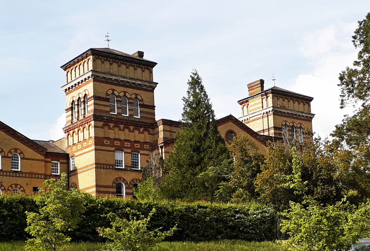 HAYWARDS HEATH WATER TWIN TOWERS. (2) (05WS23) St Francis Hospital, Haywards Heath, just off the A272 road, they form part of the original establishment building of what was formerly a Mental Asylum dating from 1859, which finally closed in 1995. The site became the University Hospitals, Sussex NHS Foundation Trust, Sussex. The present two water towers date from the opening of the building in 1859 and add to the grandeur of the main entrance. Grade II listed. See (05WS09) also. Grid Ref. 337228. 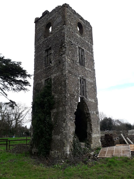
Whitehill Tower - Built in 1862 this derelict tower near Caterham in Surrey mystifies passers by as to its original purpose. It lies on Tower Farm and can be seen from the upper end of War Coppice Road. CR3 6AS. Was it planned as a water tower? REGION England - Southern, WATER TOWER INTEREST |
||||
|