|
 Martello Tower Database SITE UNDER CONSTRUCTION
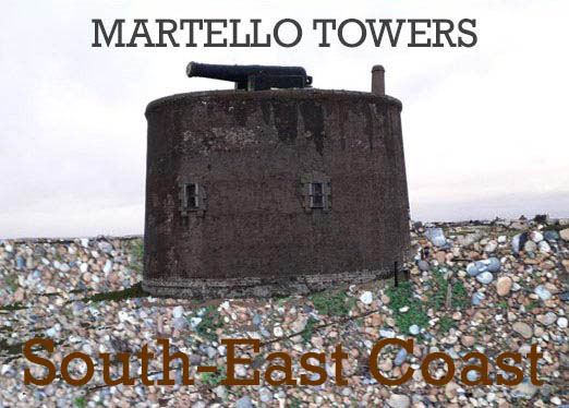
The Martello Towers of England's South-East Coast
A database prepared by the Martello Fellowship
TO VIEW PICTURES CLICK THE CANNONS ON THE DATA BELOW
UNDERLINED TITLE INDICATES THE TOWER STILL EXISTS
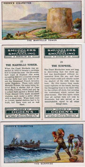
Having built more than 100 fortified gun towers around the British coast in the early 19th century, the question that the MARTELLO FELLOWSHIP seeks to address is what happened to them once the threat of invasion from France had passed? Coastal communities were disrupted by the war effort and left with the debris to try and find a use for or destroy. Smuggling of goods from France had been rife along the coast and this was disrupted by the sudden presence of such buildings and those that manned them. Similar applied to other activities including wrecking and the salvage of ships cargo resulting from catastrophe at sea. Such activities often involved whole communities and were integral with the rural economy, even if not the law.
Rising import taxes led to an explosion in smuggling in the early 1800s. Goods were shipped to shore under the cover of darkness and as many as 300 horses would be made available to move the goods inland to major markets such as London and Brighton. The Navy set up a blockade to try and intercept the smugglers, often using old naval vessels as a base of operation. Inevitably Martello towers provided an alternative and the preventive service, as it was known, and their families made them a home. During the 1830s the arrangement was revised by establishing a Coast Guard Service and this led to the construction of purpose made buildings to operate from and live in.
A number of issues brought about further change, one of which was the reduction in taxes on French imported goods. Another matter that caused conflict in the communities was that the Coastguards were often local family members and had conflicting loyalties when dealing with smuggling by their immediate relatives and friends.
Examples of how the martellos were used can be taken from the Enchantress Tower at Rye (number 28). Coastguards moved into the Martello with their families but as the service became better equipped with purpose made buildings, the Enchantress Tower was used as a prison for smugglers.
Coming up to date, many martellos have been destroyed by the sea or used for military target practice and weapons testing. Others have been adapted for residential purposes. Some have been altered out of all recognition while others remain quietly rotting in much their original state. Our database hopefully brings greater appreciation of these interesting white elephants from the past and their future along the coast.
In addition to the 29 Martellos built on the east coast detailed lower down this page, 74 towers were built along the south-east coast as follows. These are recorded numerically.
Tower 1
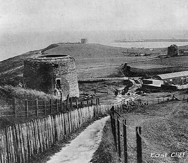
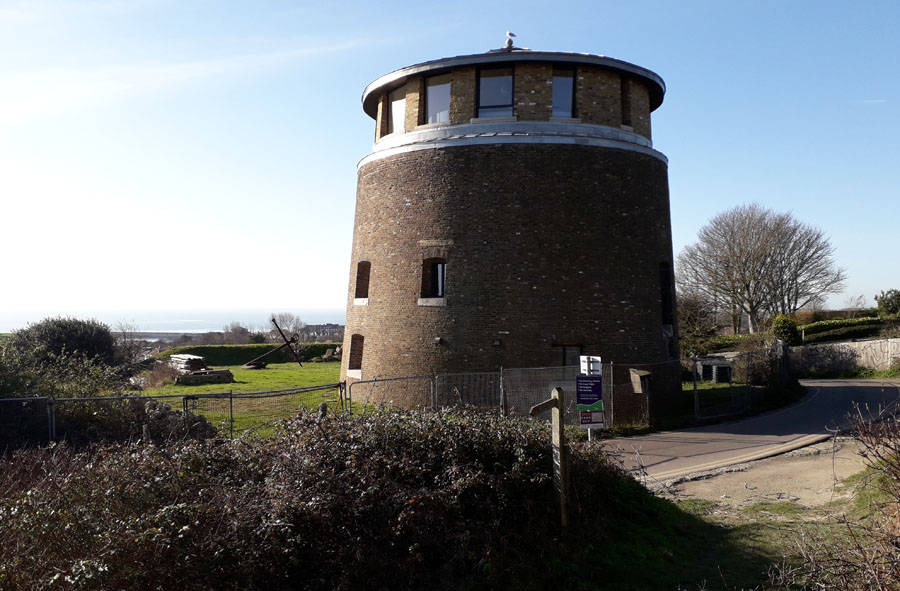
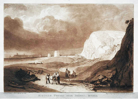
 East Cliff, Folkestone. TR24093731. No. 1 stands on the cliffs 200 feet above East Wear Bay, north of Folkestone town. It was converted for residential use in 2015. Grade II listed. See pictures: picture 1 shows Tower No.1, picture 2 shows Tower No.1 on left, 2 on the right and 3 centre distant.
Tower 2
Wear Bay Road, Folkestone. TR23973698. Residential. Grade II listed. Martello Primary School is adjacent. See picture.
Tower 3
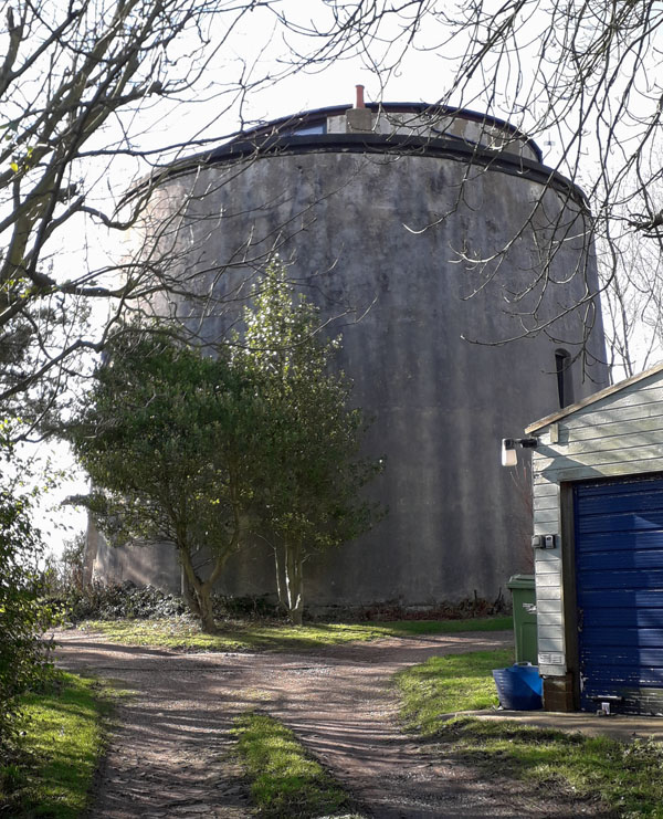
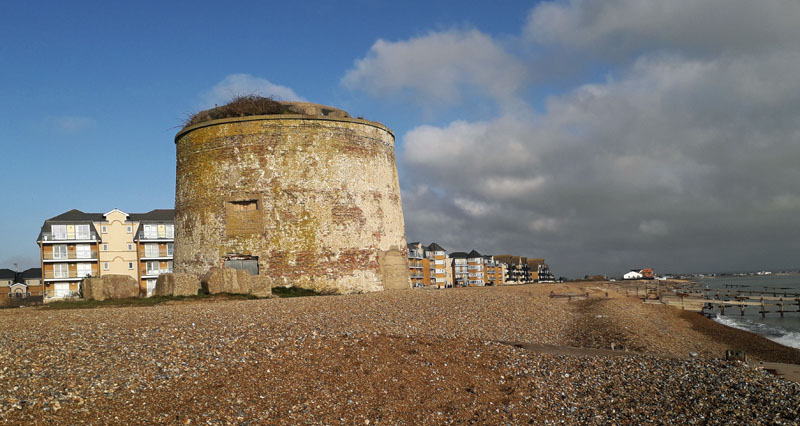
Folkestone. TR24063663. Martello Tower No. 3 was constructed on the cliff edge at Folkestone above Copt Point. After 1850, the tower was used by the Coastguard, with the Coastguard members and families living there. During the Second World War, a concrete observation point was built that linked the tower with the adjacent coastal battery. The tower was disused after the war until 1990 when Shepway Council bought it and later opened it as a visitor centre. It was used as such up to 2011 but since then has laid idle most of the time with its condition deteriorating, although now used for occasional exhibitions. See picture.
Tower 4
Folkestone. TR21133536. The tower is situated on Radnor Cliff in a private garden near the notice to Sandgate Point, at the western end of 'The Leas', a public green space. The tower survives well despite some later alterations but is now totally overgrown. Steps lead up to a viewing platform, otherwise inaccessible. See picture.
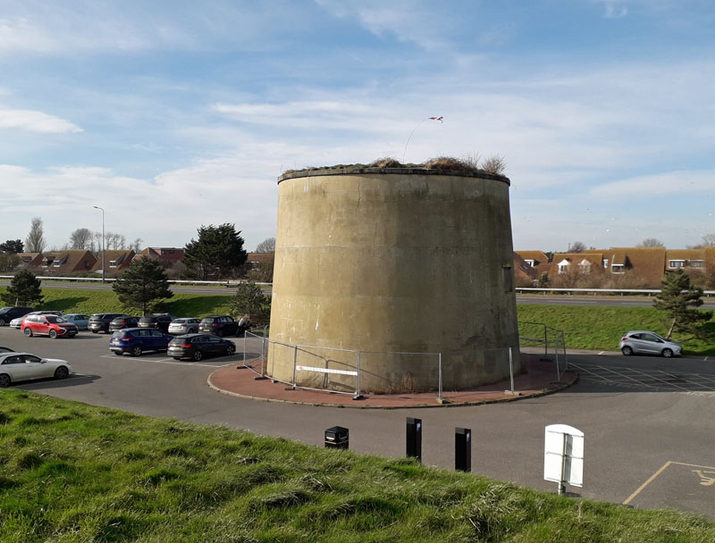
Tower 5
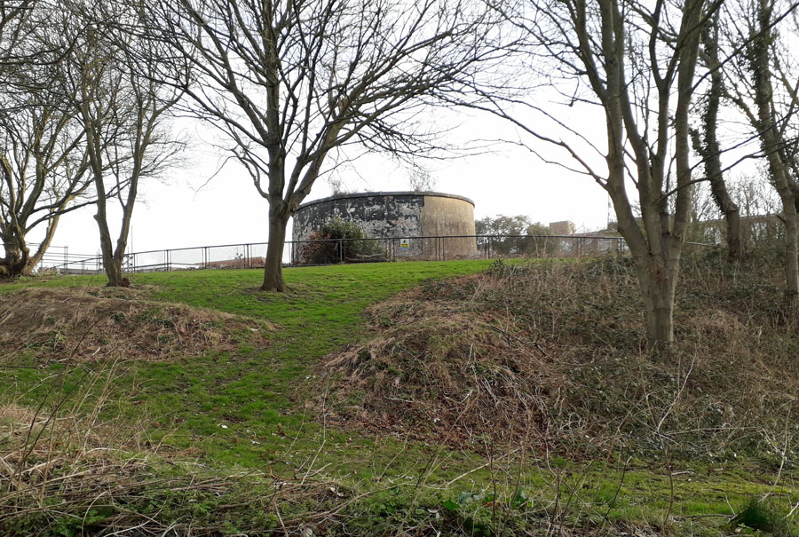
Coolinge Lane, Folkestone. CT20 3RB. TR20773554. Set within a dry moat, it is one of a clifftop series of six moated towers, constructed in 1805-6 to defend the coastline between Hythe and Folkestone. It now lies in the grounds of Folkestone School for Girls and can be seen from the boundary fence bordering Enbrook Park. See picture.
Tower 6
Shorncliffe, TR20223537. Disused. Grade II listed. Park in Military Road. Take the footpath directly opposite Bybrook Way. See picture.
Tower 7
Sandgate, TR19863530. Disused. Take the footpath uphill on the left, on the right hand bend in Encombe Road. See picture.
Tower 8
Sandgate, TR19413523. Residential, at the top of Hospital Hill. See picture.
Tower 9
Shorncliffe, TR19023516. Disused. Grade II listed. 400 meters west of tower 8. Difficult to find, we have resorted to a picture from martellotowers.co.uk, with permission.
Tower 10 - Tower 12
Demolished when the esplanade was constructed.
Tower 13
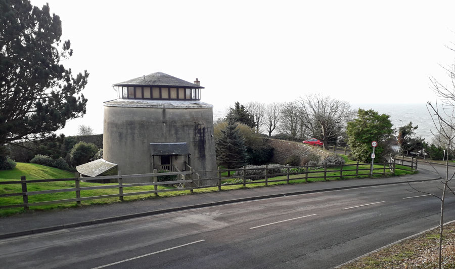
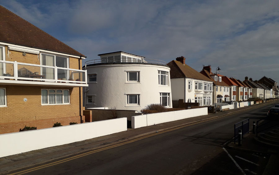
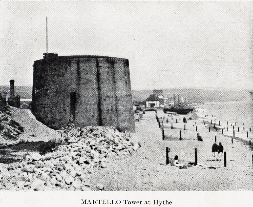
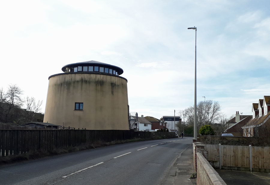
West Parade, Hythe, Kent. TR15873399.
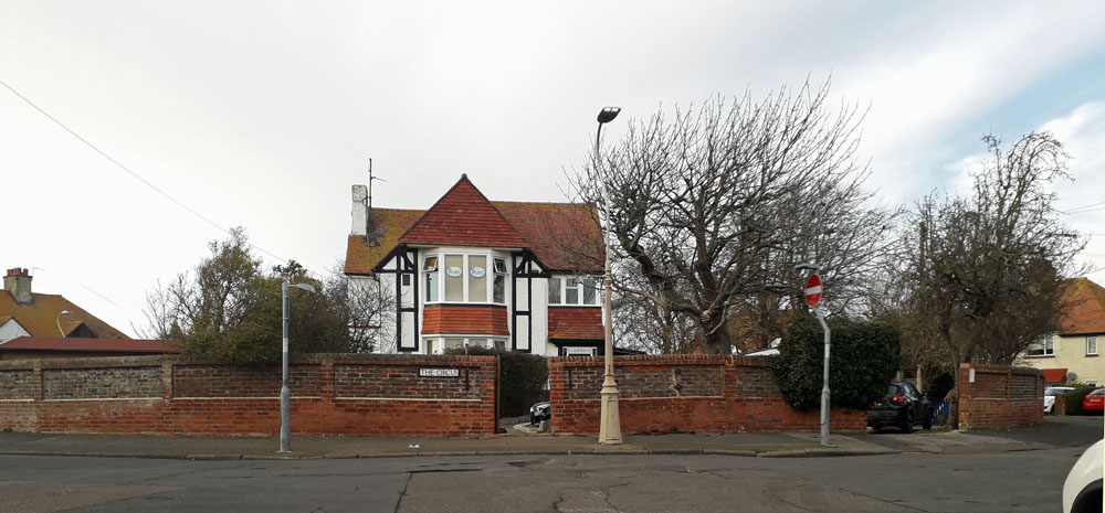
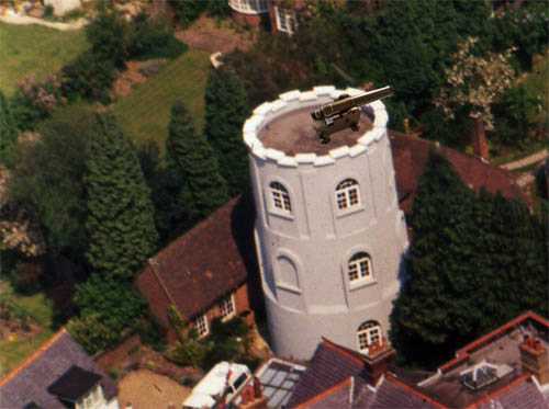
It was sold to a builder in 1928, who undertook repairs and renovations and converted it into a residence. It was sold again in 1938 and used as an observation post in the Second World War. Further renovations and modernisation were carried out in the 1960s. The walls were made thinner by the removal of some internal brickwork and new large windows were added. The outcome is that this tower has retained it original cirumference and is maintained for residential use. See picture.
Tower 14
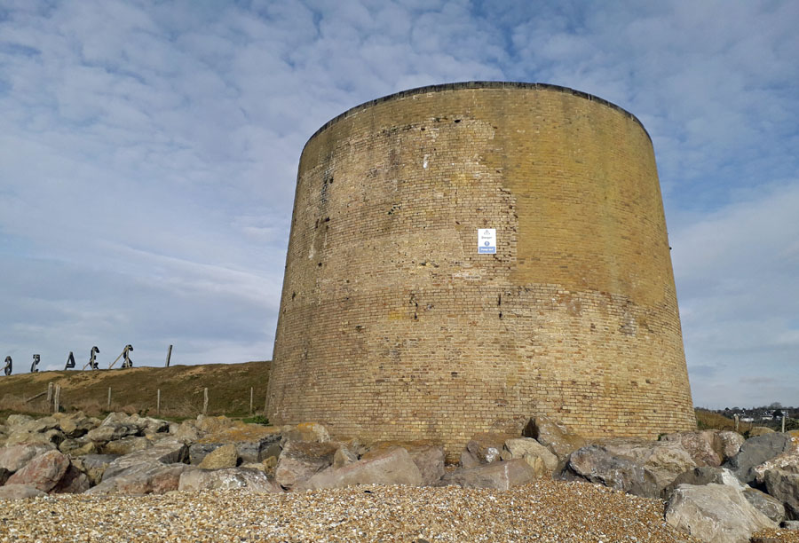
Hythe, Kent. TR15493383. Scheduled Monument. Lies on military firing range. See pictures.
Tower 15
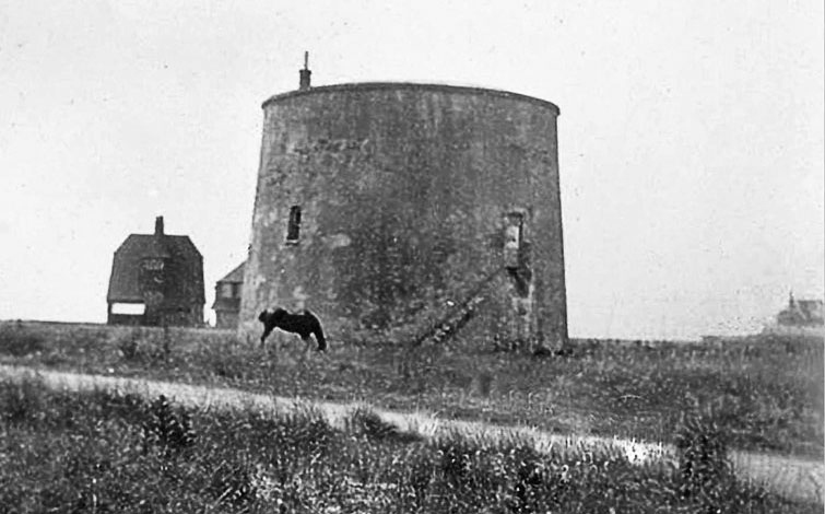
Hythe, TR15213369. Lies on military firing range. See picture.
Tower 16
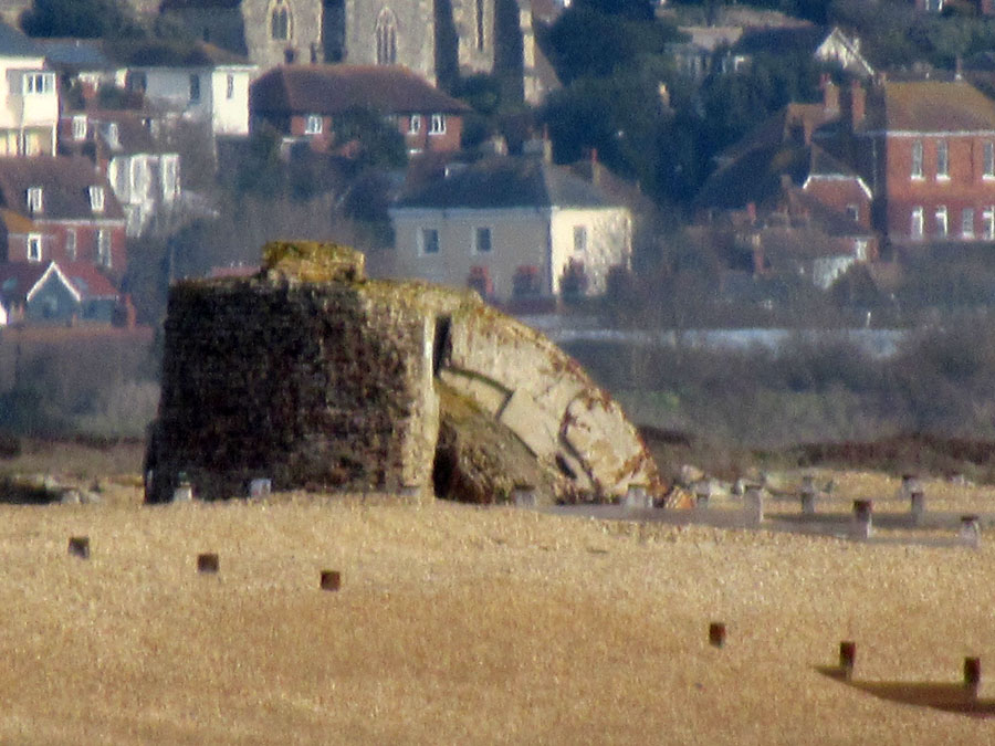
Hythe, TR149335. Lost to sea. See picture soon.
Tower 17
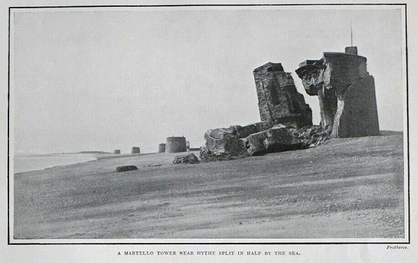
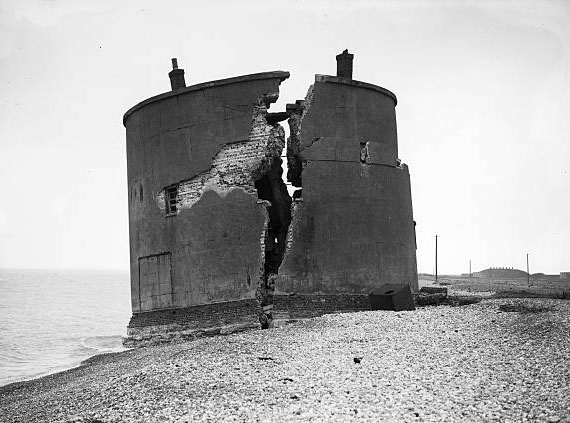
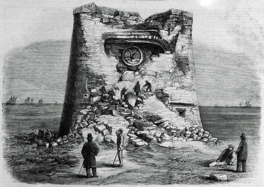
Hythe, Kent. TR146334. Collapsed circa. 1899. See picture.
Tower 18
Demolished/lost to sea.
Tower 19
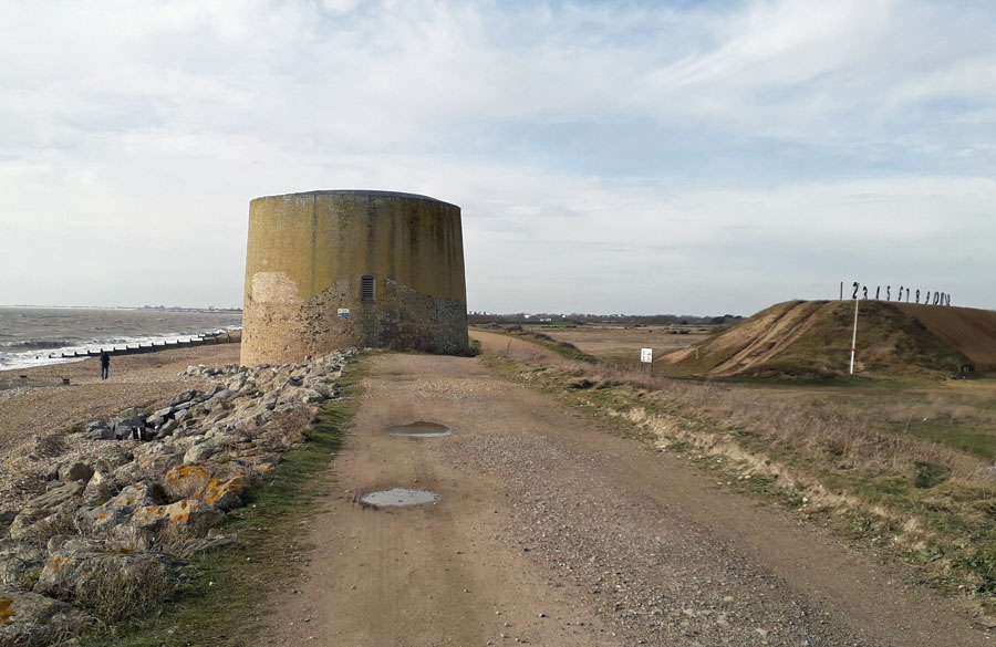
Hythe, TR13913291. It was built in 1806. In the 1960s it was in a sound state and was listed in 1973. In the late 1970s it was undermined by the sea. Lies on military firing range. Can be viewed from the nearby Redoubt. See pictures.
Tower 20 to Tower 22
Demolished/lost to sea.
Tower 23
Dymchurch, TR113304. Residential. See picture.
Tower 24
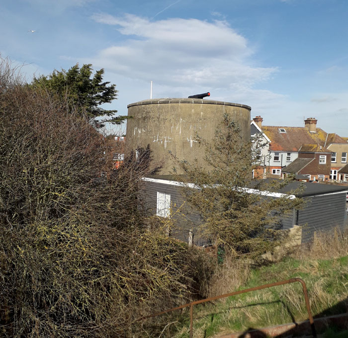
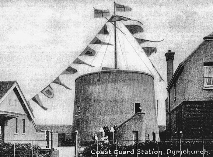
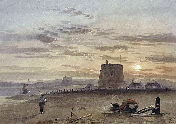
Dymchurch, Romney Marsh, Kent, TN29 0NU. TR102292. Following use as a signal tower, from about 1819/20, it was taken over by the newly formed Royal Naval Coast Blockade Service in the war against smuggling on Romney Marsh. During the Second World War it was used to spot enemy aircaft approaching England. It was restored as a museum in 1969 and is now in the care of English Heritage. Open April - October. The tower contains almost all of the features of the original design including brickwork, front and parapet doors, window openings, fireplaces, ventilation shafts and the original 24 pounder muzzle-loading cannon on the gun platform. Grade II listed. See pictures.
Tower 25
Dymchurch, TR101290. Not in use although exterior restored in the 1960s. It was apparently for sale in 2017 for between 70-75 thousand pounds. See picture.
Tower 26
Dymchurch, TR093275. Lost to sea/domolished 1871. See picture soon.
Tower 27
Dymchurch, TR113304. Semaphore station demolished 1841. See picture soon.
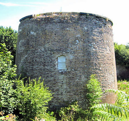
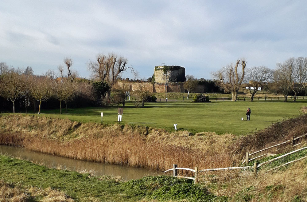
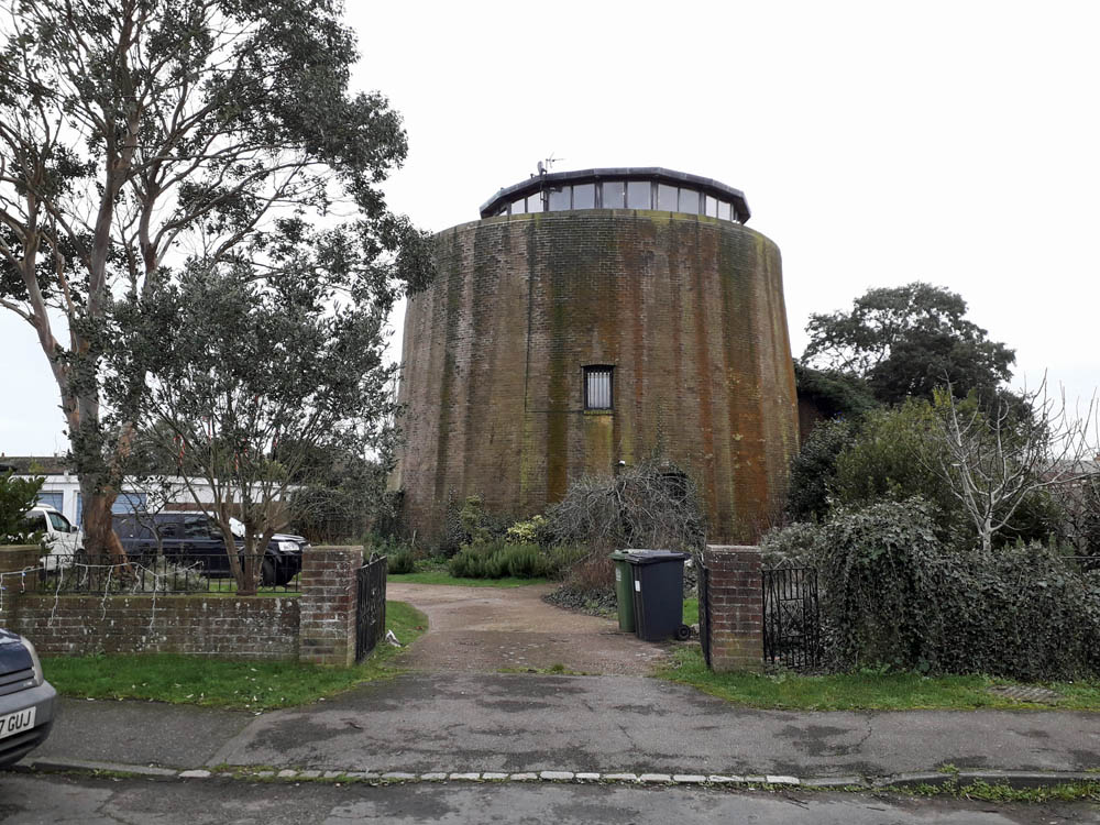
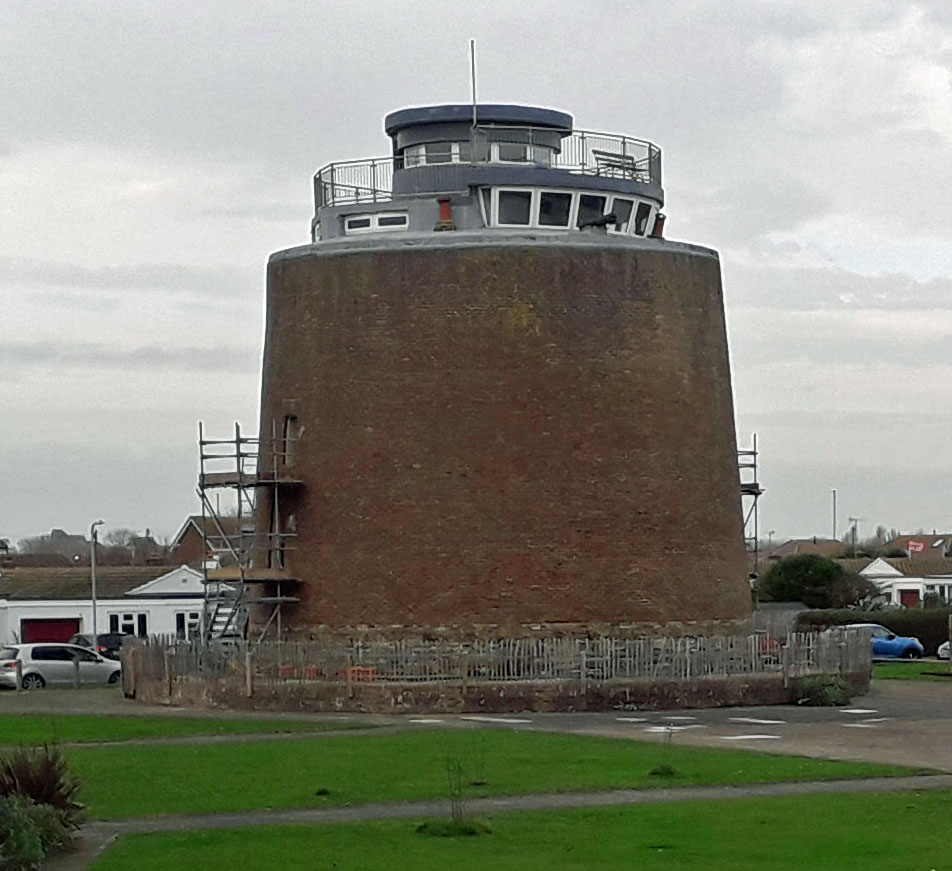
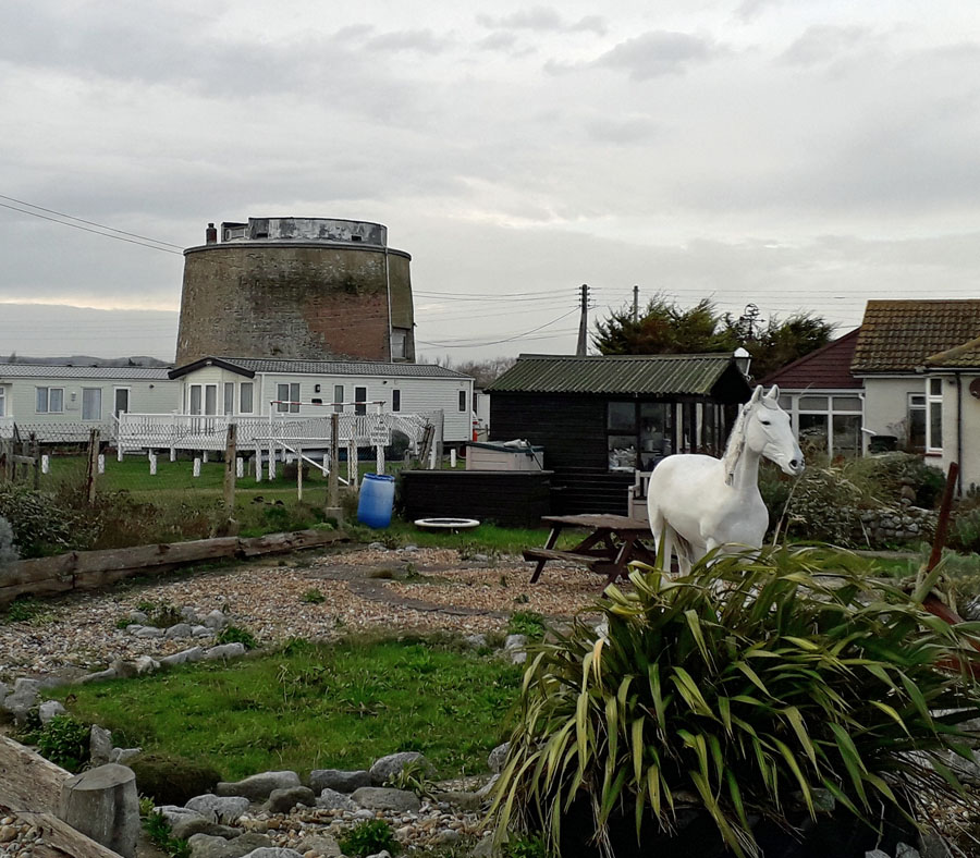
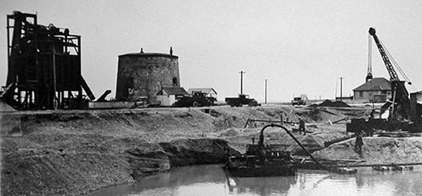
Tower 28
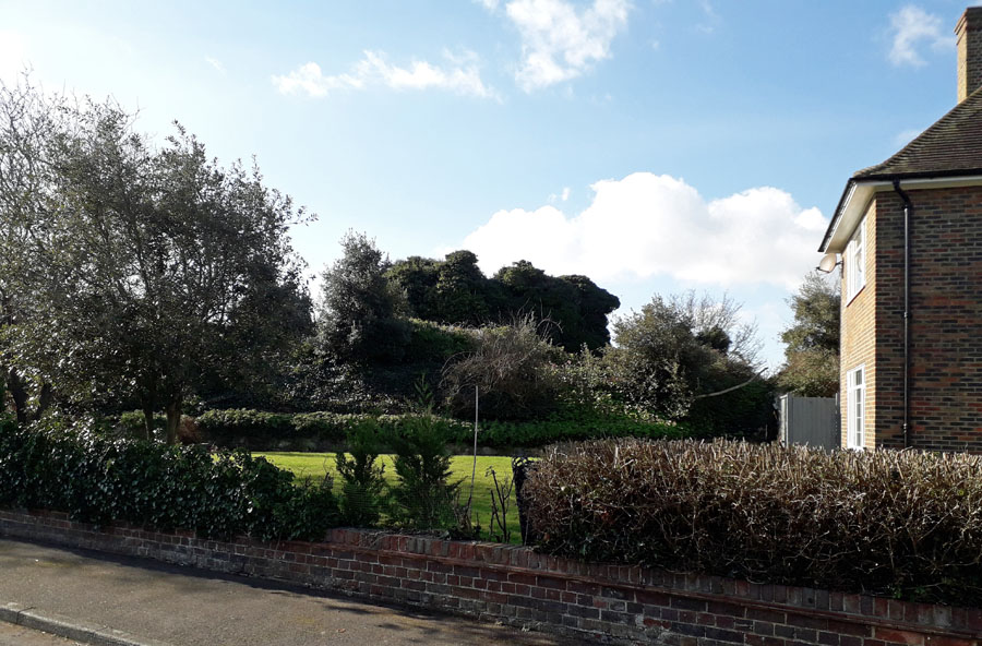
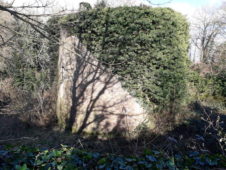
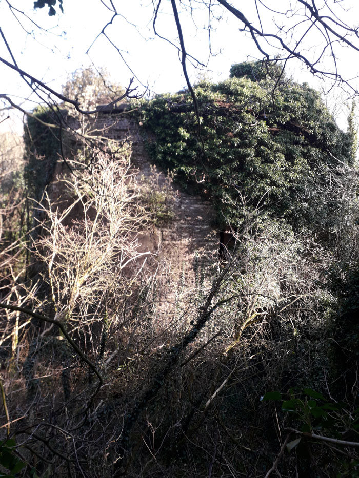
Rye Harbour, Icklesham, East Sussex. TQ942188. Known as the Enchantress Tower. Scheduled Monument and Listed grade II. status. Vacant/not in use. Distinct walled moat on mound. See picture.
Tower 29
Rye, East Sussex. Believed to have once stood near the harbour mouth it is now lost without trace.
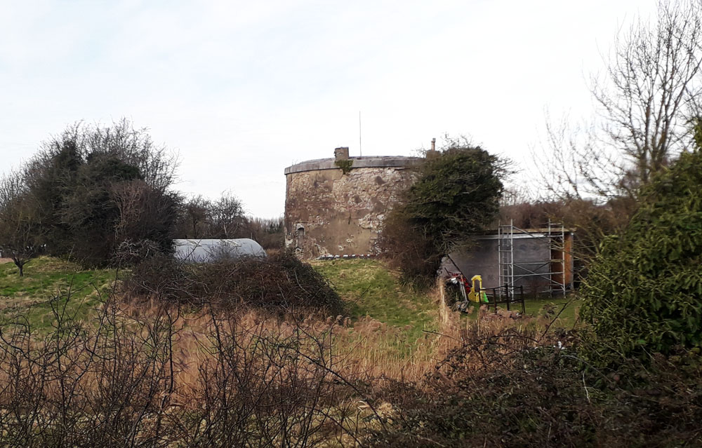
Tower 30
Winchelsea Road, Rye, East Sussex. TQ918199. Vacant/not in use. On private property and in need of tlc. See picture.
Towers 31 - 54
All these towers have disappeared for a variety of reasons, demolished, lost to the sea, destroyed by target practice, etc. Where details are known they are listed below. Today we can speculate on the whereabouts of former sites as in the example between Normans Bay and Cooden at grid. ref. TR705065 - see picture (where tower 55 can also be seen in the far distance on the left).
Tower 39
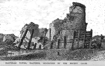
St Leonards, East Sussex. TQ658039. Known as the Bo Peep Martello, Bo Peep being the preventive service, sheep being the owlers and tails being smuggled tubs. "Little Bo Peep has lost her sheep and does not know where to find them. Leave them alone and they will come home, wagging their tails behind them!" The tower partially collapsed into the sea in 1876 and the Royal Engineers blew up what remained soon after. See pictures including one with tower 40 in background.
Bulverhythe or Bo Peep is a suburb of Hastings, East Sussex. The locality apparently derived its name from the hide-and-seek proceedings of smugglers, who were very active in the once very thinly populated district featured in the old nursery rhyme Little Bo-Peep. Stell�s Guide, first published in 1794 described the interesting walks in the surrounding district and notes the �Bo-Peep�, a public house by the roadside, where company may enjoy a fine prospect of the sea and Beachy Head from the hill behind the house. It appears that the inn or tavern was originally called the �Old England Tavern� or the �New England Bank� at Bo Peep. This old inn in particular, is mentioned in the early 18th century tales of smuggling. It was the centre of a district often used by the smugglers, being convenient for running their contraband cargoes ashore, and the scene of frequent conflicts between them and the Blockade Men. The first annual horse race was held on Bulverhythe Salts, Bopeep on Oct 3 1823. It was so successful that in September 1826 the course was moved to South Saxons at the bottom of Filsham Road and this allowed 6,000 spectators a better view from the surrounding slopes. West Marina Station opened in 1846 and was the nearest station to Hastings until 1851 when the Bo Peep tunnel through to Warrior Square and Hastings was completed. As the suburb developed, postcards and adverts at the close of the century show the Bopeep Hotel adjoining the West Marina Station, with trains departing for Hastings. The Bopeep metaphore was thus perpetuated into the 20th century.
Tower 40
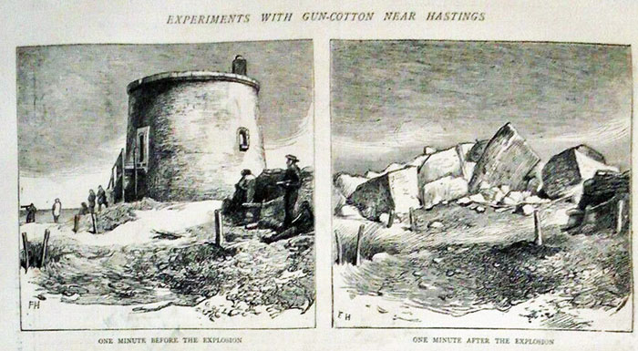
St Leonards, East Sussex. This tower survived until 1872 when experiments with gun cotton resulted in it being blown up. See picture.
Tower 55
Normans Bay, East Sussex, TQ682053. This tower has been intermittently occupied during its lifetime. There was a WWII pill box on the roof. In 1997 it was reported as tatty and boarded up. The following year the 'for sale' price dropped by 35,000 pounds to 130,000 pounds. Other uses included experimental wireless telegraphy in the early 20th century. Today it is renovated and residential. See picture.
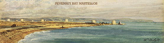
Towers 56 to 58
Pevensey Bay, East Sussex. Lost to sea/demolished.
Tower 59
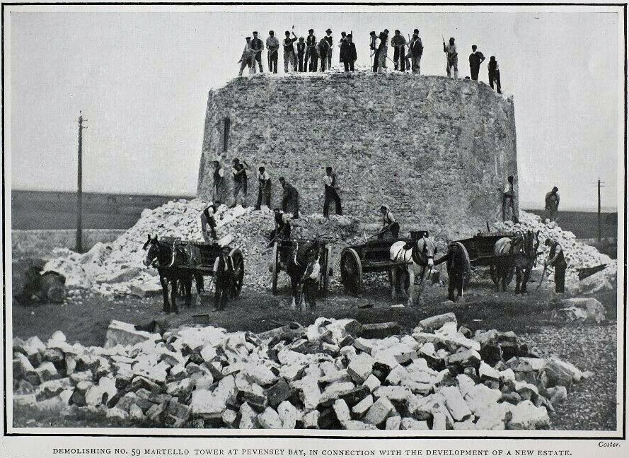
Pevensey, East Sussex, TQ662043. Demolished 1903 when housing was being constructed in the vicinity. see picture.
Tower 60
Leyland Road, Pevensey, East Sussex. TQ658039. see pictures. Residential. see picture.
Tower 61
Surrounded by modern blocks of flats, East Sussex, TQ657038. Residential with cannon. see picture.
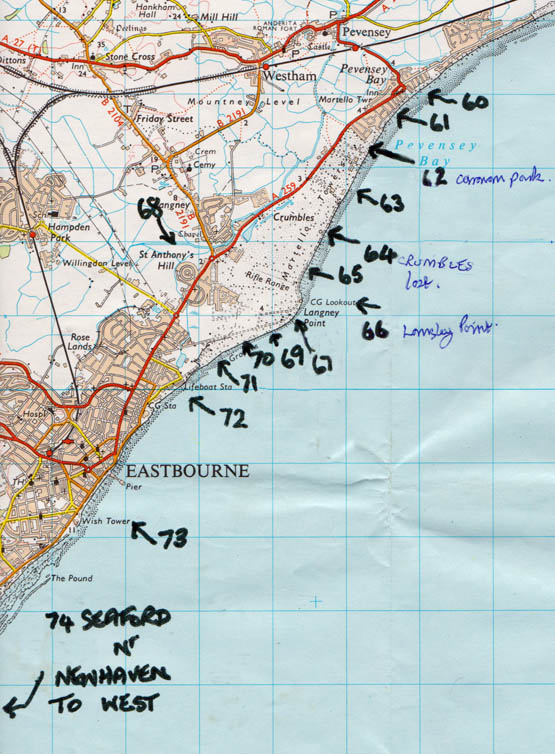
Tower 62
Lodge and Caravan Park, Pevensey Bay, East Sussex, TQ651031. Residential. see picture.
Tower 63
Pevensey Bay, East Sussex, TQ649027. Destroyed by enemy during WWII. See picture.
Tower 64
Crumbles, East Sussex. TQ647022. Lies just south of Pevensey in an area that was once a wild habitat for coastal life. Today the entire area is developed with up to 4 storey housing and marina and is known as Sovereign Harbour. To get to the tower, go down Pacific Drive. Access to the beach is along a gated track opposite Long Beach View, off Pacific Drive. The tower is at the end of the track. It stands empty and in need of Tender Loving Care. See picture.
Tower 65
South of Pevensey, East Sussex. TQ645016. Lost to sea.
Tower 66
Langley Point Tower, Eastbourne, East Sussex. TQ644013. Disused - see picture.
Tower 67
Eastbourne, East Sussex . TQ644012. Lost - Fate unknown.
Tower 68
St Anthony's Hill, East Sussex. TQ628016. Located a mile inland west of Sovereign Harbour, the tower was a target for the military in 1860 and subsequently demolished. A housing estate on the site reflects the landscaping of the tower and is called The Circus. The house at the center sits on the circular site of the martello. Access to the lower levels of the original martello can apparently still be made via a manhole. See picture.
Tower 69
Eastbourne, East Sussex. Lost - Fate unknown.
Tower 70
Eastbourne, East Sussex . TQ646006. No longer in existence.
Tower 71
Eastbourne, East Sussex. TQ633004. Used as a target for testing Royal Artillery Armstrong rifled guns in 1860. Subsequently demolished. See picture.
Tower 72
Eastbourne, East Sussex. TQ627001. Demolished before 1887 when the War Office sold the site to Carew D Gilbert. See picture.
Tower 73
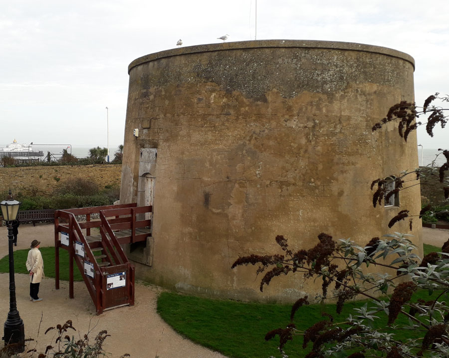
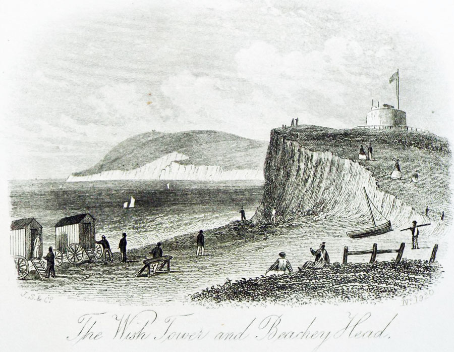
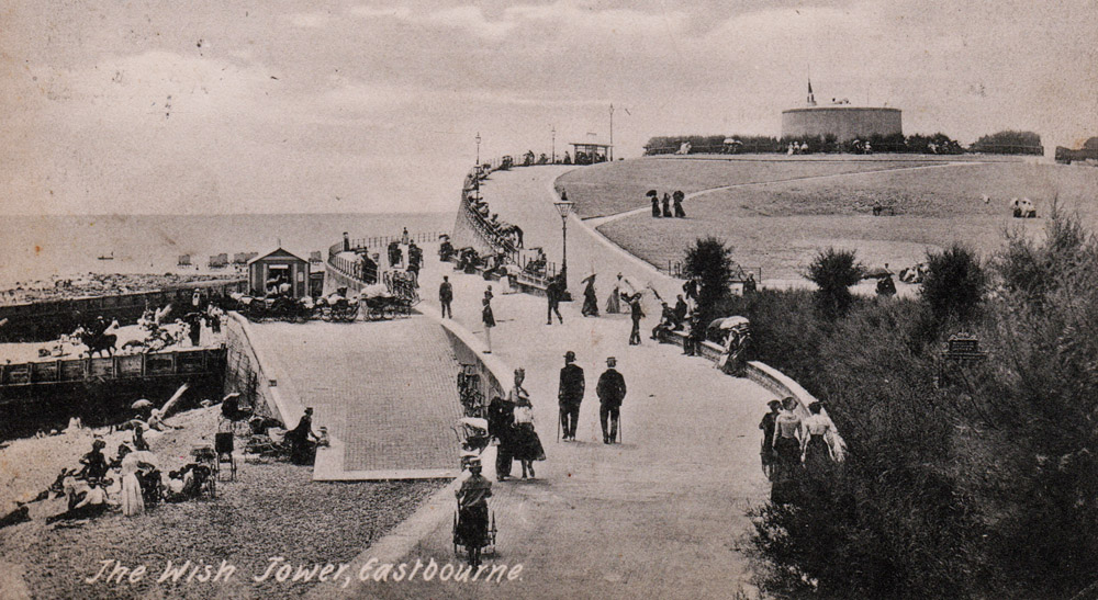
The Wish Tower, Eastbourne, East Sussex. TV613982. Not in use at the moment although has been used for a variety of activities including, between 1812 and 1860, a coastguard/preventive service station against smuggling. This was rife at the time and involved many who had family members and friends on both sides of the law, with interesting results. In the picture c.1900 the cannon appears to be still in place. see pictures.
Tower 74
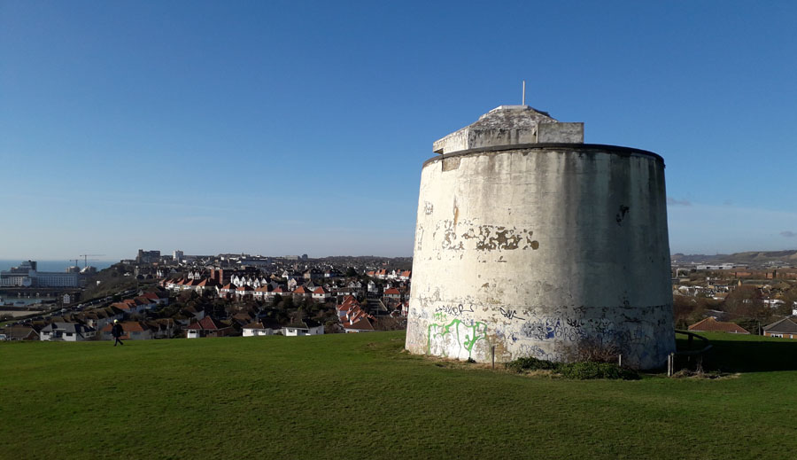
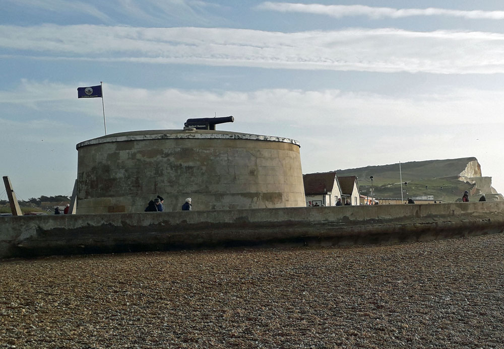
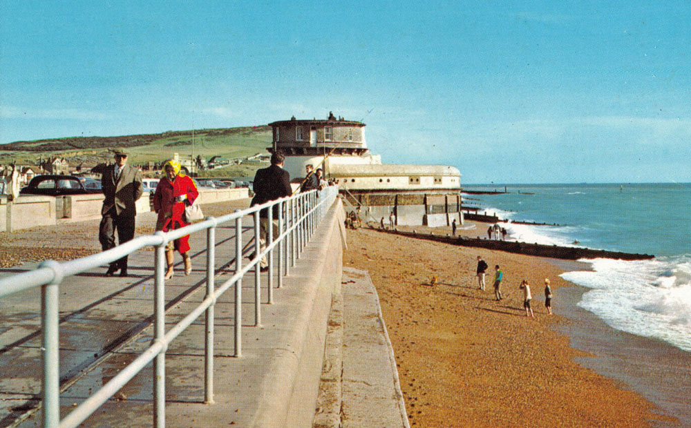
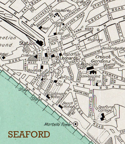
Museum, Seaford, East Sussex. TV485985 Now with cannon and open to public. Earlier subject to restoration. See pictures.
More details will be added as research continues, do contact us if you can supply more data.
Website: Click Here
ADDITIONAL INFORMATION
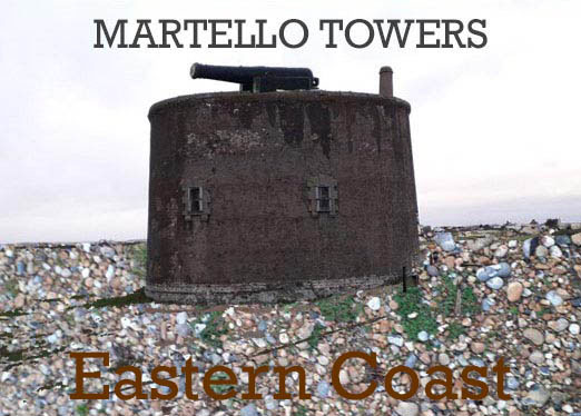
The numeric database detailed on this web page is supplemented by a second alphabetical Martello database for those located on the EASTERN COAST of England. To view this additional Martello database click above.
Both databases are run by the Martello Fellowship at:
Tower House, Tower Road, KT20 5QR. United Kingdom.
Martello@thespas.co.uk
LANDSCAPE
Coastal
REGION
England - Southern
|